




After a settled start to this week, with high pressure in control, heavy downpours and thunderstorms look to spread up from the south from early Wednesday, with the risk continuing through to the end of the week.
Tuesday will again be predominantly dry and settled with warm sunshine for many, with high pressure still holding on, warmer too today- with temperatures reaching 23-26C inland across England and Wales. However, low pressure over northwest France today will bring more in the way of cloud across SW England and Wales - with some scattered showers, locally heavy, pushing northwest. It will also turn cloudier further east across southern England through the afternoon, with a threat of showers towards the south coast.
But it’s overnight and through Wednesday we start to see increasing risk of heavy showers and elevated thunderstorms pushing up from the south across central, southern and western areas of England along with Wales - as a tongue of warm and humid air (characterised by 850 hPa wet-bulb potential temperatures of 16C+) moves north and is lifted by a shortwave trough also moving north.
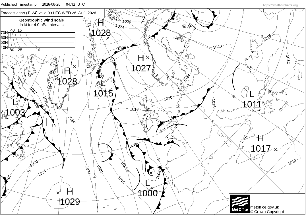
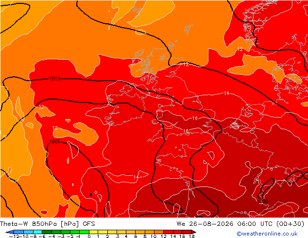
Heavy showers and a few thunderstorms are likely to develop towards SE England and East Anglia in the early hours of Wednesday within the warm plume axis advecting northwest out of the near continent - as increased forcing moves up from the south with shortwave trough. A band of heavy showers and elevated thunderstorms then spreading north and northwest across the Midlands and northern England through the morning but tending to weaken. Sunny spells following from the south across Wales, central and southern England - but with temperatures reaching 24-26C and higher humidity inland - we may see further heavy showers and thunderstorms develop here - particularly north of the M4 across Wales, The Midlands and perhaps up into NW England. Heavy showers and perhaps an isolated storm may develop across SW Scotland too into the evening.
Showers and storms that develop inland during Wednesday will tend to fade overnight, but another wave of heavy downpours and thunderstorms looks to spread up from the south across southern England and south Wales in the early hours of Thursday morning. This second wave is forecast to bring a more widespread risk of strong or perhaps severe thunderstorms - with a risk of hail, flash-flooding, frequent lightning and strong winds.
Upper low moves southeast toward Iberia before moving NE to the Bay of Biscay - this will strengthen the SW flow aloft and increase forcing for ascent of warm moist air advecting out of the near continent - allowing a wave of thunderstorms / heavy rain to develop and push north over England and Wales on Thursday
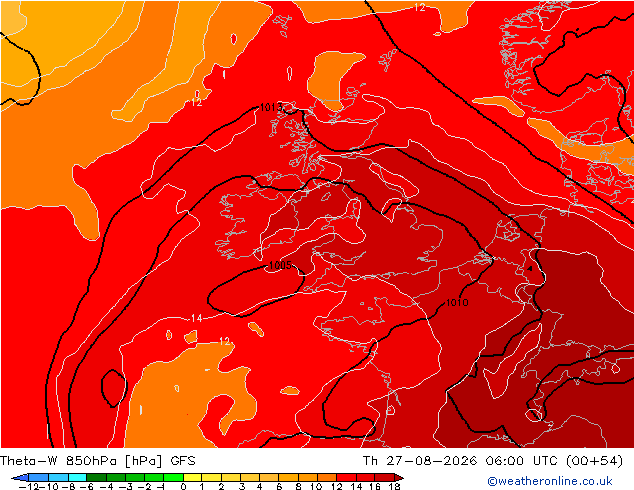
The greater risk of thunderstorms with severe weather spreading north on Thursday is due an upper low moving southeast over the Atlantic towards Iberia on Wednesday before drifting to the Bay of Biscay strengthening the south / southwesterly flow aloft creating increased wind shear profiles, while cooling temperatures in the mid-levels and increased cyclonic vorticity spreading up from the southwest, in association with the upper low, destabilises continued warm moist air advection from the near continent in the lower levels.
ECMWF Lightning density map showing greatest risk of lightning
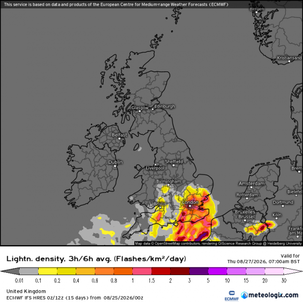
Heavy downpours and thunderstorms moving in across the south early Thursday will drift north across England and Wales during the day, with a continued risk of hail, flash-flooding, hail and strong winds locally. More uncertainty whether the heavy rain and thunderstorms reaches Scotland, perhaps into the far south, as an area of low pressure looks to move northeast over Wales then northern England later in the day, which will tend to pull rain and storms towards the North Sea.
The risk of a few thunderstorms amongst heavy showers on Friday across central, southern and eastern England as low pressure clears eastern England out over the North Sea, though the risk clearing from the west through the afternoon - as cooler, fresher and more stable airmass moves in from the west in wake of the low clearing east.
Loading recent activity...








