Throughout the summer, back into May 2026, it has been a memorable few months. The heat and lack of rain have been particularly notable in England and Wales. With a Bank Holiday weekend coming up (not for Scotland), it seems that the weather is finally going to change. Is that the end of summer? It’s too early to say, but invariably when the majority of UK schools go back in September, the weather can be lovely.
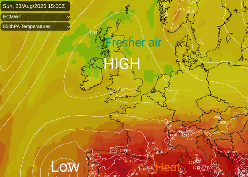
Over the weekend and into Monday, the UK has been experiencing cool nights and fresh early mornings. This is due to a north to northwesterly flow coming down from the Arctic. Temperatures have fallen down into single figures where there have been clear skies and in the shade by day, and in the evening you just need a sweater as the air is quite different. If you are in bright sunshine, then it still feels very warm as that August sun still has real strength.
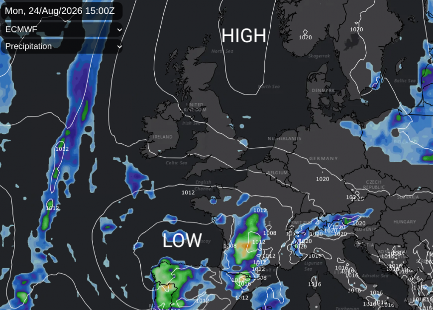
High pressure has brought a lot of fine and settled weather to the UK for the start of the week but that high is slipping away towards Norway. One low pressure, off NW Iberia, has brought rain to Portugal with showery bands over parts of Spain. France has warnings on Monday for heavy, thundery showers across many parts. There is the risk of flooding in southeast France and over the Alps into northern Italy from intense thunderstorms with torrential downpours.
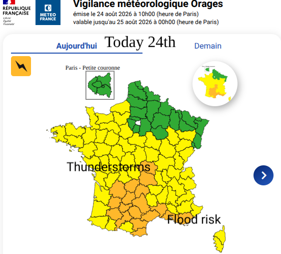
Meteo France warnings for Monday 24th covering widespread area for Thunderstorms.
After the easterly flow on Tuesday, there will be more cloud about and showers linked to a new low out in the Atlantic. This low pressure is going to stick around for days, churning about and elongating over the UK, stretching northwards. This will bring showers, also thunderstorms and potentially longer spells of rain to some parts. However, where and how much rain will depend on the development and path of the low pressure. The forecast models vary beyond Thursday
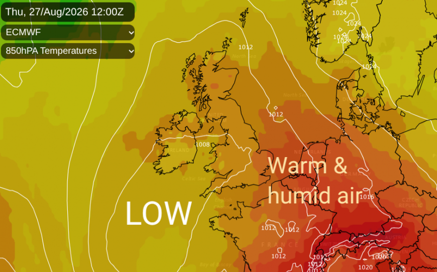
In the middle of the week, warmer and more humid air will push up through the UK. This will be a noticeable change from the fresh, sometimes nippy, air that we have on Monday to a more close and muggy midweek.
Temperatures midweek will be in the 20s Celsius, with 24 to 28C for inland England and Wales. By Saturday these will have faded again down to 21 to 24C as that fresher feeling returns and the warmth and humidity heads off to central Europe.
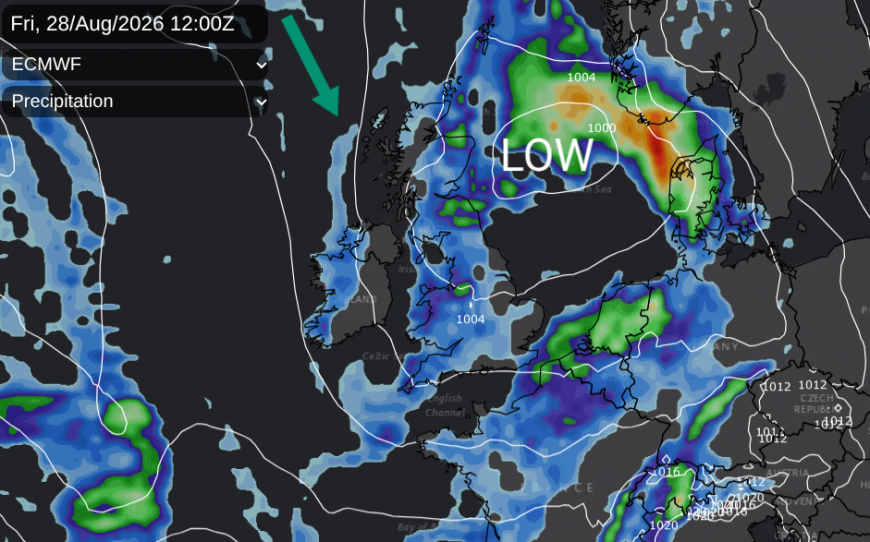
The lingering low pressure could bring heavy rain onshore for a swathe of eastern Britain, or result in lines of showers clipping Kent. It all looks rather slow-moving for Friday, but the detail is rather elusive. This remains the case through the weekend. Low pressure introduces the likelihood of showers and rather mixed weather but with bright, even sunny gaps in between.
As the low pressure finally draws away over the North Sea, it will allow a return to the fresher northwest flow. So we aren’t expecting the humid and muggy air from midweek to be around by Saturday.
Looking at the models, there are small low pressures which might move across the UK bringing rain, or showers as they head eastwards, but there is low confidence about when they develop and their paths adn timings. The ECM takes a small low over southern Britain by Saturday night which would bring welcome rain to the drought areas, but the GFS doesn’t develop that low at all. By Sunday, more of the models show a larger Atlantic low moving towards Ireland. This also could bring frontal rain and showers but always with sunny gaps and some useful fine weather. This low is forecast to be over the UK for Bank Holiday Monday, which could result in a mixed day with blustery showers and bright spells, but there is no point trying to glean any detail from an hourly output on a weather app at this stage.
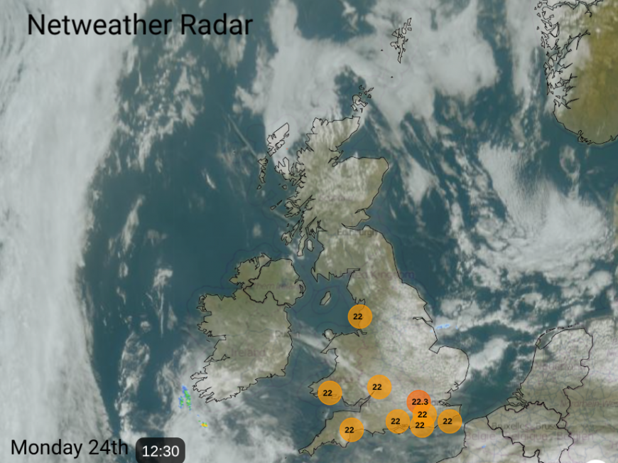
A solitary shower showing on the Netweather radar close to Lincolnshire coast. Top ten temps at midday (22C)
We will keep you updated this week, and there is always the Netweather Radar for tracking showers on the day.
Loading recent activity...