The mostly dry and settled weather we saw on Saturday will continue on Sunday and Monday for the majority of the UK, thanks to high pressure in control. However, it will turn more unsettled from Tuesday, with increasing chances of heavy rain and thunderstorms spreading north - especially on Thursday and Friday. It will also turn warmer and more humid for a time too, with temperatures perhaps reaching 27C in the south on Wednesday, before turning cooler on Friday.
High pressure in charge for now, but turning unsettled from the southwest from Tuesday, with increasing risk of rain and thunderstorms, though detail remains uncertain for now
The change to more unsettled weather next week will be thanks to high pressure sat over the UK today drifting northeast to Scandinavia. This will allow an area of low pressure over the northeast Atlantic near Portugal this weekend to drift northeast towards the UK early next week, followed by further areas of low pressure moving north or northeast.
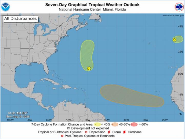
The low just to the west of Portugal today is unusual - because it is being tracked by the U.S. National Hurricane Centre - as the low has a small window this weekend in which it could acquire subtropical or tropical characteristics as it moves towards Portugal and northwestern Spain. Though this chance has remained low, 20% chance yesterday of subtropical or tropical depression formation, 10% today. But it’s interesting nonetheless that the low is being tracked for such possible formation - as tropical or subtropical storms tend to form much further southwest over the tropical North Atlantic.
The US National Hurricane Centre have been tracking the low west of Portugal (top right corner)
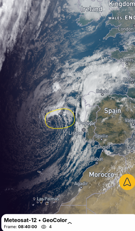
The low west of Portugal this morning will bring band of heavy rain and thunderstorms across Iberia today, before the low drift northeast over the Bay of Biscay arriving over NW France later on Monday, though weakening as it does so.
Monday will see high pressure continue to keep the majority of the UK dry and fine with plenty of sunshine. with temperatures reaching up to 25°C in the south and high teens further north.
Then the low moving in across NW France Monday night will introduce cloudier skies with some showers across southern England Monday night and Tuesday morning before tending to die out, with warm sunshine developing across many parts - with temperatures reaching high teens in the north, low twenties in the south. However, as the low begins to drift northwest towards southern Ireland, further showers look to spread northwards across SW England, Wales and Ireland later in the day. A few showers are also possible across NE England and eastern Scotland.
Chances for thunderstorms increases from Wednesday as an upper low dives down from the northwest into the Bay of Biscay before chances tail off from the west on Friday as the low moves on east. However, details over where will see greatest chance of thunderstorms remain uncertain for now - as track of surface lows differs between models.
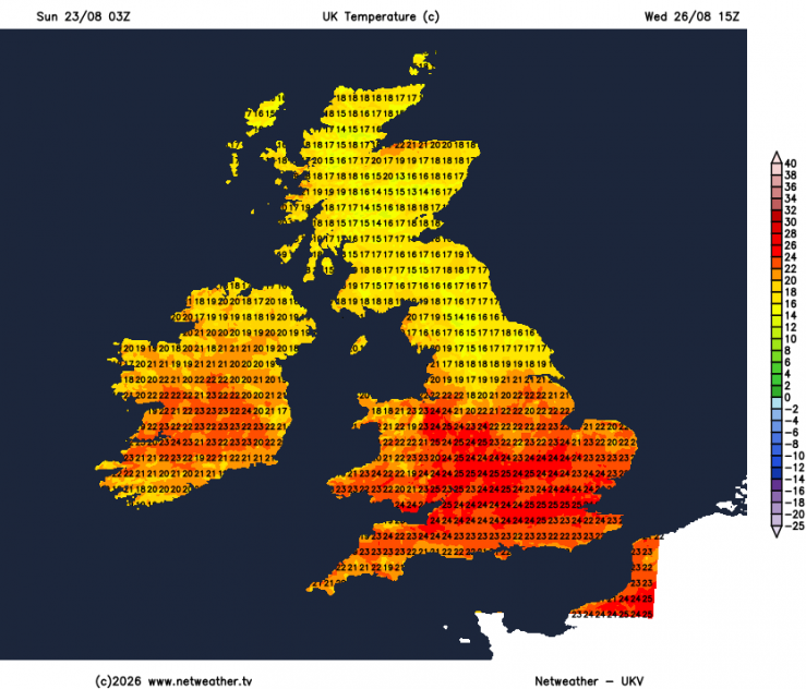
A weakening area of low-pressure will move in across Ireland on Wednesday, bringing cloudier skies and showery outbreaks of rain north across Ireland, SW England and Wales. Further east, possibility of some early heavy showers or thunderstorms clearing north through the morning, then it will turn noticeably more humid, as a southerly breeze develops, with temperatures lifting to 25-27°C across the south in any sunny spells, though skies could be cloudy at times, with further heavy showers or thunderstorms developing, particularly from the Midlands northwards.
Very warm and humid on Wednesday
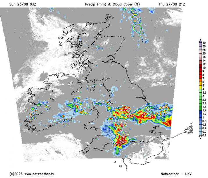
Thursday looks to see a new area of low pressure move in from the southwest toward southern Ireland. This will bring heavy showers, longer spells of rain, and localised thunderstorms northwards widely across the UK through the day. A risk of flash-flooding from possible intense downspouts in places. Drier and sunnier and weather may spread across southern areas in the afternoon, which could allow temperatures to reach 25C and feeling humid too.
Some uncertainty, with models diverging, but a new secondary low may develop later on Thursday towards SE England or near continent and move north across eastern areas on Friday - bringing a spell of heavy and perhaps thundery rain along with increasingly strong winds across central and eastern England and perhaps across southern Scotland later in the day too. Elsewhere seeing sunny spells and scattered showers. Temperatures will begin to fall as cooler air arrives from the northwest through Friday.
Potential for some very wet and stormy weather moving north on Thursday, but detail remains uncertain for now
The Bank Holiday Weekend looks to remain changeable but cooler with winds from the west or northwest bringing showers and occasional longer spells of rain, some sunny spells too.
Loading recent activity...