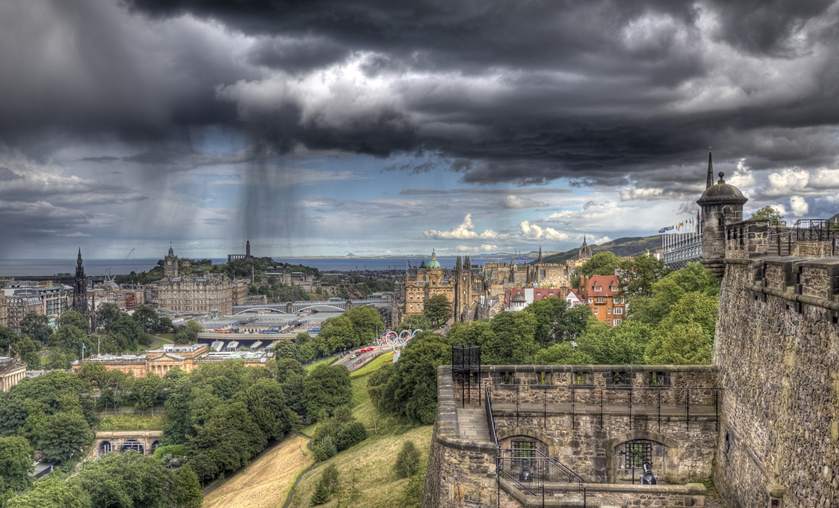
A day with some rain over the UK, following a night that managed to wet the ground slightly in many areas.
A waving front over the English Channel has been edging eastwards, bringing rain to the southern counties of England, finally! It’s not going to reverse the drought or six weeks of dry, hot weather but at least it is a refreshing change.
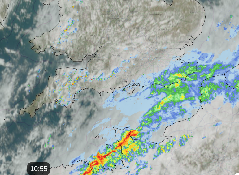
A low pressure centre is swinging in from the northwest and around that are plenty of showers. These include some heavy downpours and the risk of hail and thunder. Northern Ireland has a yellow warning for thunderstorms this afternoon and evening with up to 30mm of rain possible.
“Heavy showers and thunderstorms likely to lead to travel disruption and flash flooding in some places.”MO
Last night torrential rain caught out a group of campers in Dumfries & Galloway, SW Scotland. Galloway Mountain Rescue Team were called out in the early hours of Tuesday morning by Police Scotland, after four campers became stranded by Loch Enoch when the site flooded.
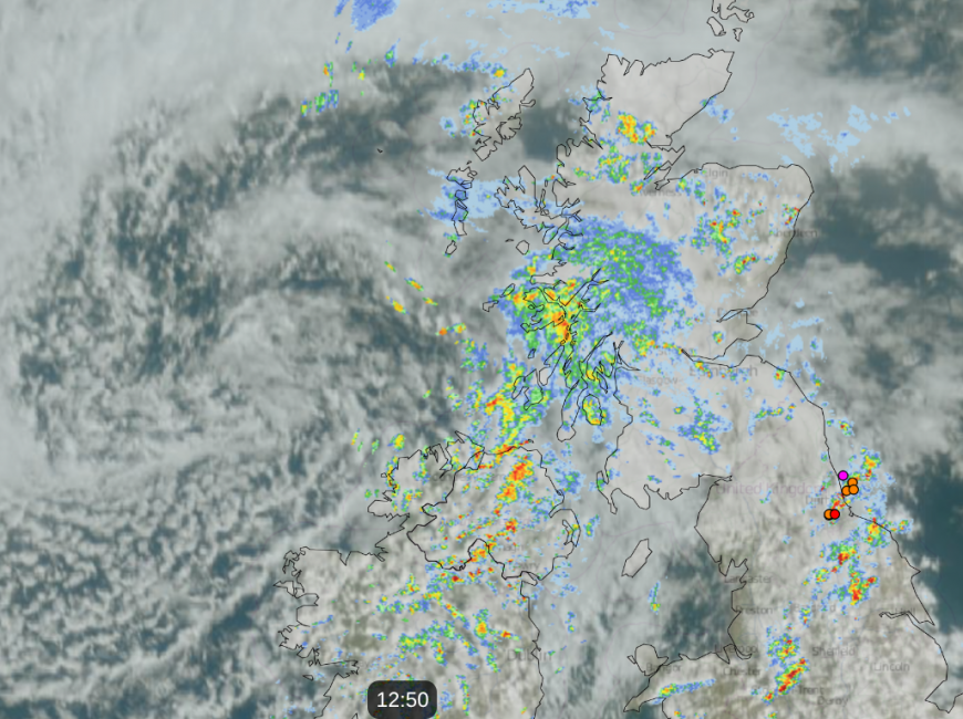
Netweather Radar 12:50 with coloured dots showing lightning strikes in past 30 mins
Eastern Scotland also has a yellow warning for thunderstorms later today (Weds 19th), including Aberdeen for the evening rush hour.
“Slow-moving heavy showers and thunderstorms are expected this afternoon, bringing some flooding and travel disruption in a few places.”MO
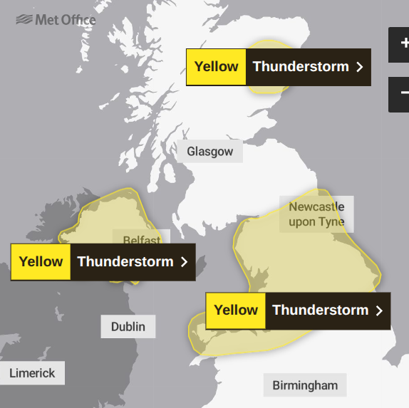
There is also a warning over northern England and north Wales from Wednesday evening overnight into Thursday morning. Thinking how hard the ground is in places, if there are sudden heavy showers which don’t move on very quickly, there will be a lot of surface water.
Other areas could see heavy showers; the warnings relate to forecast impacts. The Southern Uplands, also around the Humber and Lincolnshire, show signs of some lively downpours. Edinburgh looks to be on the cusp of wet weather from the west and a bit of shelter for the coast of the Firth of Forth. Take your brolly if you are off to the Fringe Festival today. It looks fine for the rest of the week.
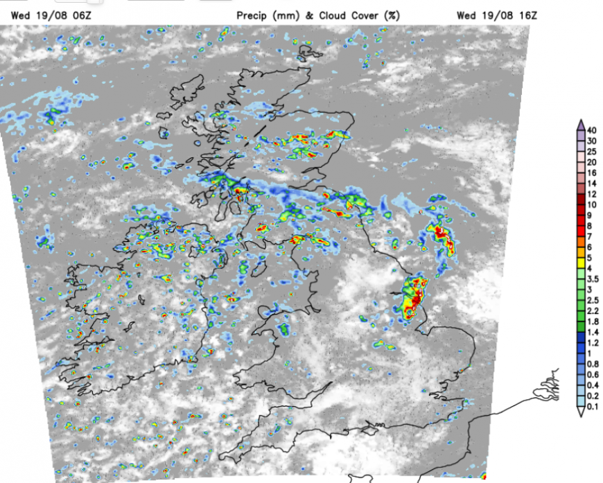
Overnight, the focus of the showers moves over northern England and around the Irish Sea. There will be some swinging into western Wales and SW England. A northerly flow will bring cooler air over a good part of northern Britain and the island of Ireland by Thursday morning. This will reach through the Midlands and Wales during the day. Daytime temperatures will be around 16 to 22C.
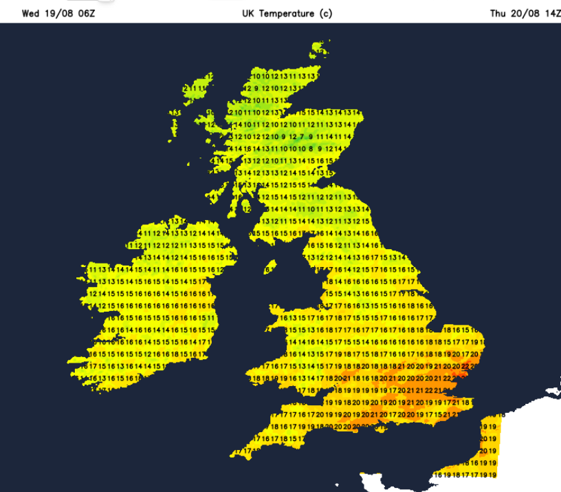
The bands of showers will shift southwards during Thursday. Through the afternoon, the risk of heavier showers will be over Wales, the Midlands and eastern England, heading for the M4 and London by evening rush hour. All these showers will be hit and miss, some locations seeing welcome rain and others missing out.
By Thursday night, the light northerly flow will be across all of the UK, with a fresher feeling in the south and a nip in the air for inland Scotland.
In the northerly flow on Friday morning, there will be a cool, sunny start inland for Britain but the risk of heavy showers for eastern/NE England and NW Wales. SW Britain and around The Wash could see some lively showers by Friday lunchtime. Otherwise dry and cool to end the working week. The weekend nights look cool, chilly in the north if you are thinking about camping.
Loading recent activity...