Tuesday splits the country in two. Rain is close to certain across Caithness, Sutherland and Orkney, where 15 to 20mm will fall, wettest before dawn and again in the evening. That is about four times what those coasts normally take on the date. The Outer Hebrides carry about an 80% risk with far less rain in it. Elsewhere in Scotland, and across Northern Ireland, Cumbria and Wales, there will be a 20 to 40% chance of a shower, rising to a 60% risk around Carlisle and in Ayrshire. London and the South East will stay mostly dry, and somewhere between Kent, the Thames estuary and south Essex should reach 25 to 26C in the afternoon. Today edges it, at 27C in London.
Forecast Rainfall into Tuesday
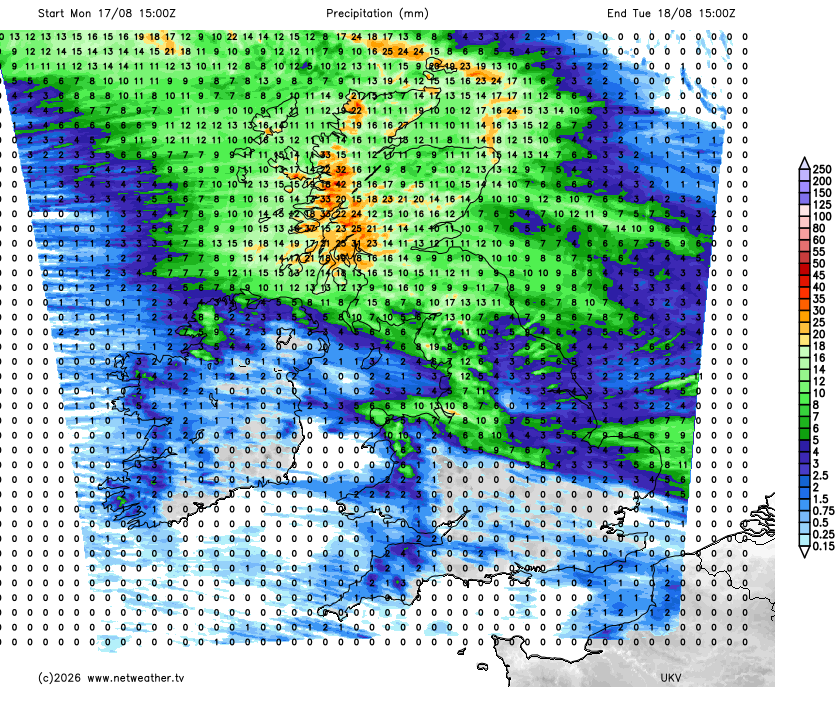
Rain reaches the Welsh Marches late on Tuesday evening and crosses the rest of England overnight. It moves into Wales and the Cheshire Gap around midnight and over the Midlands and northern England in the small hours, with Lincolnshire, East Anglia and the south coast last of all. Eastern England will be clear again first thing, and the rain should be moderate rather than heavy.
Forecast Rainfall Tuesday into Wednesday
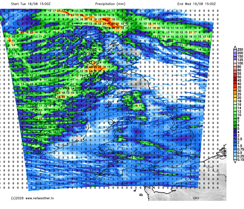
The low behind it, out in the Atlantic north-west of Ireland, tracks straight over the country on Wednesday, its centre over the Irish Sea by lunchtime. Daytime showers should be a northern and western business. There is a 50 to 70% chance of catching one across Scotland, Northern Ireland and the Pennine towns of Lancashire and West Yorkshire, and the heaviest of them should be over the Pennines and western Scotland. Southern and eastern England should be much drier once the early rain has gone, at a 20 to 40% risk, and the Midlands, East Anglia and Wales drier still.
Whether any of it helps is the harder question. The Environment Agency put almost three-quarters of England in drought on 10 August, after the driest July in 190 years, and fires across England and Wales prompted a national government alert on Friday. This week does not touch that. Between Tuesday and Friday, England and Wales as a whole will collect about two-thirds of the rain those four dates normally bring. The eastern counties, the Home Counties and the Thames valley will be drier than that, and only north-west England and the Pennine parts of Yorkshire are likely to reach or beat their average for the time of year. And on top of that, ground baked this hard takes water in more slowly, as a share of what falls runs off rather than soaking away - as well as not helping the drought situation, it can lead to the increased risk of flash-flooding during heavier bursts.
Forecast Rainfall Wednesday into Thursday
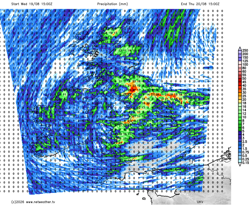
The low clears into the North Sea on Thursday, then pressure builds from the Atlantic west of Ireland, and by midday the wind over Scotland and northern England has swung round to the north while the south is still west-south-westerly. Rain will run west to east across northern England at first light, and showers should become widespread through the afternoon. Lancashire, Greater Manchester and Yorkshire are wettest, at a 60 to 80% chance, with a 50 to 60% risk across the Midlands and the Welsh hills. The south-east takes the tail of it, at a 30 to 40% chance. Thunder is possible where the showers gather, the risk peaking near 50% around Norwich.
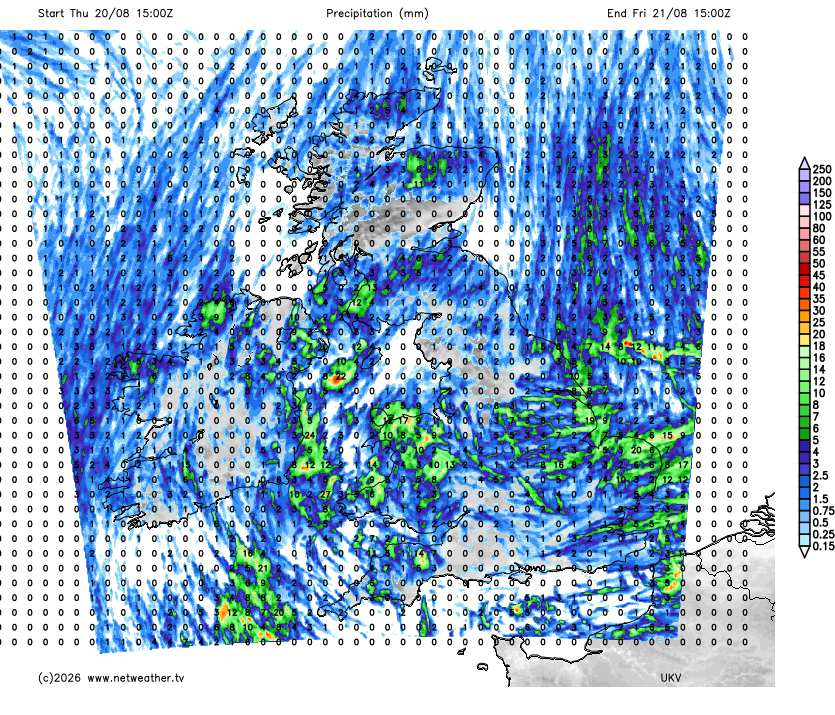
Forecast Rainfall Thursday into Friday
Friday morning is likely to be the coldest before the weekend. Sheltered glens in the central and eastern Highlands could fall to 3 or 4C under a clearing sky. Galashiels is likely to be nearer 8C. Expect 9 to 11C across the Pennines, the Welsh hills and the west Midlands.
The afternoon is likely to stay quiet. The ridge behind Thursday's change should settle north-east across Ireland and western Britain, the northerly holding with it, and nowhere carries more than about a 40% chance of a shower. Nowhere is certain to stay dry either. The two rainfall models part company on the afternoon: netwx-mr keeps a band of light rain over northern England and another into Wales and the south-west, while the higher-resolution UKV has almost nothing. Friday afternoon could run about four degrees below the late-August average nationally, and eight below it at Newcastle, which may reach only 14C.
Loading recent activity...