This afternoon will be warm and mostly sunny across central and eastern England, with 29C likely from the Mersey and Cheshire through the Welsh borders to the Severn. A ridge of high pressure lies across the British Isles. The light easterly round its northern edge comes off the sea, so the North Sea and Thames estuary coasts will sit at 20C to 22C. Cloud will be thicker over Scotland, Northern Ireland and the north-west. The only rain anywhere will be over the Outer Hebrides and the northern Highlands, where there is around an 80% chance of a shower during the day.
Wednesday will raise everything by five or six degrees. The ridge will transfer east onto the near continent and the flow over England and Wales will swing round to the south, drawing warmer air up its western edge. Close to 35C should be reached across the Severn valley, the Welsh Marches and south Wales. The Welsh coast will not share that evenly: Aberystwyth should reach 34C while Llandudno stays nearer 26C. Rain will be confined to the far north-west, with around a 70% chance of showers on Skye, wetter there than today.
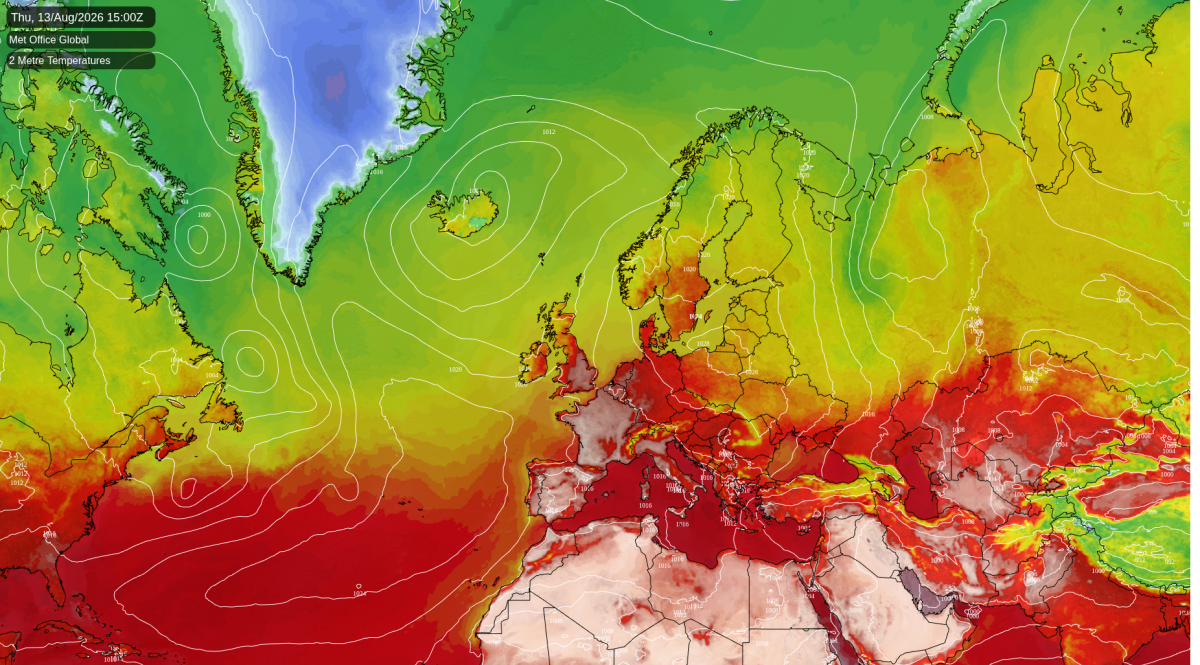
Thursday is where the heat tops out. High pressure will be centred over Denmark and northern Germany, with an Atlantic trough west of Ireland. Britain will sit squeezed between the two, in a southerly that runs the length of the country rather than up its western side. That is what swings the warm core east. Look for a potential 38C over London and the Thames valley, with the heat reaching north-west into the east Midlands and south Yorkshire under an almost cloudless sky. Leicester would be about fourteen degrees above its mid-August average.
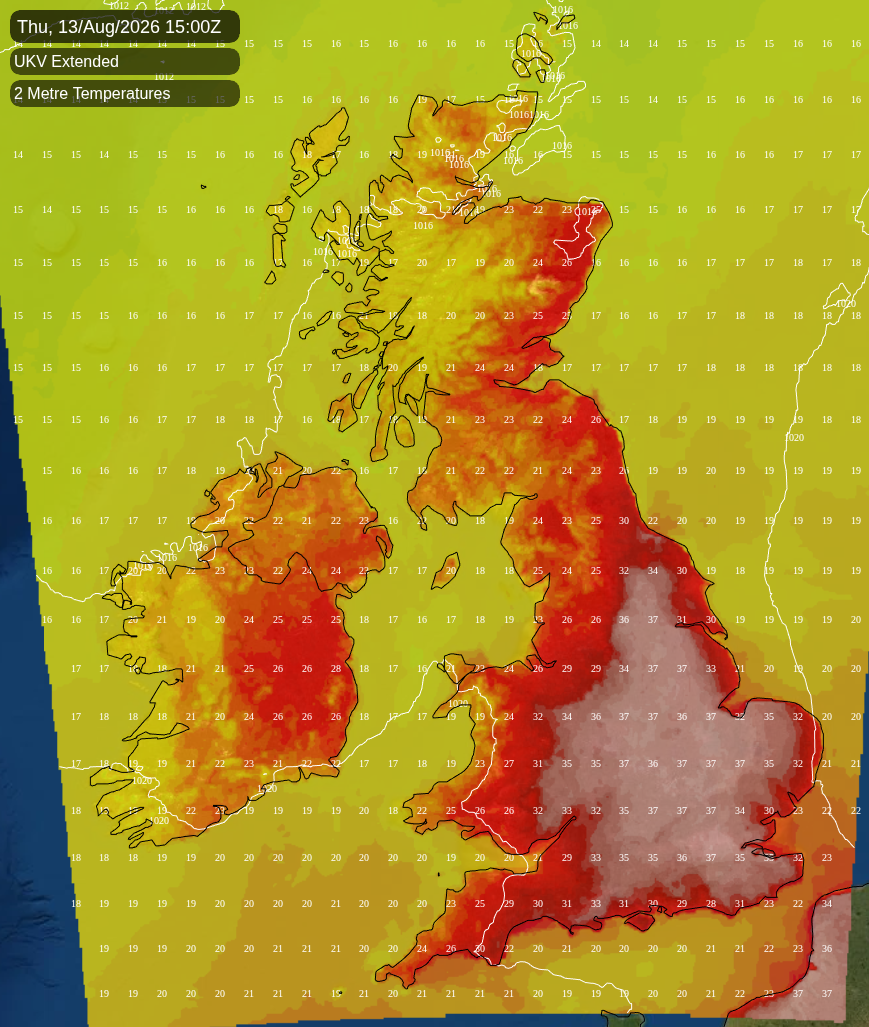
ECMWF, GFS and the Met Office all place that pattern the same way, so the shape of the day is settled. The figure itself could still move a degree or two either way. Amber heat-health alerts cover most of England from this morning until Friday evening, almost exactly the span of the hot afternoons.
Nights barely cool down in the middle of the week. London and the south coast will hold above 20C on Wednesday night and again on Thursday night, while Scotland and the north-west stay in the mid teens. Nineteen degrees will separate the country's two ends on Thursday.
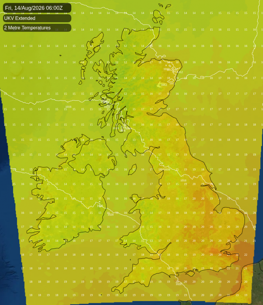
Friday will split the country in two. An Atlantic ridge will build from the south-west, push the continental high back towards the Baltic and turn the wind west to north-west, so the boundary between the two airmasses slides south-east during the day. North-west England is likely to manage only 19C to 21C by mid-afternoon, while Essex, Kent and the Thames estuary could hold 30C under a slot of clear sky lasting into the evening.
Saturday is quiet and ordinary. Brighton is likely to reach 26C and Kilmarnock 16C, with showers running along the western Highlands and the Great Glen at around a 70% likelihood. The Netweather medium-range model brings showery rain across the Channel into Kent, Sussex and Hampshire in the evening, and the Met Office's high resolution model keeps it offshore. A 30% risk covers both.
Rain will arrive from the west on Sunday, and this time it reaches well beyond the Highlands. There is an 80 to 90% chance of it across Northern Ireland and Scotland, with Londonderry and Argyll the wettest places in the country by evening. North-west England, Yorkshire, Wales and the south-west carry a 60 to 70% chance. The Midlands have an even chance. Eastern England and the south-east are most likely dry, with about a 40% risk of a shower. The models part company here. The Met Office's global model drives a low along the north-west approaches and wrings a lot out of it, while ECMWF and GFS both hold their Atlantic low much further west. The western half of the country gets wet in all three; the amounts and how far east the rain reaches are open. Saturday night will be the coldest night before the rain, down to 5C in the Welsh hills under clear skies.
Loading recent activity...