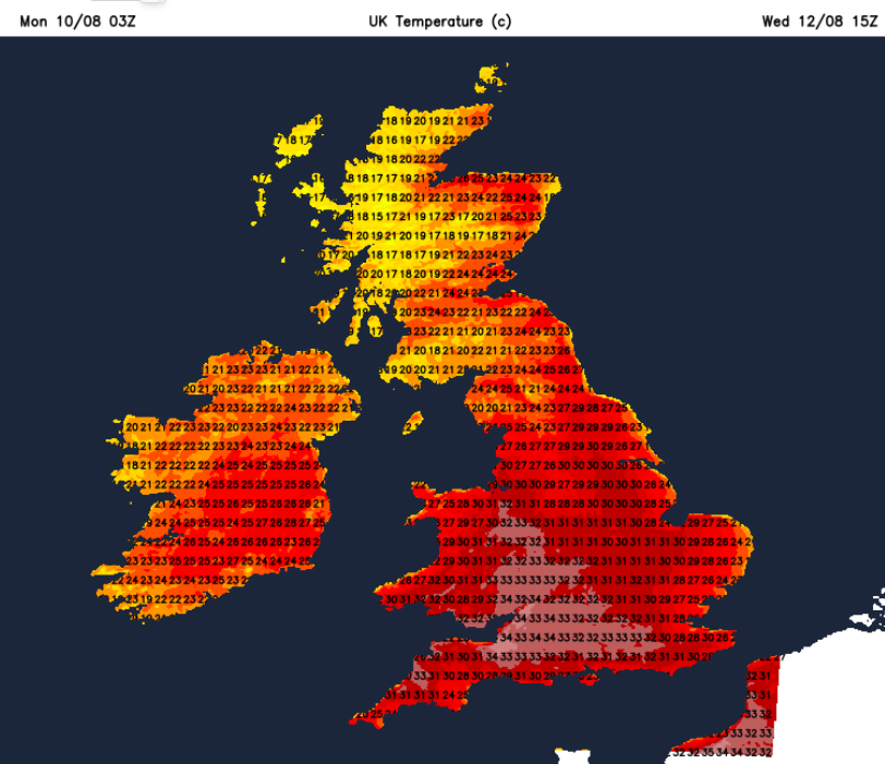
On the way is heatwave number five for summer 2026 as temperatures move back into the high 20s and 30sC, with 36C predicted later this week. There is the possibility of 37C for southern Britain by Thursday. The UK August maximum temperature record is 38.5C from 2003 at Faversham in Kent. This returning heat, with more dry weather, means even more strain on our water supply.
The National Drought Group is meeting to decide if more regions of England will be declared as being in drought.
Update 9pm Monday 10th "Almost three-quarters of England is now in drought". The East Midlands, Lincolnshire & Northamptonshire, Kent & East Sussex, and Solent & the South Downs became the latest to move into drought status today. 45 million people are now in a drought area with over 27 million people now living with restrictions on water use. The North East, and Yorkshire, have moved to prolonged dry weather, the stage before drought.
By the end of July, half of England was in drought, and all of Wales, as most of eastern Scotland experienced ‘moderate/significant water scarcity’.
Environment Agency for England “Rivers are running low, farmers are having to harvest crops early, wildfire risk is increasing, and millions of people are living under restrictions on water use.” July 2026
Restrictions are likely to reach more people by next weekend and could extend to businesses. Many individuals are under TUBs, the Temporary Usage Ban (or hosepipe ban), but the next level up would be a NEUB.
“A non-essential use ban (NEUB) is a more serious step that water companies can take if dry conditions continue after a hosepipe ban has been introduced. While hosepipe bans mainly affect households, NEUBs specifically target businesses.” Ofwat
Drought is likely to be declared across more of England this week as there has been little or even no more rain this month. Wisley in Surrey has recorded zero rainfall for 54 days. The previous record was 36 days in 1976.
“Public water supplies remain under increasing pressure with continued dry weather and high demand. Over 25 million people have restrictions on their water use.” Environment Agency 7th August
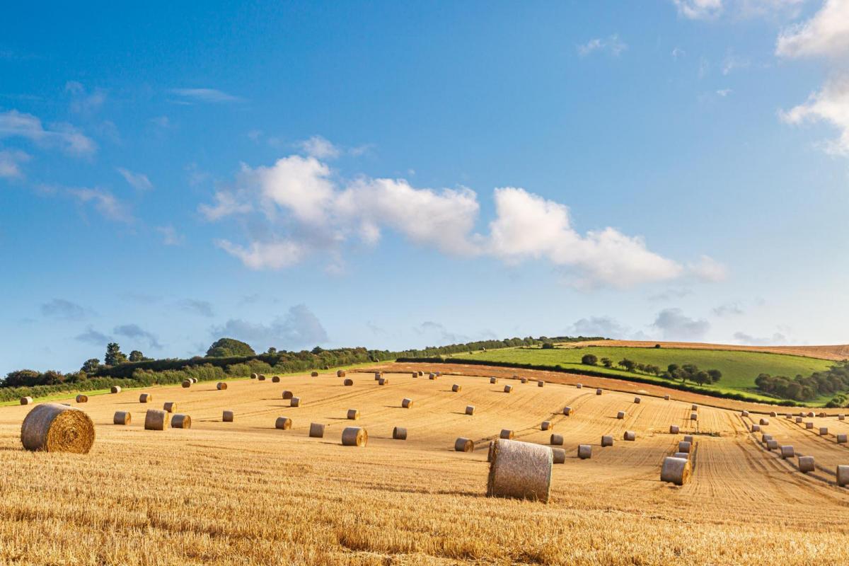
As reported on BBC Radio 4’s Farming Today on Monday, farmers are reporting reduced crop yields, poor grass growth and pressure on winter livestock forage stocks. There are water abstractions in place to protect low river flows, which also lead to algal blooms, fish deaths and deteriorating water quality.
The very high risk of wildfire spread continues for the southern and central two-thirds of England and Wales. There is no significant rain in the forecast (away from NW Scotland) and another widespread heatwave this week for drought-hit areas.
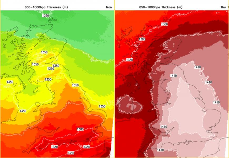
The change of airmass from Monday to Thursday
Before the fifth heatwave begins, 2026 has recorded 34 days when temperatures have reached 30C or above. This equals the 1995 record of 34 days, so that will be broken this week. There will be increasing heat by day and at night.
We are not even seeing the impacts of the Super El Niño yet. However, around the world, temperature records are being broken in many countries. Historic heat at Hong Kong observatory, hottest day and night on record (data via Extreme Temperatures around the World on BlueSky). Stations in China, Japan and the Philippines have been breaking local station records. In South Korea, Seoul Incheon saw their hottest night ever on record, with a minimum of 29.5 C. In the Middle East, Abu Dhabi Bateen Airport has broken its highest maximum temperature with 48.3C and highest minimum at 36.4C. Imagine that, a nighttime value that is the same as the top temperature forecast for us in the UK during the day, in full sunshine!
Central eastern Europe has just seen intense heat in the past week for Italy, Slovenia, Poland and Croatia. Kiev, Ukraine, recorded its hottest night on record with a minimum of 26.0C, truly a tropical night.
Croatia, Serbia, Italy and Sardinia all remain on red heat warnings for Monday 10th August. France has yellow and amber heat warnings for tomorrow (Tuesday), and it is this heat over the near continent which will move over much of the UK.
Remember the Met Office can issue Amber or even Red “Extreme Heat” warnings much like the heavy rain or strong winds warnings. These consider the impacts across a region as well as the high temperature values.
“Extreme heat not only affects us but can also place strains on water and energy utilities, road and rail transport and the health and fire services.” Met Office
Today
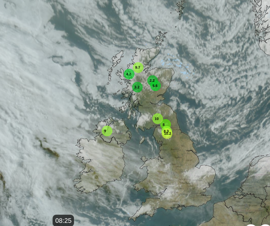
Netweather Radar 0825 Mon 10th showing very little rain, areas of cloud and ten lowest temperatures at 8am
There is a coolness in the air for northern Britain and Northern Ireland to start the working week. The area of thicker cloud over The Wash is a fading weather front which once again failed to bring any rain to southern Britain. High pressure is over the UK for Monday, bringing more settled and dry weather, but you can see a shield of white cloud out in the Atlantic. This is associated with a large low pressure which viewers hoping to see the partial solar eclipse on Wednesday evening will be keeping an eye on. Forecasts coming soon.
For Monday: 19C in Edinburgh for the festival, Belfast 19C, Cardiff 24C and London could reach 27 or 28C in the afternoon sunshine. On Tuesday there will be damp and cloudy weather for northern Scotland, particularly the Western Isles. Elsewhere, fine and bright, often sunny. Many areas will feel warmer, a few degrees higher than on Monday, except around the Thames estuary, Essex into east London. Here an east to SE breeze will just lower the temperatures.
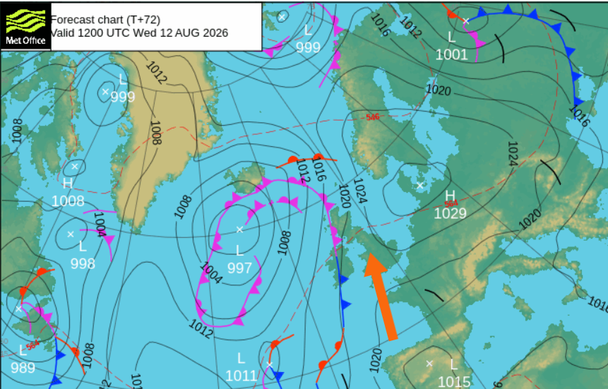
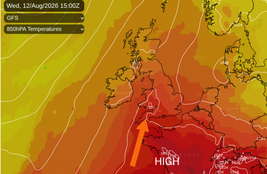
As the high pressure slips eastwards over Denmark, this allows the European heat to surge up over the UK. The winds will fall light, from a southerly direction. With high pressure just to the east of the UK, there will be slowly descending air, plenty of sunshine,and bone-dry ground - all allowing the heat to build for Wednesday and Thursday until it is shoved eastwards on Friday.
Glasgow up to 24C by midweek as Scottish schools return. Newcastle 30C by Thursday. Manchester 32C, Bristol 34C and for Norwich perhaps 35C by Thursday. Greater London might see 36 or 37C. We await the drought updates.
Loading recent activity...