El Niño continues to intensify steadily this summer and is expected to dominate global climate patterns in the August-October 2026 season, increasing the likelihood of above-normal temperatures across much of the world and driving significant shifts in rainfall patterns, according to the World Meteorological Organization. Combined with exceptionally warm global oceans and the likelihood of a positive Indian Ocean Dipole, the developing El Niño is expected to shape weather patterns across many parts of the world in the months ahead.
El Nino signified by the warmer than normal waters in the central and eastern tropical Pacific
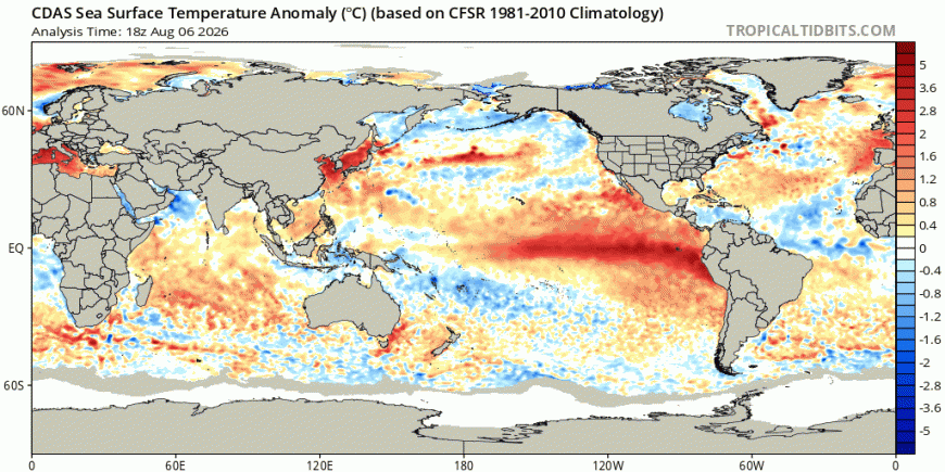
The event developed unusually fast through mid-2026, outpacing historical benchmarks like the 1997–1998 event, with central Pacific indices climbing past +2.1°C above average. The new ECMWF seasonal forecast shows the event peaking near +4.0˚C in December — obliterating the previous Super El Nino record.
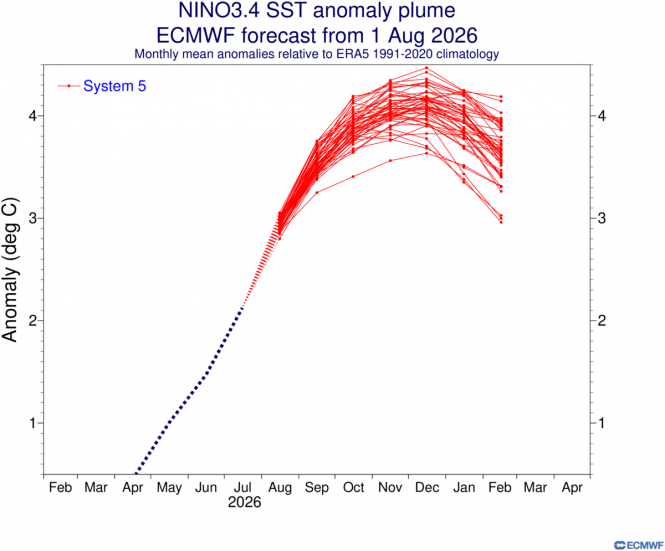
El Nino tends to be strongest during the winter months, and its global impacts are typically most significant in the northern hemisphere winter, though impacts on weather patterns are likely from this autumn and through 2027.
A super El Niño indirectly impacts Europe by intensifying summer heatwaves - as we have already seen this summer, but shifting weather patterns toward milder and wetter than average conditions later in autumn and early winter with increasingly active Atlantic storm tracks
As El Nino tends to indirectly affect weather patterns in Europe, the trend to wetter-than-average conditions this autumn may be gradual and may not occur until later in autumn. Southern Europe may see wetter than average conditions early on in autumn, due to anomalously high sea surface temperatures that have built up in the Mediterranean over summer, locally as high as 32C in the western Mediterranean, with the exceptionally warm waters lingering into autumn. The seasonal cooling of the air aloft as day length shortens and higher latitudes cool above these very warm seas and also strengthening of the subtropical jet stream, typical of strong El Nino events, will likely increase the risk of above average rainfall in September and October across southern Europe initially, looking at the latest ECMWF seasonal forecast, before rainfall increases above average across NW Europe, including the UK too in October - December period.
ECMWF seasonal forecast suggests the dry weather will end this autumns, as a wetter signal grows stronger in the October - December forecast.
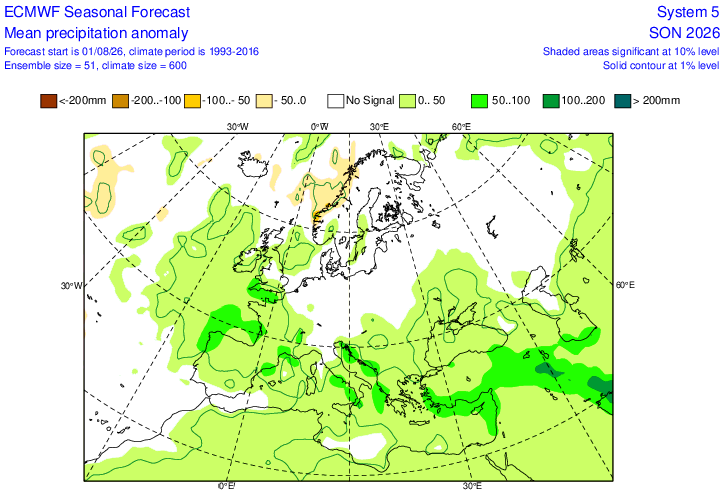
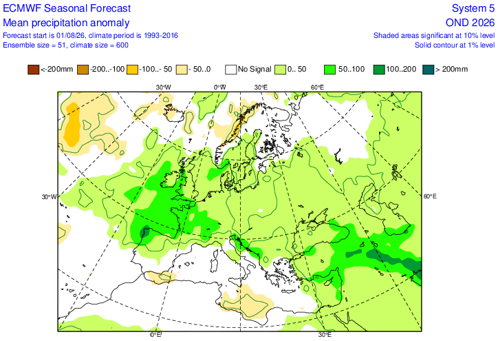
ECWMF seasonal indicates low heights / pressure will dominate through autumn
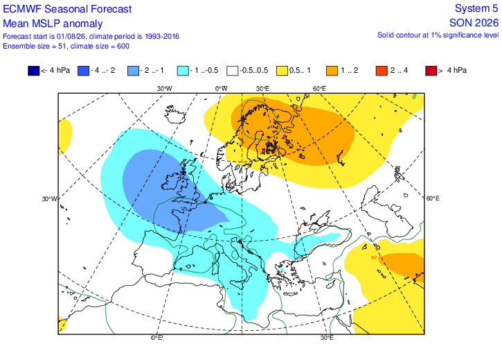
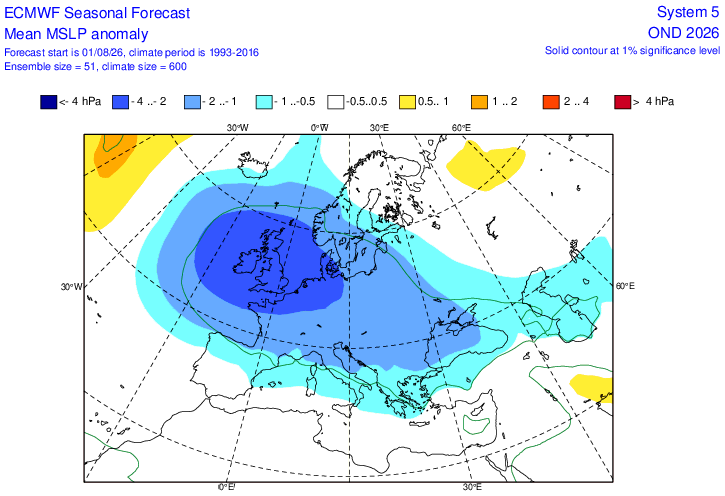
For the Netweather seasonal forecast we use composite 500 hPa pressure patterns that prevailed in years with a similar ENSO state - whether El Nino, La Nina or neutral and weak or strong events.
With a very Strong ("Super") El Niño expected later this year, we look back at the few years that featured such events - which are determined by ocean temperature anomalies exceeding 2.0°C above normal.
The 3 autumn months during these strong El Nino events in the past, albeit only 3 sample years, give a composites at 500 hPa as below, using reanalysis of those years.
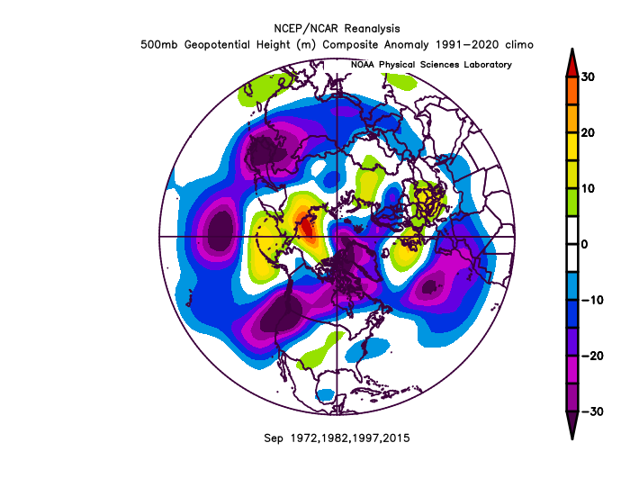
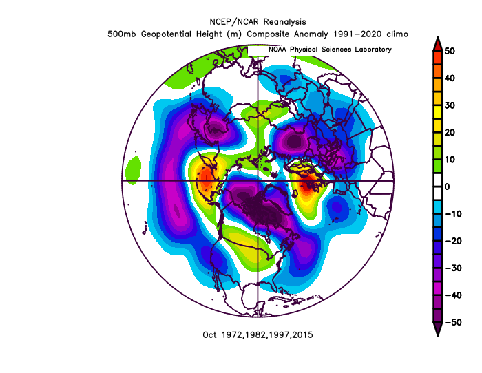
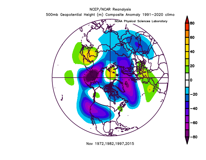
It does show higher heights / pressure dominant in September and October, but lower heights / pressure in November. This doesn’t really fit the forecast from the ECWMF seasonal.
If we look at a composite of years where a El Nino developed late spring / early summer into a strong event, like this year, when El Nino was officially called in June, it looks like below for all 3 months. Those years were 1965, 1972, 1982, 1991 and 2023. Still a high pressure signal for October, but low pressure for September and November.
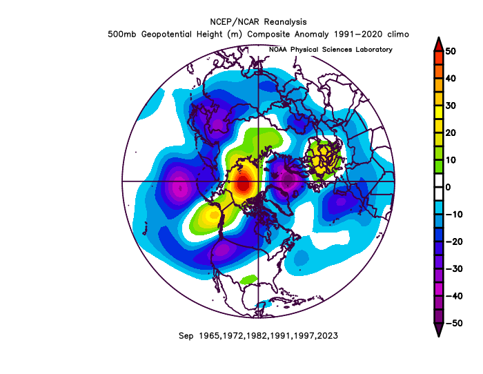
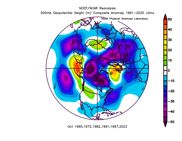
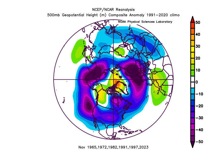
So, given the ECMWF seasonal forecast update suggests low pressure in charge in the mean in the autumn with rainfall increasing to above average in the south and west, we may be in for a wet autumn, more particularly October onwards based on the forecasts. However, temperatures are also forecast to be above average. Using the analog method of composites of years that had El Nino develop late spring / early summer, it looks more mixed with a strong signal for high pressure in October, but strong signal for low pressure dominating in November. September less clear cut.
Even if autumn turns out wet, rainfall will have to be a well above average to make up for the deficit in rainfall across drought-stricken areas of England and Wales since last winter.
Loading recent activity...