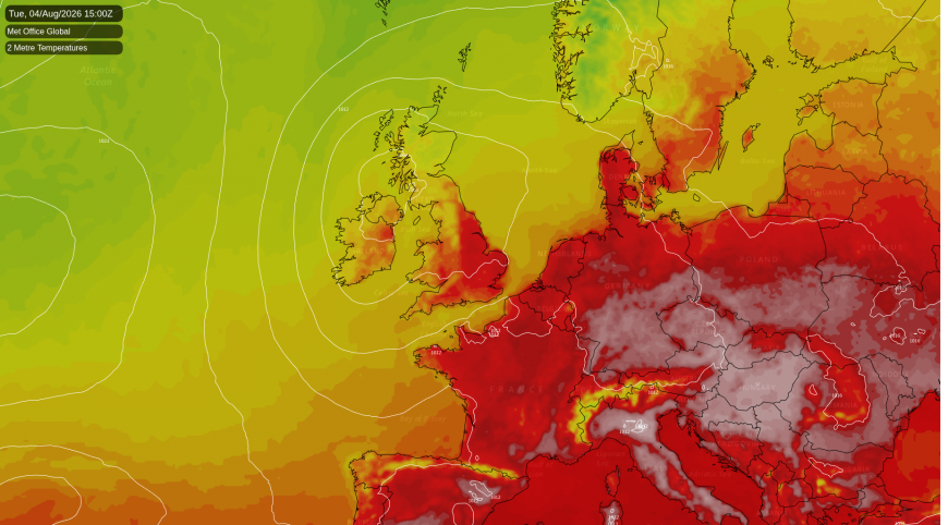
Tuesday is the last hot day of this spell, though not the hottest: today edges it, with around 34C expected this afternoon in the south-east. Tuesday still reaches the low thirties in the eastern counties, with the high twenties widely through the Midlands and south-east. UKHSA has amber heat health alerts across the East Midlands, East of England, London and the South East, and yellow alerts for much of the rest of England. All expire at 9am on Wednesday, roughly when the weather changes.
That heat is confined to one side of the country. A low of around 1008 hPa over Ireland and the Irish Sea leaves England in a warm south-westerly feed ahead of it, while Scotland sits on the cooler, moister northern flank of the same system. The Northern Isles and Hebrides manage only 14C, under rain that turns heavy over the western Highlands. Wales and the far south-west catch scattered showers, while the Midlands eastwards stay dry. Coastal exposure counts even on a hot day: the Sussex coast holds around 23C while east Kent reaches 31C, the sea breeze biting a few miles inland.
Northern Britain has a wetter day, and a Met Office yellow warning of thunderstorm covering all six counties of Northern Ireland, valid from 1100 to 2000 on Tuesday. Rain probabilities peak in the mid fifties through the afternoon and evening, with the heaviest bursts late in the afternoon and into the early evening. The chance of thunder at any given spot holds at about 20% across the warning period: a possibility rather than something to expect. Most places will get heavy showers and hear nothing, but anywhere catching a storm could pick up a lot of rain quickly.
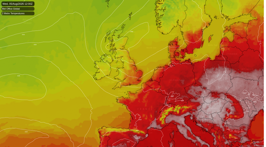
Wednesday is when it turns. The low deepens to about 1004 hPa and tracks north-east while the Atlantic ridge builds behind it, leaving the UK squeezed between the two in the tightest pressure gradient of the week. Gusts reach the mid forties on exposed western coasts and 30mph or more well inland, though Scotland sits out of it, staying under 20mph. The eastern counties fall back to 24C, eight degrees down on Tuesday, and the country finishes about 3C below average. The models put the low in different places, ECMWF over Scotland and the Met Office's global model further south-west near Ireland, so where the strongest winds occur is still open.
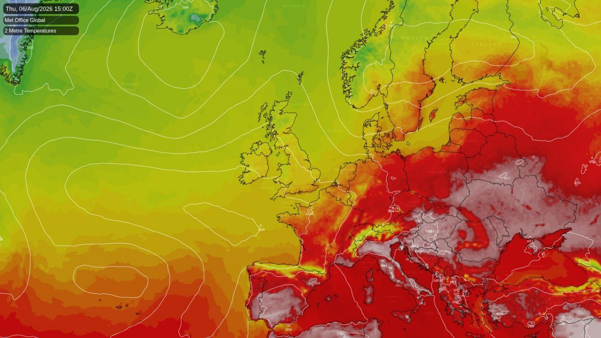
Thursday is the coolest day of the week against average, about 4C below it, and parts of eastern England reach only 17C where 25C is normal. Winds swing north-westerly and ease, with a few showers in the north and west. The Met Office model keeps a shallow trough over the country through the day, while ECMWF builds high pressure in more firmly, so there is a chance it turns drier and quieter than expected.
Friday quietens down further as pressure builds, though the breeze does not disappear entirely: gusts still reach around 30mph in exposed spots. Clearer skies overnight let temperatures fall away inland, to around 6C in the coldest sheltered valleys and single figures in rural parts of Wales, the Marches and inland southern England, while towns and coasts hold in the low teens. ECMWF is keener than the Met Office model to build the ridge right over the country, so if that verifies Friday would be calmer still and the night colder than the figures suggest. Afternoons reach about 22C in the south-east either way.
In context, this follows a July that was record warm, dry and sunny in parts of southern England and Wales, with large areas of England under 1mm of rain all month, though far less remarkable further north. This week changes little: what rain there is falls on Scotland and Northern Ireland, while the driest ground in the south and east stays mostly dry.
Netweather's month ahead outlook, covering 10 August onwards, keeps that north-south split running, with the southern half of England around 2C above the long-term average and most of England and Wales on the dry side of normal.
Loading recent activity...