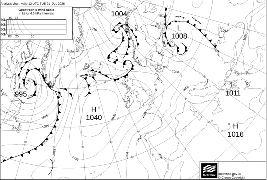
High pressure sits to the west of the UK this week and keeps most areas dry and warm through to Friday, with the strongest sunshine across England and Wales. Temperatures reach the mid-20s widely and climb into the high 20s in southern England later in the week, around 25 to 29C in the warmest southern counties. Winds stay light, so it feels very warm wherever the sun is out, and UV levels run high in the clear spells, worth a thought for anyone outdoors for long stretches. In the south-west, heatwave conditions look likely to continue, though this is well short of earlier in the month, when temperatures peaked at 35.5C.
High pressure to the west of the UK on Tuesday lunchtime
Northern Scotland and Northern Ireland stay cooler and cloudier, with light showers or drizzle mainly on windward western coasts and hills, and the far north cloudy and cool on Wednesday. Northern England keeps warm sunny spells and stays largely dry, with only an isolated afternoon shower, and a few showers are possible across East Anglia. Northwest Scotland is the one part of the country likely to see anything more than passing rain before the weekend.
July has been exceptionally dry across much of the UK. Parts of the south and south-east have gone more than a month without meaningful rain, and weather stations in the south-east have measured no rain at all for a fortnight. In Scotland, SEPA has eastern catchments including the Tweed, the Don and the Firth of Forth in moderate water scarcity, with July flows on the Tweed at Coldstream the second lowest recorded there since 1971. The ground is dry, the wildfire risk is raised in places, and there is little relief for gardens, farmland and low rivers. On the community, attention has turned to the weekend and the first sign of rain.
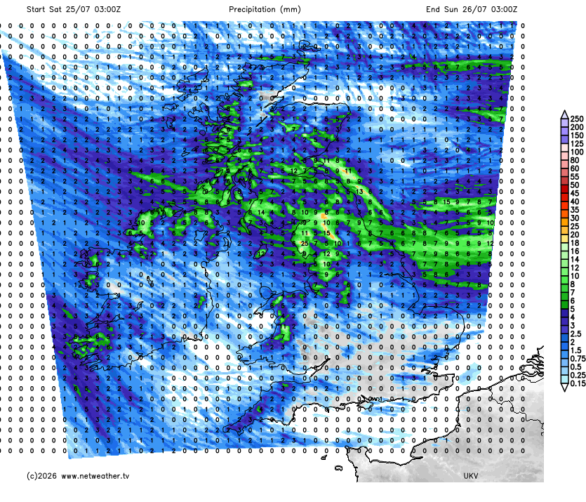
That rain arrives on Saturday. Outbreaks of more widespread rain look likely to push into the north, turning things more changeable, with many areas seeing some rain at times followed by showery bursts across the north and north-west. How far south and east that rain reaches is where the models differ: the faster runs spread it across much of the country through Saturday and Sunday, while the slower ones keep the south largely dry into the start of next week.
Loading recent activity...