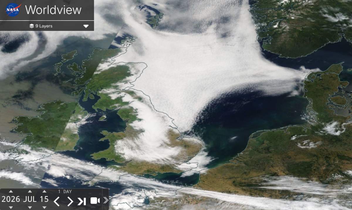
For the end of the week, we will see the easterly flow back to a northerly one. Over the past few nights, a blanket of low cloud has crept in, giving grey, cool mornings which offer the hope inland that the sun will appear. This flow around a high pressure to the north has been steady as the east coast of Britain recognises the rhythm of the seafret or haar. The satellite image from Wednesday shows how the low-level layer covers the coastal plains but seeps into the valleys and glens inland. It creates these dendritic patterns, like tree branches.
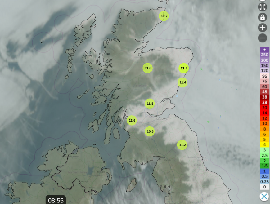
Netweather Radar showing low cloud from North Sea before 9am Thursday and lowest temperatures
The top NASA worldview image contains two satellite passes, one from late morning as the cloud begins to thin. You can see how the Cumbrian Fells and the higher parts of the Southern Uplands have stopped the cloud blanket's progress as it travels westwards on Wednesday. The North Sea is mostly white, a reservoir of cloud ready for the next night until the wind changes.
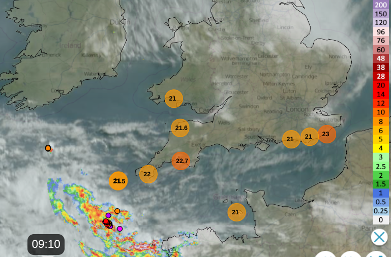
On Thursday, the cloud didn’t reach into the Midlands; the winds are lighter today. There will be a northeasterly breeze for Essex and Kent, and for the Channel Islands. You can see on the Netweather Radar echoes away to the southwest and coloured dots from lightning strikes. Jersey has a risk of a thundery shower this afternoon but the UKV model keeps any rain just offshore on Thursday. It will be close to the south coast of Cornwall, with more medium-level cloud over the Channel.
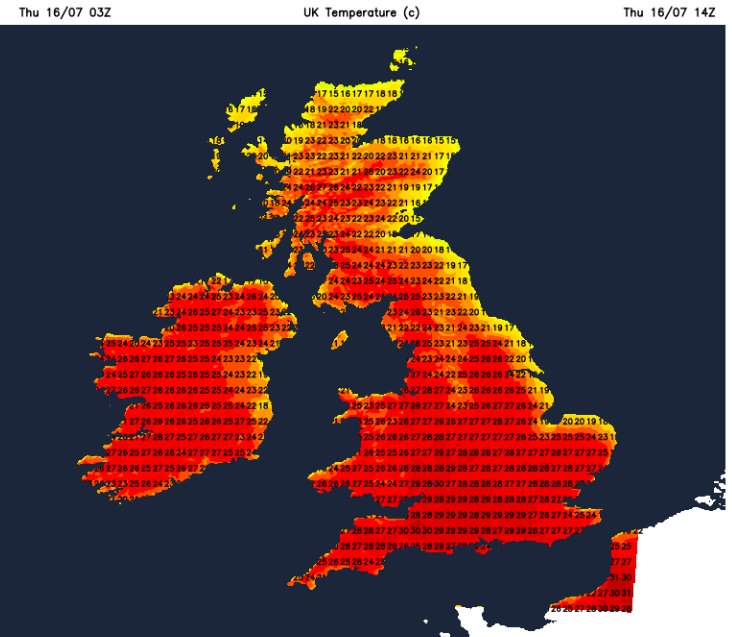
It will be another very warm or hot day for most of the UK. Temperatures will reach into the mid to high 20s Celsius, up to 30C for a few parts of inland England, also possibly Cardiff, and very likely for London. Hurn near Bournemouth Airport reached 30.5C on Wednesday 15th as Tiree off the west coast of Scotland saw 15.4 hours of sunshine. For those stuck under the low cloud along the east coast of Britain, temperatures will be 16 to 18C.
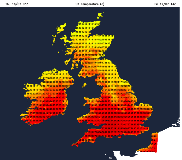
As the High begins to drift westwards over the north Atlantic, the flow will change to the north. By Friday morning, the low cloud will be over more of northern Scotland and along the eastern counties of England, but not reaching so far inland. So Edinburgh will have a sunnier morning and could reach 20C. After the heat of Thursday, those areas in northern England that have sunshine may not feel as hot with the northerly flow. The sun will still be strong with high UV.
There is a small risk of an isolated shower for southern England later on Friday but the theme of more dry weather with warm sunshine continues, away from the North Sea blanket. The cloud in the far north will bring some patchy light rain at the weekend.
Loading recent activity...