




Wednesday is St Swithin’s Day, the 15th July which, according to the proverb, serves as a forecast for the next 40 days. If it rains, then 40 wet days will follow. If it is fine, then it should stay dry.
This is not the most robust of forecasting tools, but for the next ten days, some parts of the UK will see little rain as the very warm and dry conditions remain.
Schools in Northern Ireland and Scotland have already broken up for their summer holidays, into week three now. For England and Wales, the end of the summer term is approaching, this week or next. We would be expecting a change in the weather, ready for the kids being off school.
There are hints that there could be a change on the way for the following weekend, not this weekend. The European ECM model brings an Atlantic influence with bands of rain and plenty of showers over the UK. However, there is uncertainty as the GFS model is less unsettled, showing a few clusters of heavy showers over East Anglia and SE England. These would be very hit and miss and more likely to result in surface runoff than any useful rain soaking into the parched ground.
What can happen with a change after a long, steady spell, is that the timing drifts. The high pressure sticks around for a while longer, and so the shift to rain and blustery winds doesn’t materialise until a few days later.
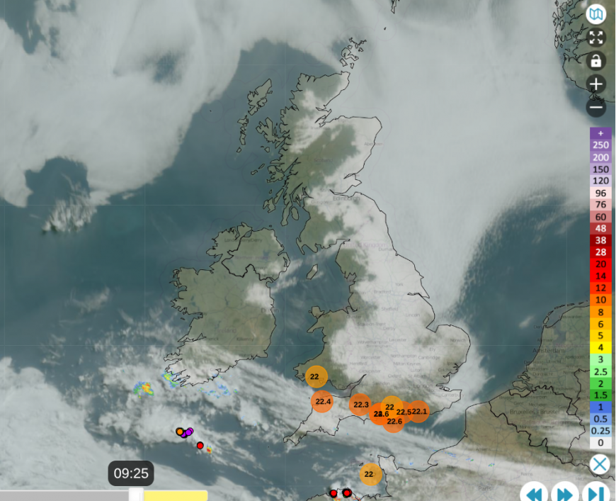
Netweather Radar 09:25 Early morning haar or fret from North Sea with lightning away to SW of UK
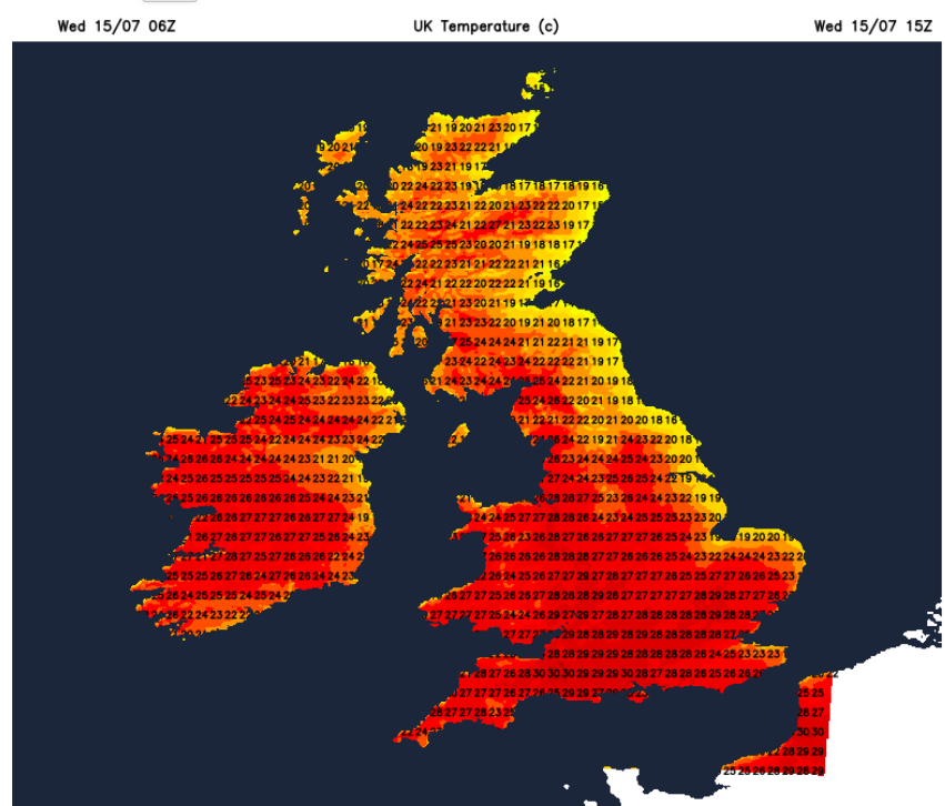
Today, high pressure is centred north of Scotland with a low pressure NW of Iberia. Around the High, there is plenty of low cloud, haar/sea fret flowing off the North Sea, bringing a cooler, grey start for parts of Britain. Through the day, this is eroded by the hot sunshine as the ground heats up. Temperatures away from the east coast are reaching 24 to 30C today, tomorrow and Friday. You can see on the earlier radar coloured dots showing sferics (lightning strikes) over northern France, as much of France remains under Heatwave warnings.
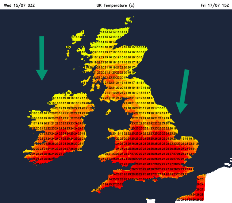
One change will be that the centre of the High shifts to the north Atlantic. The winds will back from the midweek E/NE to a light northerly, which will bring temperatures down for more of western Britain and Northern Ireland.
That northerly influence remains on Saturday and as temperatures edge down into the mid 20sC it could bring to an end the run of temperatures exceeding the Heatwave criteria. Heatwave3 has not been as humid or extreme in temperature values as Heatwave2 in June, when 37.7C was reached. However, it looks like it could hold out for 14 days, a fortnight, in parts of central southern and western England. This heatwave will be remembered for its longevity, set in a pattern of heat and dry weather.
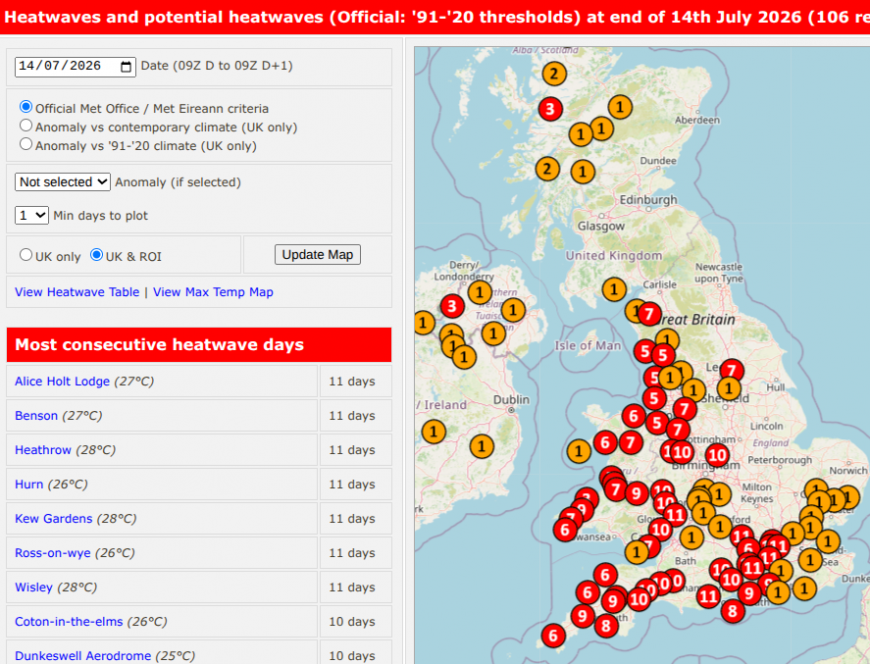
Western Scotland at 2 or 3 days with inland parts of England at 10 or 11 days at Heatwave criteria by end Tues 14th. Roost Weather
Saturday night will feel rather fresh if you are camping or out late. By Sunday, the winds will have backed to a westerly over Scotland, which will bring a real change from the heatwave conditions of midweek and allow the temperatures in eastern Scotland to rise. It has been much cooler and fresher for North Sea coasts in recent days with the breeze off the sea.
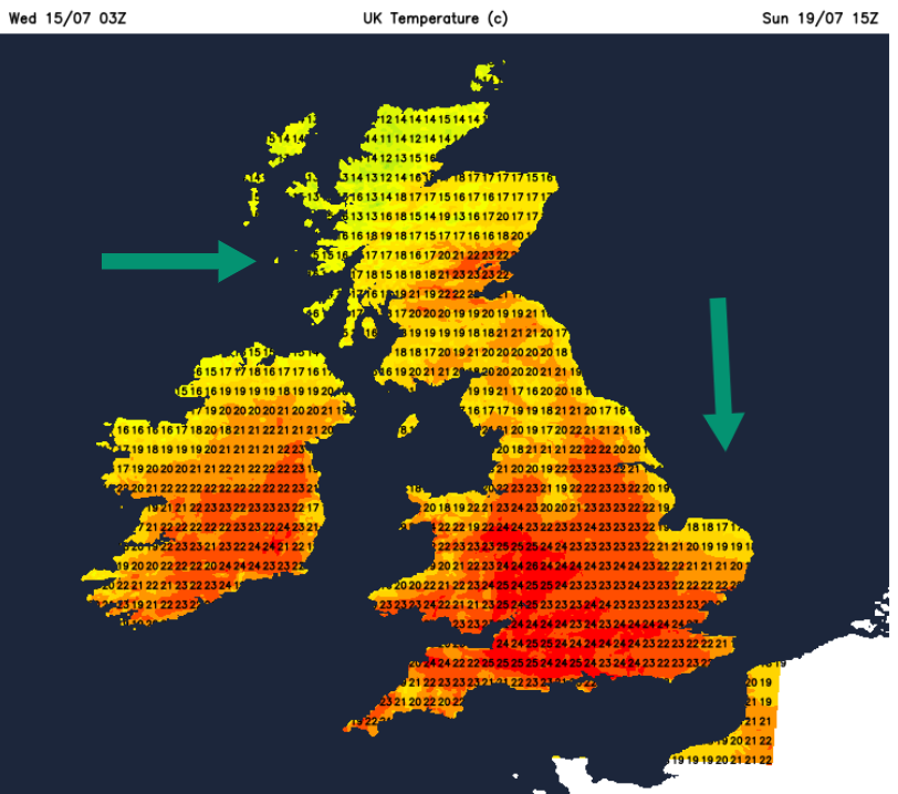
The northerly flow will bring some thicker cloud over mainland northern Scotland and the Western Isles, which will include a bit of patchy rain on Saturday, even showery bursts for Grampian. This band quickly fades but the odd shower might clip the North Yorkshire Moors as it moves southwards. And more again from the far north around Sunday lunchtime.
Much of the UK will remain dry and the list of water companies with usage restrictions is growing.
Anglia Water has a Temporary Usage Ban (TUB), a hosepipe ban.
“Anglian Water asks customers to help conserve precious water …Many rivers in the East are at notably or exceptionally low levels and reservoirs are at lower levels than expected for the time of year.”
“This decision to introduce the ban follows months of prolonged dry weather, warm temperatures and three successive heat waves, which have seen the company producing 30% more water than usual, as well as heat-related challenges affecting normal water treatment and production.”
Affinity Water has also introduced a TUB for their Central region, covering Bedfordshire, Berkshire, Buckinghamshire, Hertfordshire, Surrey, and parts of London and Essex.
Cambridge Water’s website says “A temporary hosepipe restriction is in place”
Southwest Water is introducing a TUB “From 12:00 (noon) on Tuesday 14th July, a hosepipe ban will apply to some parts of Devon.”
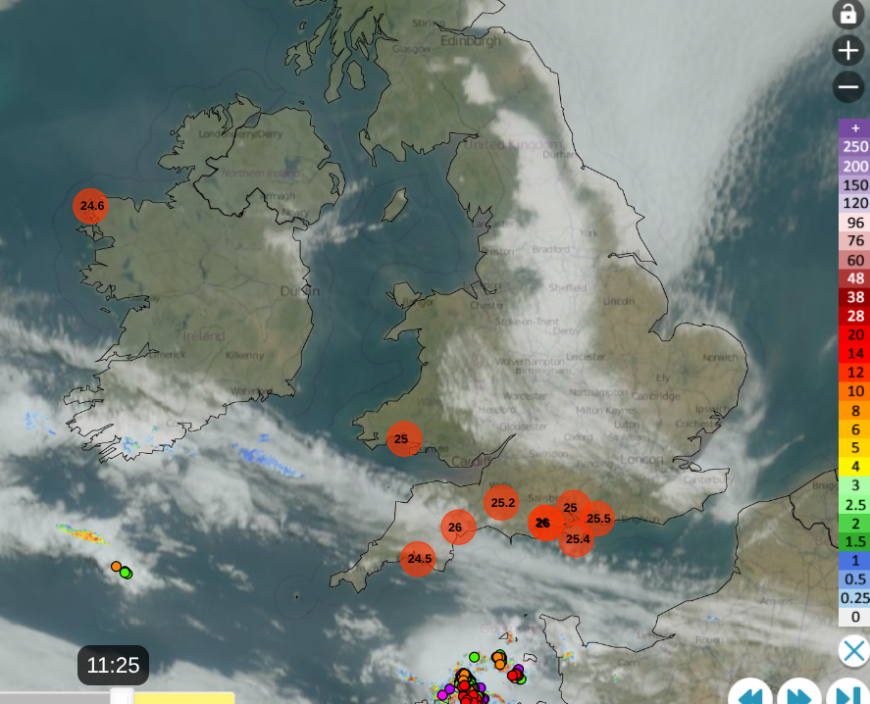
Netweather Radar 11:25 Weds 15th July with top temperatures
See how the low cloud from the North Sea has eroded away this morning and that will continue. The thundery showers are nearing the Channel Islands and the band of cloud over Devon might bring a little patchy rain this afternoon.
By Friday afternoon and evening, the ingredients will be present for a few sharp showers, even isolated thunderstorms, to develop inland over southern coastal counties of England. Not for everyone, but there is a risk. Mostly the outlook is fine, dry, warm in any sunshine, still very warm away from the east then north. The UV levels remain high.
Loading recent activity...











