The sunshine and heatwave conditions continue for the southern half of England into the fourth or fifth day, with temperatures at or over the threshold. It is warm on Wednesday throughout the UK, with only the Western Isles feeling cooler and fresher with more cloud. There will be a blustery SW wind here with patchy light rain until a band of proper rain arrives on Friday. Elsewhere, it is warm, even hot with sunshine and a close feeling in the air, but not the high humidity which made conditions in Heatwave2 in June so unbearable.
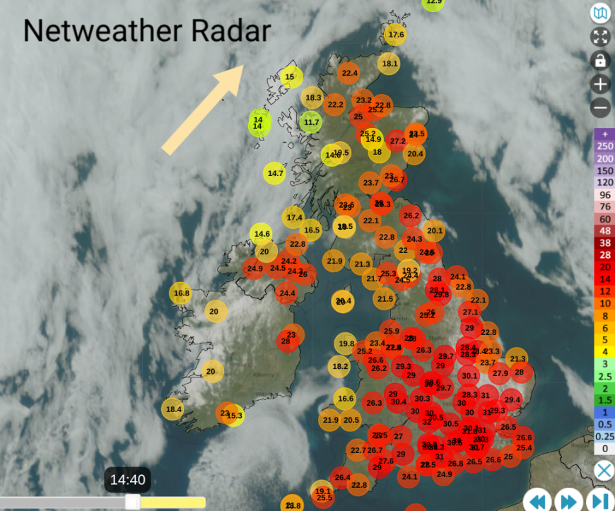
It has been much warmer today for Scotland and Northern Ireland and the same for Thursday. Friday could be warmer still with the heat increases for England and Wales and more areas into a heatwave.
High pressure is going to build over the UK, which will keep the weather steady, with light winds, more sunshine and growing heat. The only interruption will be a cold front from the far northwest, which will bring that band of rain over the NW Highlands and the Scottish Islands on Friday, possibly some thundery bursts too. If a storm does manage to develop anywhere on Friday, that could bring quite a downpour. Elsewhere, it is dry and stays that way.
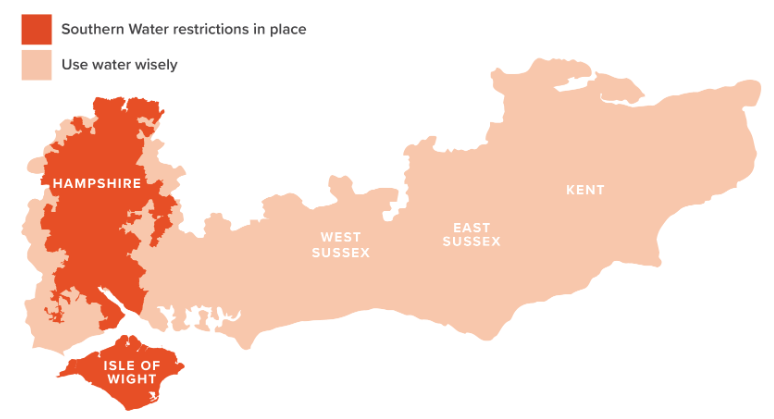
Southern Water “We will be implementing a hosepipe ban from 00:01am on Friday 10 July in Hampshire and on the Isle of Wight.”
Anglian Water remind people to value the resource and save water where you can, “ Love every drop” it’s important.
There aren't any Met Office Extreme Heat warnings this time. It will be hot with temperatures in the 30s Celsius, perhaps up to 35C, but it is midsummer. France and Spain are covered in Amber and a few Red heat warnings with temperatures in the mid to high 30s and low 40sC and very warm nights.
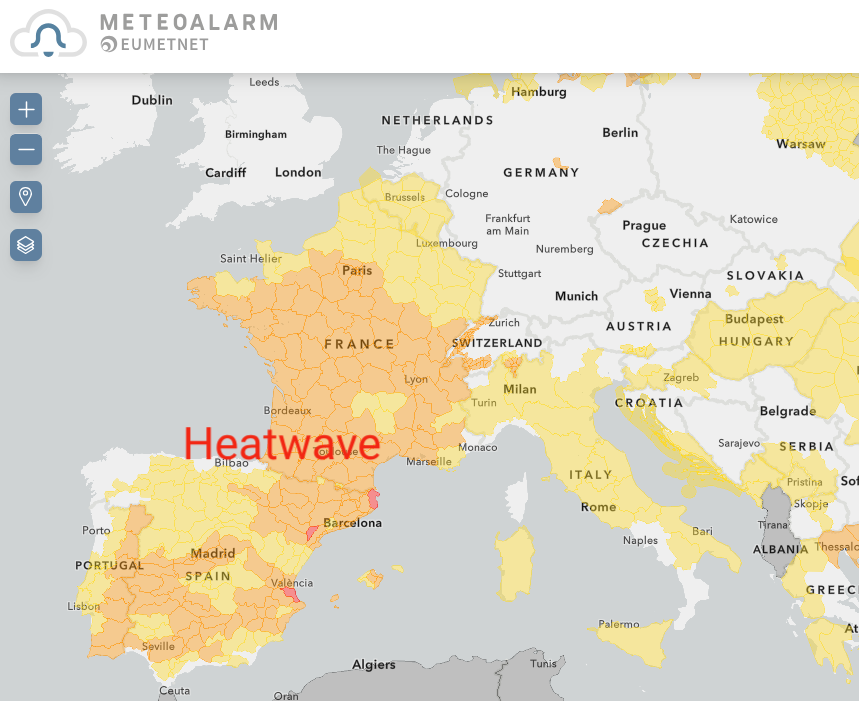
MeteoAlarm takes feeds of warnings from the national meteorological services across Europe and displays them in one place. There is nothing showing for England and Wales, whilst here in the UK, there is an unofficial reliance on a different alert.
There is mention (even in the Met Office press release) of the UKHSA’s Heat Health Alerts but this still only covers England. It is very misleading, as temperatures in eastern Wales rise, and as it was in late June for Heatwave2 when Wales broke its existing June high temperature record by over two degrees. It’s not the UK Health Security if you are only showing information for England.
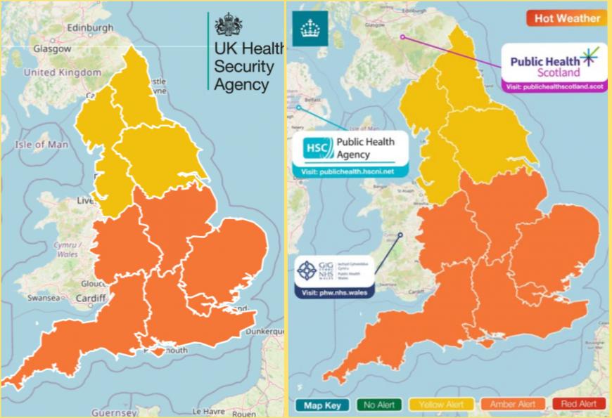
This second version has appeared on Facebook but the overall bright orange areas still give a misleading impression. There seems to be a gap until the Met Office feels that an Amber Extreme Heat warning is valid for Wales but they are happy to reference these Heat-Health alerts to cover England.
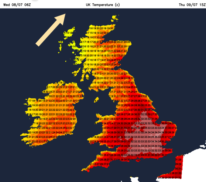
Temperatures on Thursday and Friday will be into the 30s Celsius for some parts of Britain, with highs of 35 possibly 36C by Friday. Scotland and Northern Ireland could reach 25 to 28C so very warm here too.
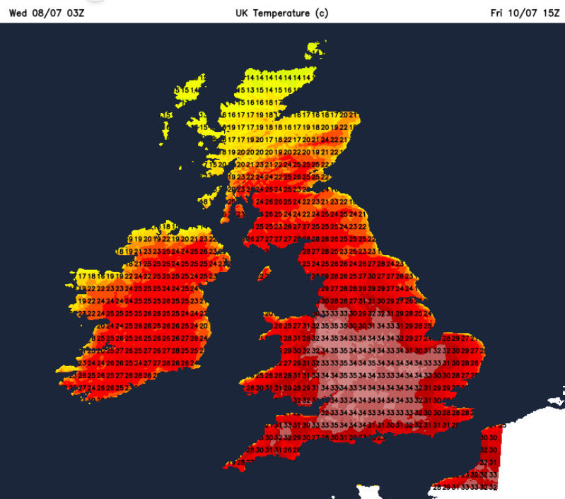
Friday night looks warm for SW Britain, and it could be rather uncomfortable for some when trying to sleep. And that takes a toll the next day as the heat continues.
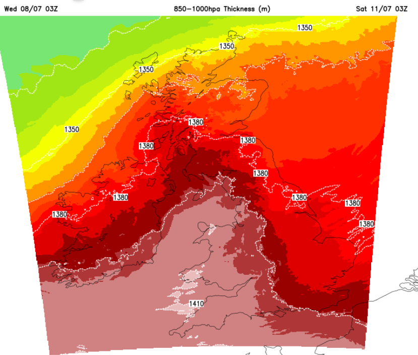
There will be a change for eastern Britain by Saturday as the wind picks up from the east/northeast and Grampian could see some heavy, even thundery rain to start the weekend.
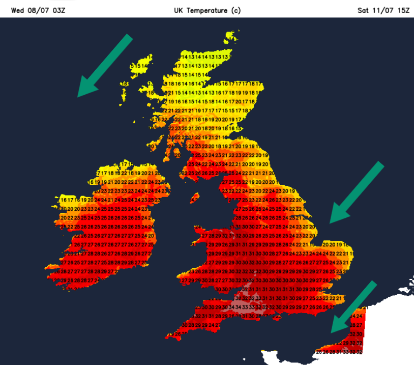
That flow off the North Sea looks set to last through the weekend.
Loading recent activity...