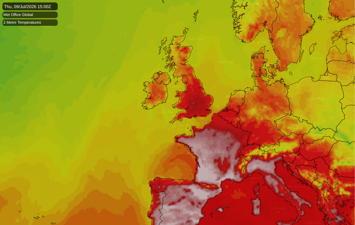
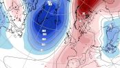
There was a time mid to late next week when I was telling people that next week would be a hot one, but more like a typical 1990s heatwave, with temperatures mostly high 20s Celsius and touching the low 30s in the south-east. However, this morning's forecast model runs have toned up the hot weather again, meaning that it is currently looking more likely to soar into the exceptional category again.
Although temperatures look unlikely to get as high as they did on 19 July 2022, when 40C was breached for the first time, the upcoming heatwave may prove to be similarly exceptional and impactful due to longer duration. The event of 18/19 July 2022 was a two day "heat spike" via a southerly airflow as high pressure moved away to the east, rather than a prolonged hot spell. Starting next Wednesday, temperatures are looking likely to hit the mid-30s Celsius in parts of England and Wales for at least four consecutive days. The latest GFS model run has the hot spell breaking down with some thunderstorms next weekend, but the ECMWF model prolongs it into early the following week, so the run of consecutive days with mid-30s has potential to extend even longer.
Like the previous heatwave, in Scotland it is forecast to be less exceptional, but high 20s Celsius will still be widespread. However, the hot weather looks likely to spread further north for longer through England and Wales than we saw in late June, which means that it has potential to be particularly exceptional in the north of England, which traditionally hasn't tended to see temperatures over 30C very often. Temperatures have potential to hit the mid-30s Celsius for a time in northern England, which could result in some places seeing values approaching what was recorded during the exceptional 19 July 2022 heatwave, when for example Durham set a new record high of 36.5C.
Warm nights will again be an issue, particularly in urban areas, where around London in particular it looks probable that temperatures will stay above 20C on several nights, making it difficult to keep houses cool without the aid of expensive air conditioning systems.
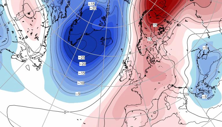
Britain will again lie on the edge of a marked "heat dome" setting up over western Europe, particularly affecting France, Spain and Portugal. Parts of France may again see temperatures exceed 40C, which used to be a rare occurrence in most parts of France but has become far more common in recent years. If we pick up a southerly bringing in air directly from France, temperatures of around 40C will be feasible in Britain as well.
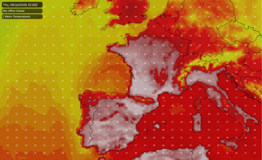
The odds are currently against us picking up enough of a southerly flow for this to happen, but uncertainty increases towards next weekend, meaning that the possibility cannot be ruled out either. For example, the latest GFS 06Z model run has toned up the heat by another notch and has temperatures getting close to 40C in the south-east next Friday. We have already set new record temperatures in two months in a row, and if this were to extend to three months in a row despite us having recently had a record smashing July heatwave, this would be a particularly remarkable outcome.
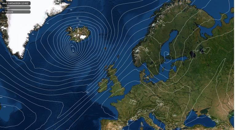
At present, Britain lies on the northern flank of an anticyclone which is bringing much of the country relatively cloudy weather, but it is expected to become sunny and dry for the majority of the country next week as the high pressure builds on top of the British Isles.
In the long running Central England Temperature (CET) series from 1659, June 2026 was the second warmest June in the series with a mean temperature of 17.4C, but still behind the remarkable June of 1846, which recorded 18.2C. It is noteworthy that in 2026 we had the second warmest June in central England despite a fairly cool first half of the month dominated by westerly winds. An implication is that if we were to have a June like that of 1846, when high pressure and southerly winds dominated for most of the month, rather than just in the second half, we could well end up with a CET of around 19C. June 1976 had a mean CET of 16.9C, which was roughly equalled in 2023 and 2025, but beaten quite comfortably in 2026.
However, as the heatwave of late June 2026 was less exceptional in Scotland and Northern Ireland than it was in England and Wales, in the Met Office's UK temperature series, June 2026 ended up 0.2C cooler than the record warmest June in the series, which was in 2023. In June 2023, hot and sunny weather was more prolonged and extended to larger areas of the country, even though the absolute maximum temperature during that month was less remarkable. The enhanced northwest-southeast split in June 2026 was also reflected by the sunshine and rainfall anomalies. In most regions it was not as sunny as June 2023, and in the north and west of Scotland, June 2026 was a fairly cloudy and wet month overall in spite of the hot and sunny spell late on. The Met Office temperature series only goes back to 1884, so does not include the exceptional June of 1846.
Loading recent activity...