The Met Office has announced that it was the warmest June on record for England and the second warmest for the UK and Wales. May and June saw heatwave conditions, and there has been ‘chat’ about another round for mid-July.
Over the weekend, temperatures around Greater London could reach 27 to 30C and next week shift into the low 30s Celsius. In summer, we would expect to see hot spells, but for another official heatwave, there would have to be three consecutive days with temperatures over the regional threshold.
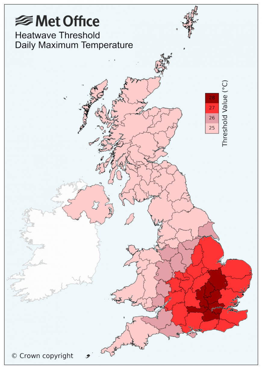
UK threshold temperatures by region
“Climate change is causing warming across the UK. All of the UK's ten warmest years on record have occurred since 2002. Heatwaves are now 30 times more likely to happen due to climate change.” Met Office
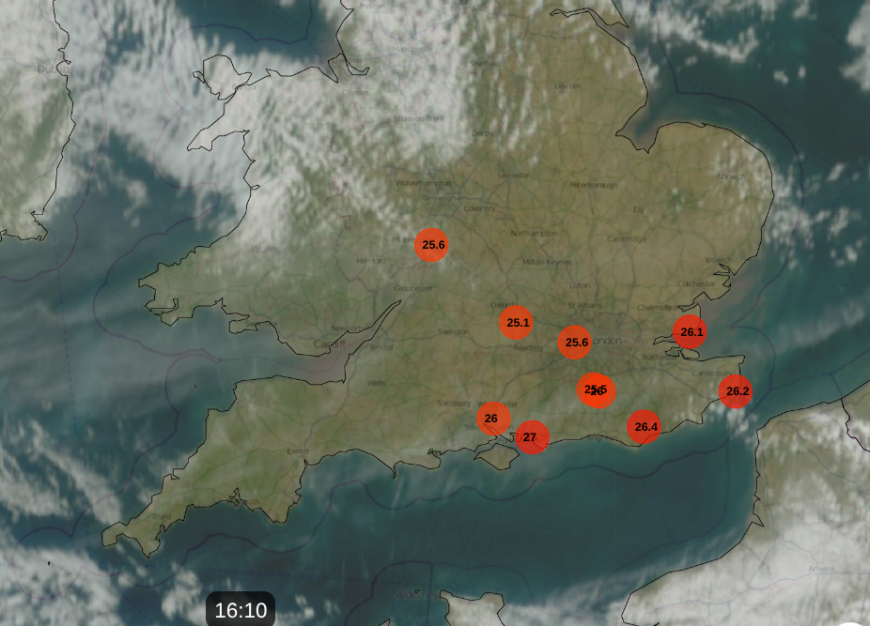
Netweather Radar Thursday afternoon showing top ten temperatures
At the weekend, Manchester looks to stay around 22 to 24C and Glasgow around 18 to 21C. Remember that in late June we beat the old June record on three consecutive days, ending on a new record of 37.7C in Norfolk. It was the high humidity and hot nights which caused strain for people as the heatwave continued. That level of humidity isn’t expected to return, so that is a plus point. There is very high grass pollen at the moment in SE Britain. London Heathrow and Wisley, Surrey saw the top UK temperature with 27.6C on Wednesday 1st July.
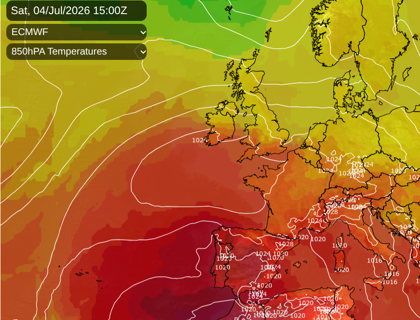
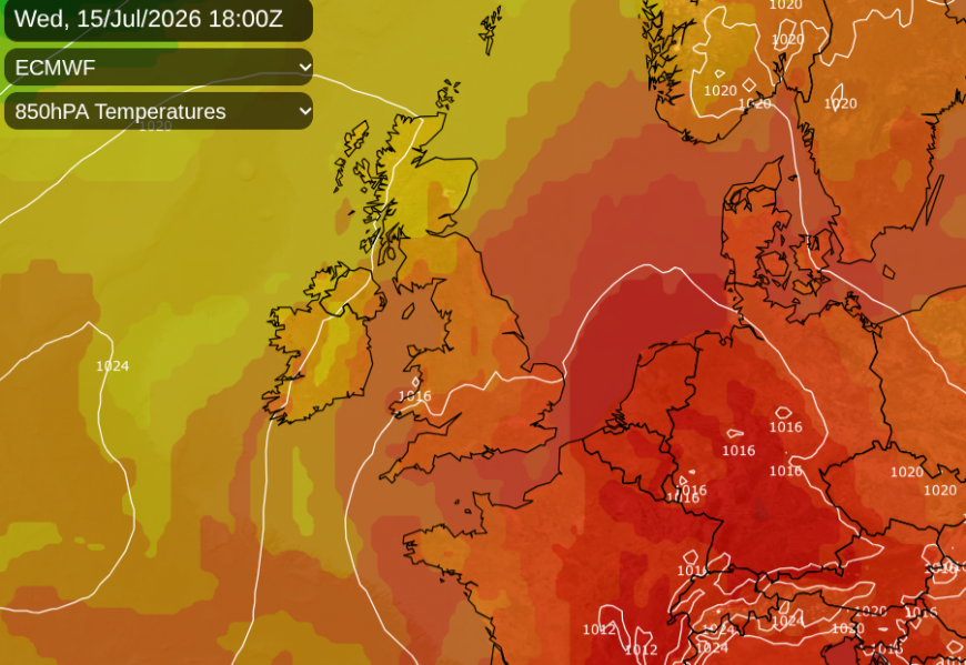
This weekend, there will be intense heat over Iberia with AEMET warning of temperatures over 40C for the interior of SW Spain by Saturday, and red heat warnings already over much of Portugal, again with temperatures over 40C inland. That heat looks to move over the western Mediterranean early next week, with temperatures rising for southern France, the Balearic Islands, also Sardinia. It is this heat that could spread northwards over the UK by the middle of next week.
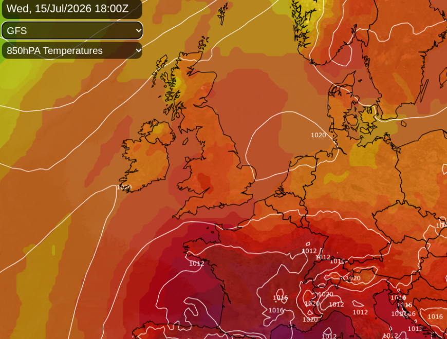
But the models vary, the ECM takes the heat more towards the Low Countries.
End of this week
High pressure will build over southern Britain on Friday but another frontal system will bring rain to Northern Ireland and western Scotland on Friday afternoon and evening. Elsewhere, it will be a warm day. Aberdeen 23C, Edinburgh 20C, York and Leeds 22C and for London and the Home Counties 24 to 27C, much like on Thursday.
Friday evening will remain warm across southern Britain, but the frontal rain and cloud will extend over southern Scotland and northern England, just into the Central Belt so a damp and grey end to the working week here.
Saturday
It will be another breezy day for much of the UK and this flow off the Atlantic will help keep the humidity down. The UV is still very strong at this time of year, so watch out in the middle of the day. In any sheltered areas, it will feel very warm with fine sunshine. The frontal band will continue to wave in from the west, particularly for western Scotland, but with more cloud and patchy rain for parts of Northern Britain and Northern Ireland. Southern Britain will be very warm but will feel fresher in the westerly wind. It looks like a good run of fine, dry weather for the crowds at Wimbledon in the first week.
Sunday
The westerly wind will whizz through the Central Belt of Scotland on Sunday, with a blustery day here. It will feel hotter for the Midlands, East Anglia, SE England, and southern counties of England. Another pulse of frontal rain will spill in from the Atlantic later on Saturday and overnight into Sunday with more cloud, outbreaks of rain and just more unsettled conditions. For England and Wales, away from counties exposed to the westerly flow, it will be a fine day with more warmth. The UKV Model is showing 30C around London.
Loading recent activity...