June’s maximum temperature record has been broken again today, just a day after the long-standing record from 1976 was broken. Merryfield in Somerset reached 36.7C on Thursday. Wednesday 24th saw 36.1C reached at Gosport in Hampshire. The 1976 June record was 35.6C. Today’s extreme heat was found across southern England and into south Wales and the Midlands, but generally to the west and southwest of London, with an easterly breeze keeping eastern areas of England a little cooler than yesterday.
Wales also exceeded its June record with 35.9C at Bute Park, Cardiff, beating 33.7C record from June 2020. Northern Ireland tied its June record with 30.8C recorded at Castlederg. In the Channel Islands, Jersey provisionally recorded its hottest day, at 39.3C smashing the previous record of 37.9C from July 2022.
Tonight
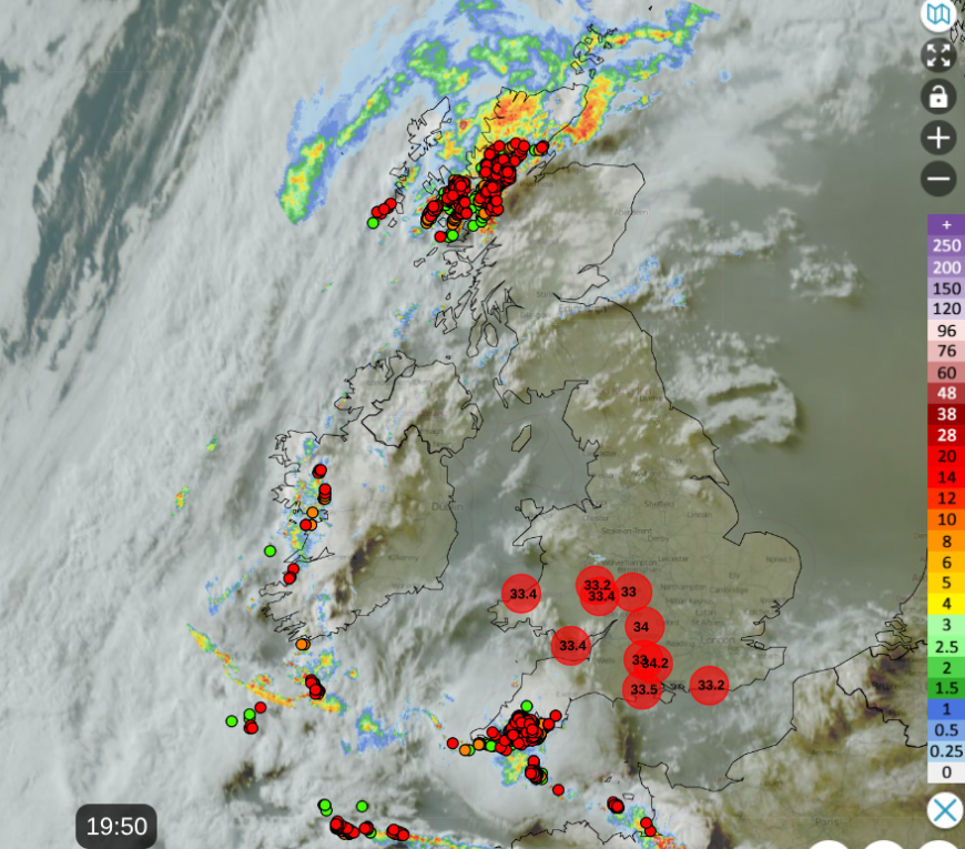
Thunderstorms are now breaking out over the western end of the English Channel where it merges into the Atlantic, with further storms developing over northwest France. Also thunderstorms area expanding into and off Western Scotland.
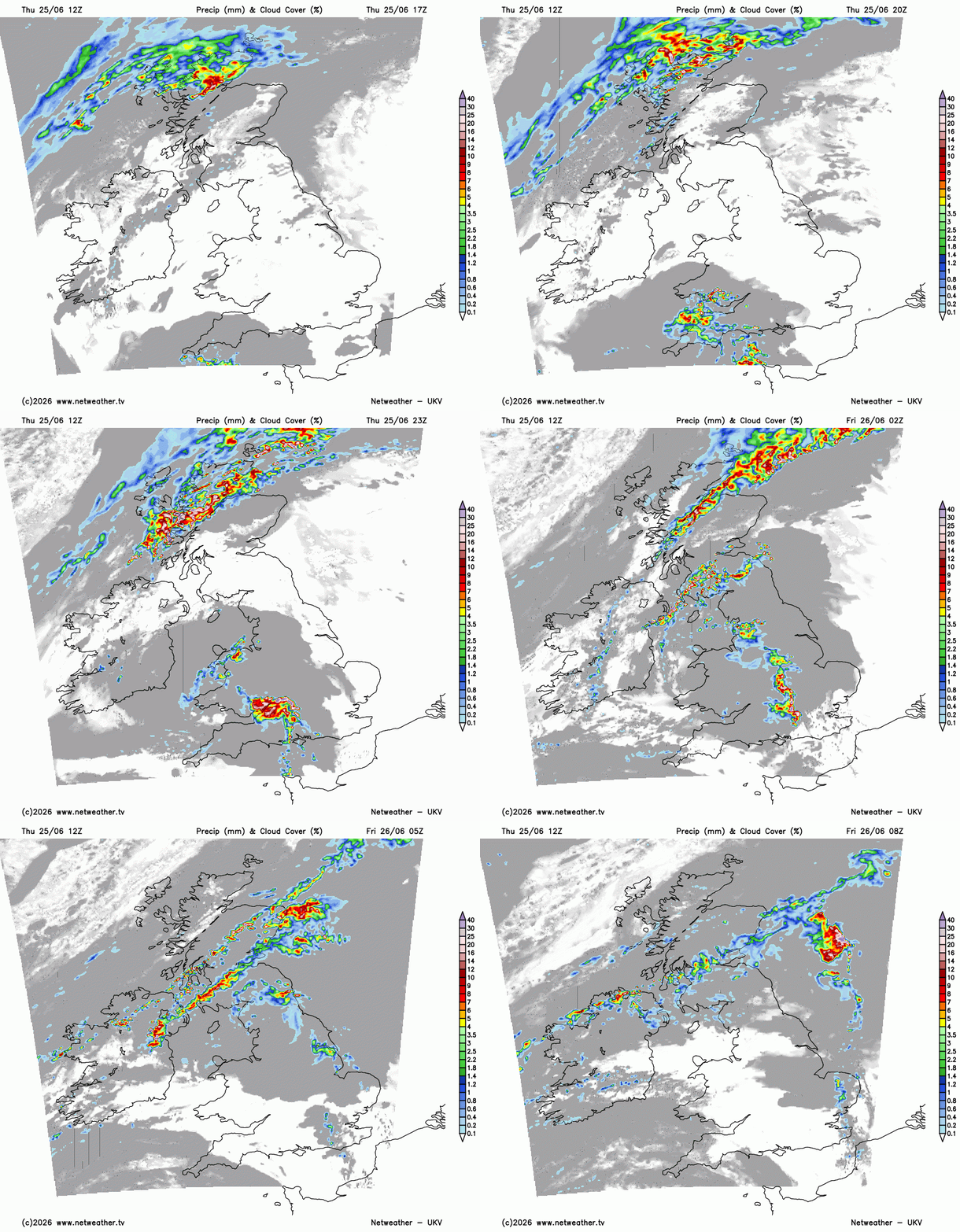
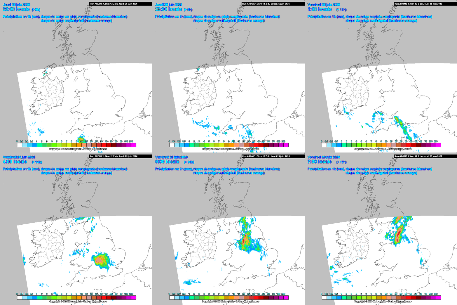
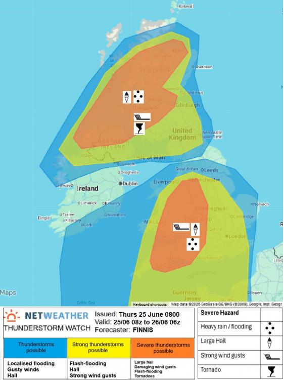
Of the high resolution models - 12z UKV shows an arc of storms spreading north across SW England & south Wales this evening before moving further north over Wales and the Midlands overnight. Storms also moving up over central southern England in the early hours, SE England & E Anglia see a few storms too. Also note lines of strong storms developing over Scotland, N. Ireland and far N of England too overnight. 12z AROME takes storms further east than its previous runs, suggesting strong activity up through central S England and into the Midlands. The model wasn't great with the storms the other day across SW England and overnight in SE England, so it remains to be seen which of these two high-res models has the best handle in the end. 00z ECWMF broadly similar, though has more activity towards SE England too early Friday morning.
For more detail on the thunderstorm risk this evening and overnight into Friday morning, a Severe Thunderstorm Watch has been issued for parts of the UK, as some of the thunderstorms may be severe. Thunderstorms developing over NW France and nearby Atlantic will spread north and northeast across southern, central and northern England along with Wales this evening and overnight, some of which may be severe, with damaging wind gusts, hail, flash-flooding and frequent lightning. But thunderstorms also look to develop in a few swathes from N. Ireland across Scotland and perhaps into the far north of England. Already storm are ramping up in an area into western Scotland. Again, some of these thunderstorms may be severe - with isolated large hail, damaging wind gusts, intense rainfall leading to flash-flooding, frequent lightning and even a tornado can’t be ruled out.
A portent of things to come for southern UK later, in terms of severity, as storms arrive and spread north this evening and into Friday morning, severe thunderstorms are developing over Brittany - with a 60mph gust recorded at Lannion on the north coast.
https://x.com/meteociel/status/2070170518100099506?s=20
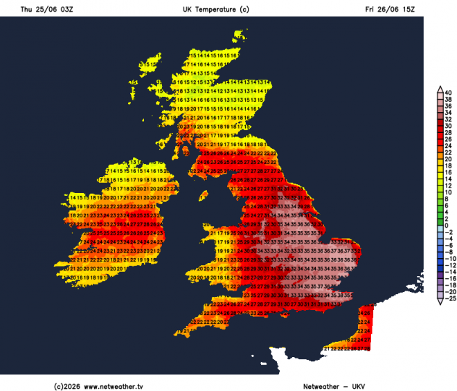
The storms may cool the air overnight where they pass, but it will be only temporary relief for central and eastern areas of England - as the heat will return with a vengeance here on Friday, with temperatures here back into the mid-30s, plus extra humidity left by storms, after being pegged back lower today by the easterly breeze. Relief further west for the West Country and Wales - which has seen some of the highest temperatures - not so hot on Friday - but still reaching the mid to high 20s inland away from coasts with sunshine and a southwesterly breeze. Perhaps some heavy rain and storms for northern England first thing, but these clearing north and turning very warm and sunny. Cloudier skies with outbreaks of rain or lingering thunderstorms for Scotland and N. Ireland through Friday.
Saturday may see further thunderstorms push northeast across SE England and perhaps parts of East Anglia in the morning, though some uncertainty on this, some of which could be intense with heavy rainfall and frequent lightning. These clearing away by lunchtime, but hot and humid conditions may linger across East Anglia and the far SE of England - perhaps reaching the low 30s. Turning breezier, cooler and fresher further west, though generally sunny before bands of rain, perhaps heavy and thundery, arrive in the north and west during the evening.
Sunday cooler and fresher for all, with a breeze off the Atlantic, temperatures back to average values for the time of year. Mostly dry and sunny for southern, central and eastern England, though could be thundery showers at first in the far southeast, northern and western areas windier with some showery rain possible.
Next week looks to have a mostly westerly flow off the Atlantic, so temperatures closer to average in the north, maybe slightly warmer than average in the south with more sunshine here, but no sign of any intense heat returning for now. Any rain next week mostly falling in the north and west, drier towards the southeast.
Loading recent activity...