It will turn drier and warmer from the south over the weekend, as high pressure builds, with much of England and Wales seeing warm sunny spells on Saturday, then Scotland on Sunday, though it may turn cloudier further south.
It will turn less settled but remain warm early next week, then by the following weekend of 20/21 June it could turn hot in the south and east of England, as a 'heat dome' looks set to build over mainland Europe, with some of this heat reaching the UK. But with the increase in heat and humidity along with the proximity of an upper trough and low pressure close to the west, we may also see an increasing risk of thunderstorms later next week and into that following weekend.
Signal for heat to build north over western Europe next week, which may reach southern UK too later next week
Low pressure has been in charge close to the north through much of this week, bringing a cool, unsettled and breezy westerly flow across the UK with widespread showers earlier in the week then a spell of rain for all on Thursday, but it’s turning drier and feeling warmer across England and Wales this afternoon, even if it’s still cloudy, heralding a build of pressure from the south, which will continue to build north across the UK over the weekend.
Saturday will continue cool with scattered showers and bright spells across Scotland and the far north of England, but further south it’s looking dry and warm with sunny spells and lighter winds than today. Dry and settled conditions spreading north to Scotland too on Sunday, as high pressure extends north and here will see a better day with sunny spells. Could see more in the way cloud spreading east on Sunday across England and Wales, but staying dry and feeling warm, especially where the sun comes out.
High pressure builds north across the UK this weekend, so becoming dry for most by Sunday and warmer too.
Highs of 22-24C in the south over the weekend, Scotland quite a bit cooler on Saturday, but on Sunday it wil warm up even here with more in the way of sunshine, with 20C possible in the Central Belt.
Although early next week does look to see high pressure relax with the flow off the Atlantic bringing a lot of cloud in across many areas, it will be warm thanks to a tropical maritime flow from the southwest. There may be a chance for some showers in the south on Monday for a time, perhaps even thundery, while outbreaks of rain look to arrive off the Atlantic across N. Ireland then Scotland and northern England through the evening. Tuesday is looking cloudy with further outbreaks of rain spreading in off the Atlantic over a wider area, but feeling warm and humid.
A cloudy but humid flow from the southwest develops early next week, which could bring some rain
From mid-week, a strong and expansive ridge looks to build north from the Mediterranean as an Atlantic upper trough amplifies south and slows to the west of Europe. A heat dome looks to develop under the upper level ridge over mainland Europe, with extensive swathe of temperatures reaching the low to mid-30s Celsius (locally more) spreading across Spain, France, Germany, Low Countries and the Alps.
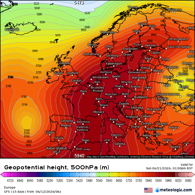
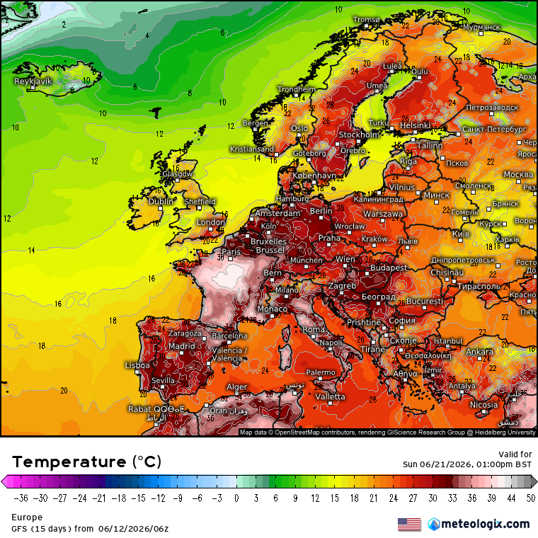
The UK looks to be on the northwestern periphery of this heatdome, closer to the influence of low pressure close to the west or northwest of Ireland. S and SE England may be close enough to the heat dome to tap into the hot and humid air over the weekend of 20/21 June, perhaps earlier and the end of next week. Some models are showing temperatures reaching the high 20s Celsius, but could get higher if the heat gains more traction to move across the Channel.
But with the closer proximity of the upper trough to the west and low pressure, the UK will likely see Atlantic fronts bring cloud and rain to northern and western areas at times. While the plume of hot and humid air spreading in across southern and eastern areas may become unstable at times, as cooler air from the upper trough to the west tries to spread further east aloft at times, causing instability and the risk of thunderstorms, perhaps severe, developing here.
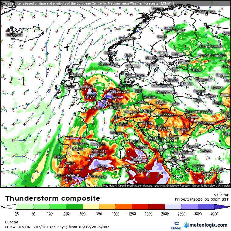
There is a lot of uncertainty over how far north heat will spread over France and potentially into southern UK later next week and into the following weekend and also the risk of thunderstorms as the edge of the hot and humid plume destabilises, but we’ll keep you updated.
Loading recent activity...