Frontal rain crossed the UK on Thursday with a shift to warmer air from the southwest after a cool and unsettled westerly flow this week. There have been heavy, thundery downpours with lightning and hailstorms for some. Even funnel clouds were reported in Grampian as the cool air from the north Atlantic moved over land warmed by summer sunshine. The low pressure will continue to edge north of Scotland on Friday but its trailing frontal bands will be a distinct boundary.
To the north, the westerly cooler airflow will continue, but to the south, pressure is building and there will be milder air tonight. Northern parts of the UK will see clearing skies with a scattering of showers continuing into the west coast of Scotland (11C) as the frontal band moves over Orkney. Northeast and eastern England will also see clear spells in the light westerly flow. Further south, there will be more cloud with patchy rain as the frontal boundary waves, perhaps up into Northern Ireland overnight with damp weather here. Southern England will stay around 14 or 15C.
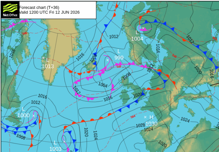
With a waving front there is always some uncertainty about how far north or south it will wander. So where will stay cloudy and damp or see more rain, particularly for windward hills. On Friday there could be three zones, showery weather into northwest Scotland with bright spells but clusters of heavier showers by the evening. The wind will also pick up and make it feel cool, but eastern Scotland will fair better up to 19C. Northern Ireland will have a fair but breeze day with the odd shower, 16-18C.
Southern England will hold onto cloudy skies through the day but feel warm with temperatures of 18 to 24C. Much of England and Wales will start Friday with a good deal of cloud, damp with outbreaks of rain for windward high ground. Gradually the cloud will lift and break across central Britain as the brisk westerly wind continues.
So the day does improve for many parts but with the frontal band to the south, the push of cooler north Atlantic air holds on for one more day. In the sunshine over England and Wales and to the lee of high ground, it will feel warmer but the high pressure will be centred over the Bay of Biscay and western France with the heat focused over Iberia. Temperature alerts are appearing for inland southern Spain, up to 38C.
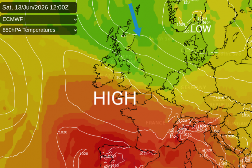
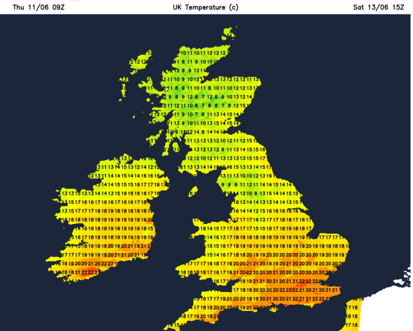
Away from the showery far northwest, Friday evening will be fine, sunny, and quite warm for England out of the breeze. By Saturday morning the low pressure will be over Scandinavia but the trailing occlusion will bring a band of showery rain into northern Scotland. It will be windy for the northern half of the UK with showery outbreaks of rain reaching Northern Ireland and NW England.
Further south there will be more sunshine and drier weather, still with a breeze from the west. It will feel warm in the sunshine with temperatures in the low to mid 20s Celsius. This will be quite a contrast to the cooler, and windy conditions to the north and east.
Saturday night will be quiet and Sunday looks fine. The winds will be lighter finally although there will be a northerly breeze along the east coast of Britain. So it will feel cool along North Sea beaches. Further west and particularly southwest it will be warmer with sunshine. Temperatures could be around 20 to 26C.
The warmer air to the south should surge over more of southern Britain by Monday night which could allow temperatures to rise into the high 20sC by day early next week.
Loading recent activity...