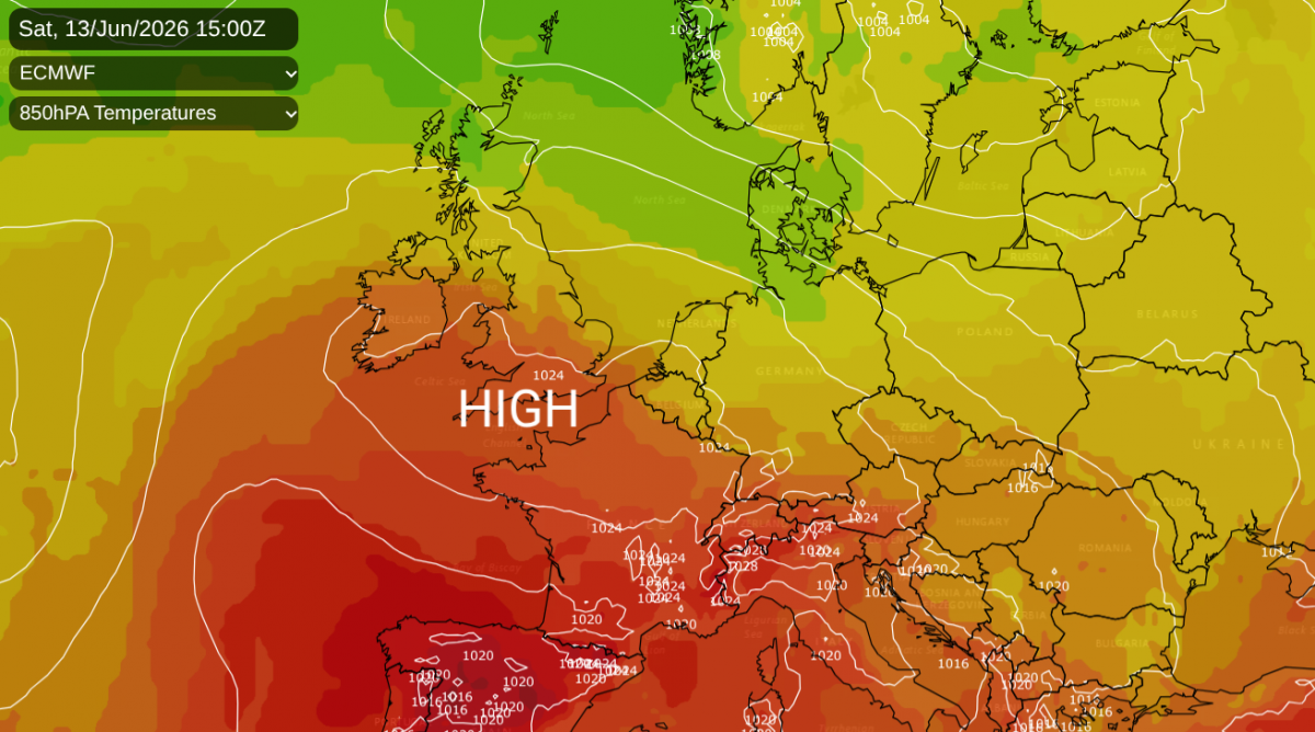
For gardeners and growers looking for rain, the next few days will provide. For those wanting a return to summer warmth and sunshine, high pressure at the weekend should lift your spirits as temperatures move away from the cool mid-teens, way up into the 20s Celsius.
Is that back to heatwave conditions? For an official heatwave, there has to be regionally high temperatures that equal or exceed threshold values for three consecutive days. These values are between 25 and 28C, so just because it looks warmer by the weekend doesn’t automatically mean it's a heatwave. We will keep you updated as the week progresses. Will this just be a change to summer warmth or a leap back to more difficult heat similar to what some areas experienced in late May.
For the next few days, it will feel warm if you are in sheltered direct sunshine but the airmass is cooler. It is coming off the North Atlantic, steered by a low pressure near Iceland. This returning Polar Maritime air will bring lots of showers and also bands of frontal rain. It will feel cool as the cloud and rain pass by and in the evenings but there will be bright or sunny spells in between. Temperatures will widely be 13 to 18C.
Western areas will always be more exposed to the feed of showers off the Atlantic. The low centre near Iceland will throw weather fronts towards the UK at the start of this week.
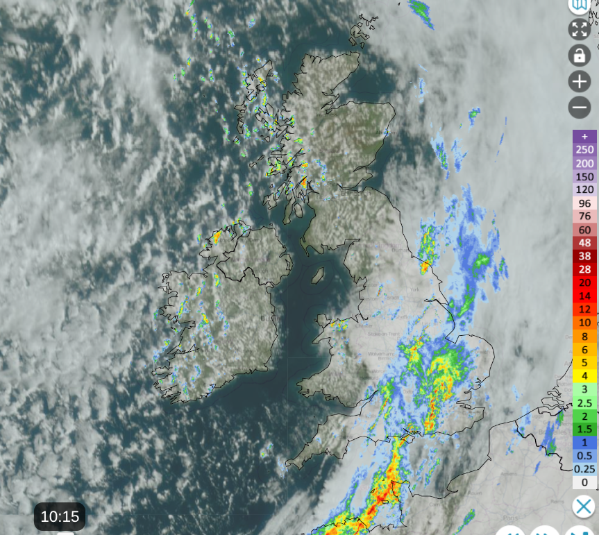
The overnight rainband has cleared from Scotland, Northern Ireland and Wales, allowing sunny skies. The cloud and rain will edge away eastwards from England today but really take its time from East Anglia. There will be heavy showers over Northern Ireland by lunchtime and these will reach the west coast of Britain later today.
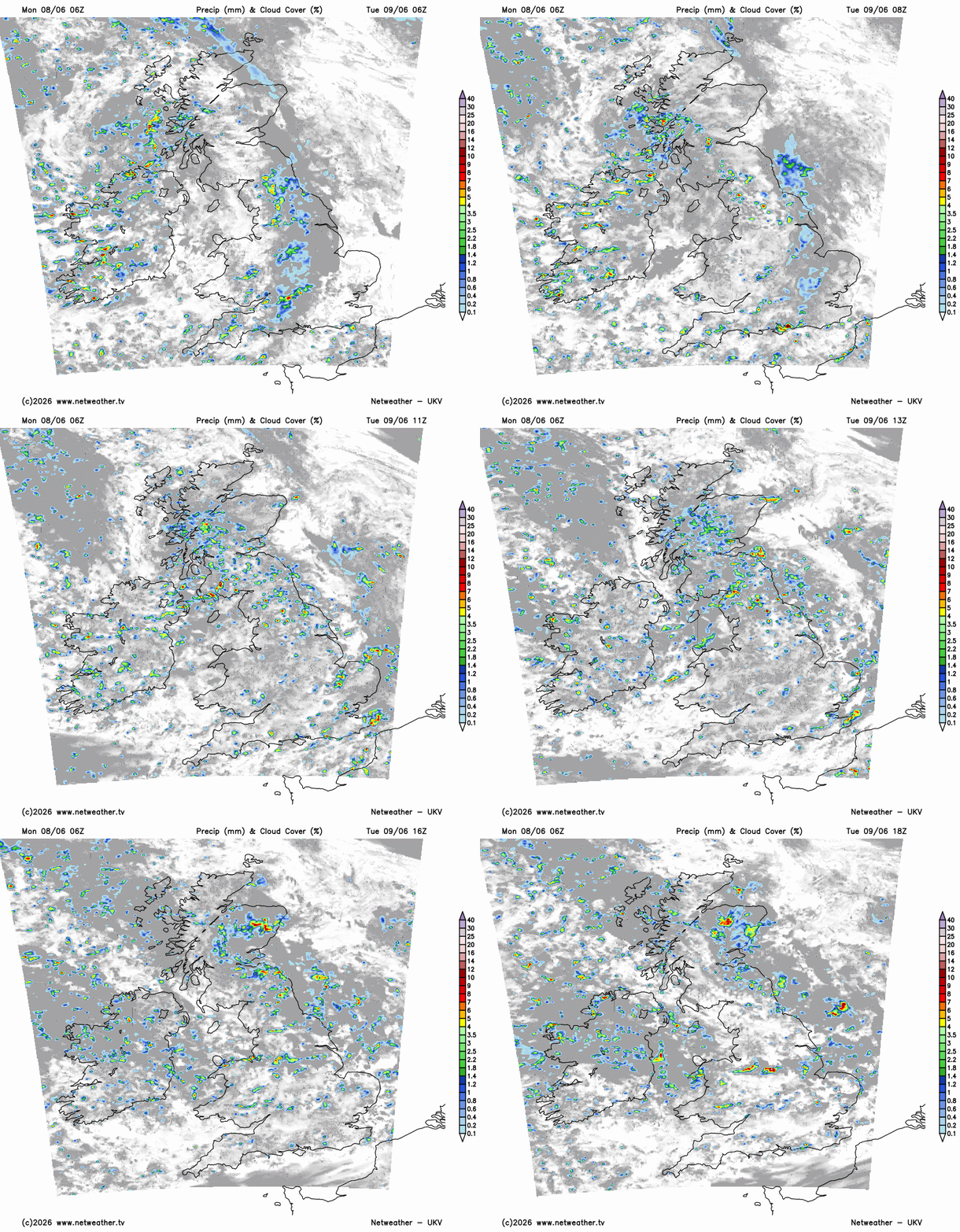
It will be cool overnight, and Tuesday will be a mixed day as clusters and bands of heavy showers work their way across the UK. Away from Scotland, there will be a moderate to fresh westerly wind moving the showers along. They will be heavy, with a low risk of thunder and lightning during the day. The showers over Scotland will be slow-moving so there is the risk of longer downpours and surface water issues.
There will be bright or sunny times inbetween again with temperatures in the mid-teens.
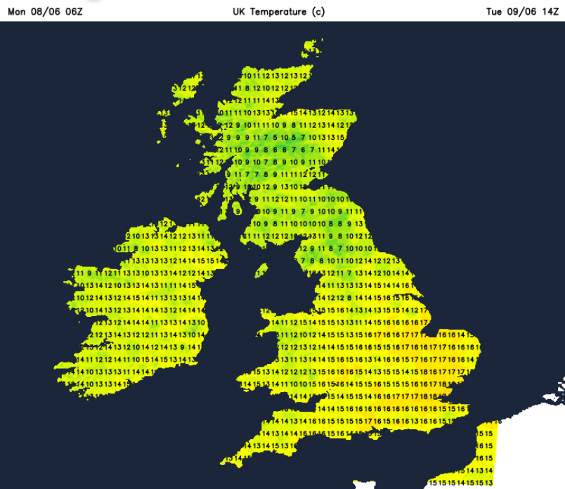
Wednesday will be another showery day with hefty downpours and bright spells. The showers will ease from the west during the day, as eyes turn to the Atlnatic for a new low pressure. It will be another cool day.
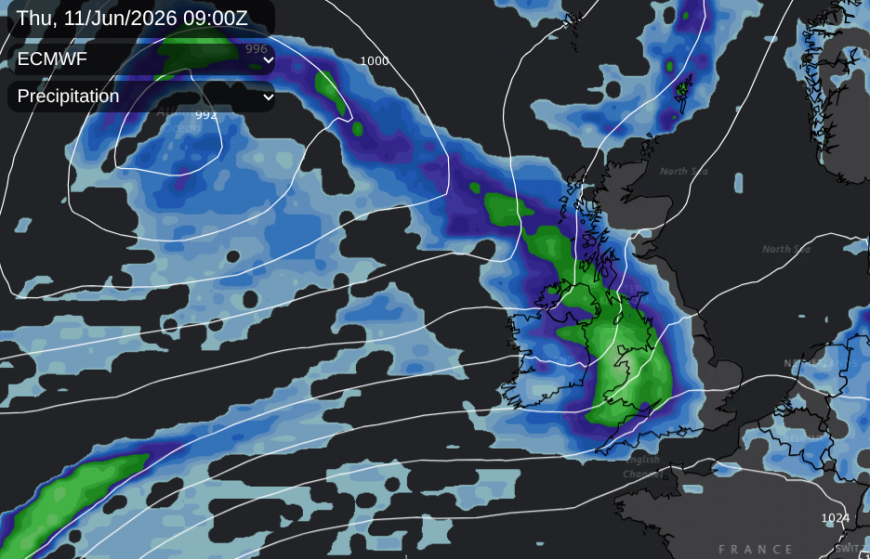
During Wednesday night, there will be clear skies for Britain before high cloud and then frontal rain arrives over Ireland. Thursday does look wet as a low pressure brings a spell of proper rain across the UK. It will turn wet and windy before the rain clears away from northeast Scotland on Thursday evening.
The UK will still be in the westerly flow on Friday but high pressure will build from the south for the end of the working week.

The unsettled weather off the Altantic will be forced further north, taking its time to clear western then northern Scotland. As the high pressure takes hold there will be drier weather, lighter winds, more sunshine and without the cool flow from the west, the temperatures will rise. We will have to see where the high settles but the strong June sunshine will get to work, and the air flow could come from the hotter south, or just stagnate and heat up under the anticyclone.
Loading recent activity...