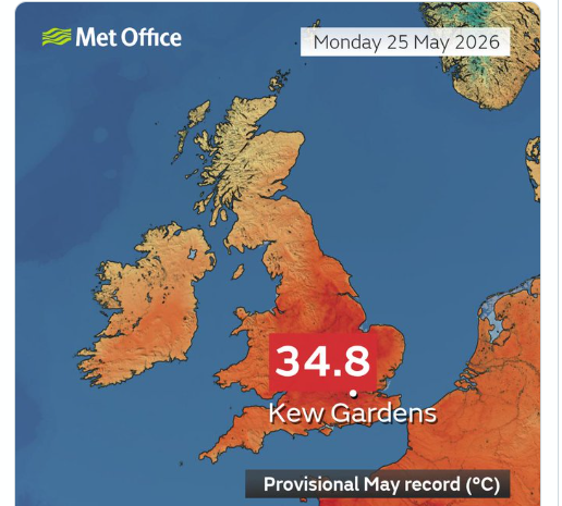
What a Bank Holiday weekend. Away from the far northwest, there has been sunshine and heat, with a record-breaking Monday. The top temperature (provisionally) was 34.8C at Kew Gardens in west London, smashing the previous month of May record by two whole degrees. This was also the hottest UK Bank Holiday on record, even beating August temperatures.
This continues to be an incredible period of May heat. We are likely to see 35+ today. It was also the hottest day in May on record for Wales with 32.2C at Hawarden, NE Wales. These records have stood since 1944, and 13 sites in SE Britain provisionally recorded higher than the previous UK record of 32.8C.
No records but Charterhall in SE Scotland saw the top Scottish temperature 26.7C on Bank Holiday Monday and Derrylin in Co. Fermanagh saw the highest temperature in Northern Ireland yesterday with 25.8C
By night, the highest daily minimum temperature on record for May has been broken again (Sunday night 19.4C at Kenley Airfield was the lowest temperature) with a Tropical Night for Kenley, when overnight temperatures stay at 20C or above. The minimum was 21.3C Monday into Tuesday 26th. This is the first time we have recorded a Tropical Night in a spring month in the UK.
All the official observations for provisional new records undergo verification checks of the site and equipment. It is a shame that St James Park, London observation site is out of action at this time. For “a value to be treated as an official national record, the Met Office follows national and international best practice and guidance.”
In the Channel Islands, Jersey beat their May record again. Sunday 30.1C and on Monday 25th 31.9C at Maison St Louis observatory. Astonishing early season heat here too.
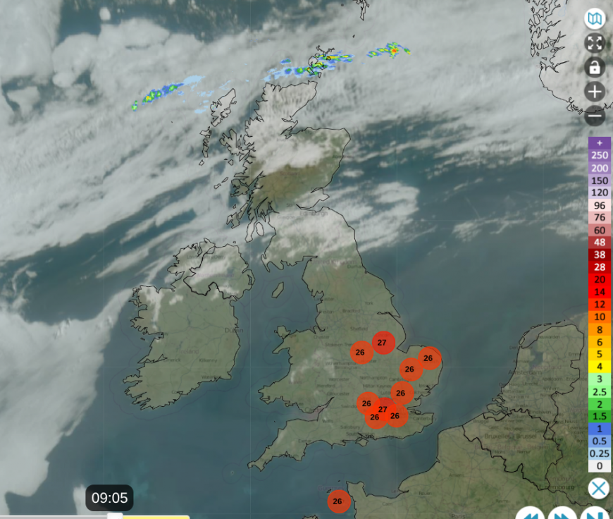 Already over 26C in parts of England in the briliant sunshine
Today
It will be hot again, potentially even hotter. There were temperatures in England around 23C before 8am, clear blue skies with more sunshine. The same hot airmass and little breeze. You can see on the satellite and radar image that there is more straggly cloud in the north, over parts of Scotland and Northern Ireland with patchy rain for Orkney to start the day. Most of this cloud will thin and break up, allowing brighter skies. Grampian could see more cloud in the afternoon, keeping Aberdeen at 17C, Inverness at 19C but for the Central Belt, Glasgow should reach 24C as SW Scotland sees a very warm afternoon. There will be a light easterly breeze picking up later today so 18C for Edinburgh and that flow off the North Sea will make a difference more widely on Wednesday.
Northern Ireland will have a northerly breeze so temperatures will vary from 16 on the north coast to 25C well inland.
Wales will have a hot day. There will be a very light northerly breeze on to the north coast (low 20sC) but otherwise a still, sunny and hot. Temperatures will be in the mid to high 20sC, again tipping into the low 30sC. Cardiff should see 32C and there is a chance that the Wales May record could be broken again. There is a small risk of isolated thunderstorms.
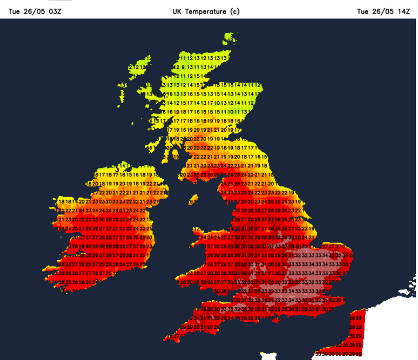
For England, it will be hot and sunny. Two things to note: there will be a light easterly wind off the North Sea developing by late afternoon, so not as hot for NE England down to the Wash by this evening. Also, there is a low risk of inland isolated thunderstorms.
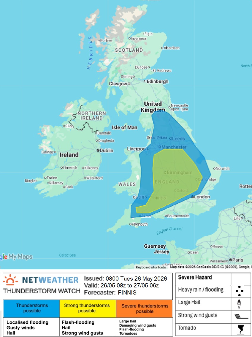
It will be worth watching the Netweather Radar from mid-afternoon into the evening to see if any cells do develop. Or just do a 360 look around the sky to see if any cumulonimbus are developing. If they do, these could produce torrential rain and lightning with large hail. See more in the Convective Forecast for May 26th. The potential is there, but for most it will just stay hot, sunny and dry. With the temperatures, expect similar to yesterday for central, northwest, southwest and southeastern England. Southern Britain could reach 33 to 35C today. Take care if you are finding this ongoing heat too much.
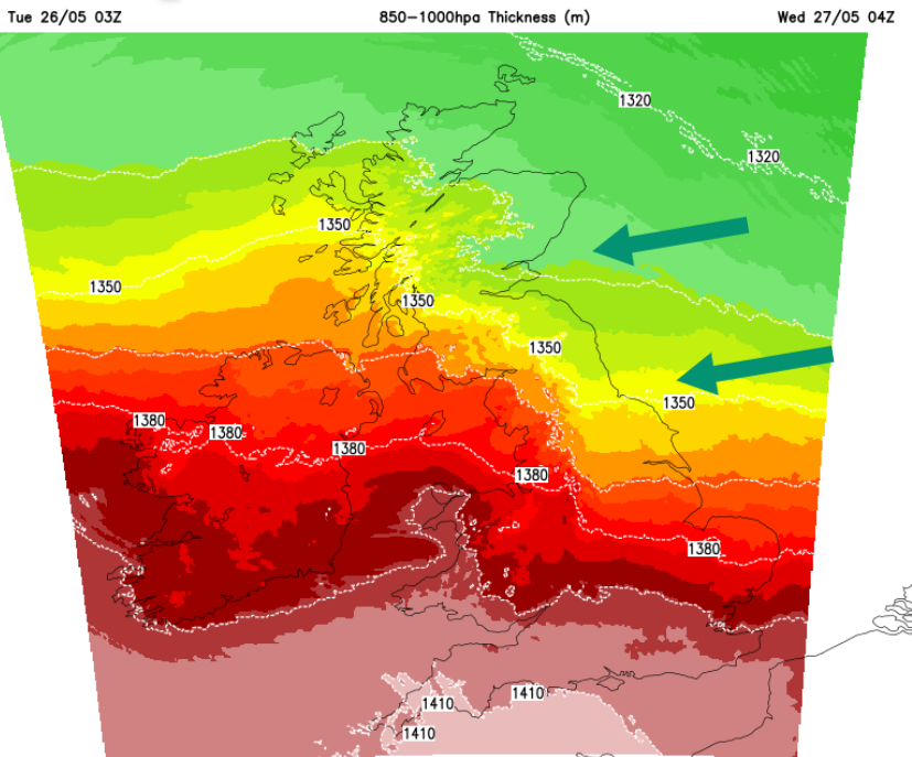
Tonight
This flow off the North Sea will make a difference, lowering temperatures for northern and eastern areas, as the heat remains for southwest Britain and southern England, including London, with temperatures in towns and cities 15 to 20C.
Wednesday
As the high shifts, the easterly flow off the cool North Sea will be more noticeable. The intense heat will remain for southwestern Britain but London and the Home Counties should be in the mid to high 20s Celsius. Still very warm but not as oppressive. The West Country into the southern half of Wales should see temperatures in the high 20sC and low 30sC.
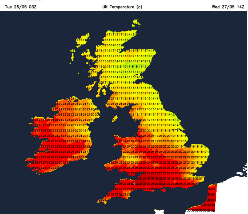
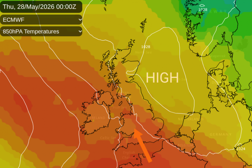
Later in the day, there could be more cloud with a few large raindrops splatting down for southwest Britain. Thursday looks very warm across the UK as a southern flow takes hold. For Southeast England the heat could last until late Saturday.
Climate Change
If you can think back barely a week and a half, the UK was sitting around 12 to 14C and we were moaning about how cold it was. This dramatic arrival of heat has been astonishing, from cool to record-breaking "historic" May heatwave conditions. We are now more likely to see these high temperatures, alongside year on year variation.
“A climate attribution study published last summer by Met Office scientists found that the chances of surpassing the May temperature record have been increasing as our climate changes as a consequence of human greenhouse gas emissions.
The study found that breaking the 32.8°C May record is around three times more likely now in our current climate than it would have been in a natural climate not impacted by greenhouse gas emissions. What was around a 1-in-100 year event is now around a 1-in-33 year event.”
Loading recent activity...