Sunday was the hottest May day for nearly 80 years as parts of England and Wales saw a second day of reaching heatwave threshold. England, Wales and Northern Ireland recorded their highest temperatures of 2026 on Sunday, which was also the UK's hottest May day for at least 79 years, as Kew Gardens in west London recorded 32.3C (90.1F).
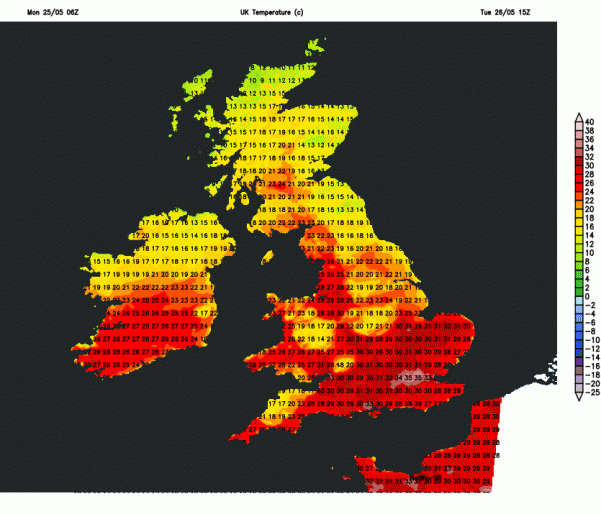
The unusual heat for late May will intensify further today and tomorrow and this afternoon the UK has now provisionally recorded its hottest May maximum temperature on record, with 34.0C recorded at Northolt in NW London and 33.5C at Heathrow not far away, beating the current record of 32.8C set in 1944 and 1922. Temperatures tomorrow may reach even higher, between 33 and 35C.
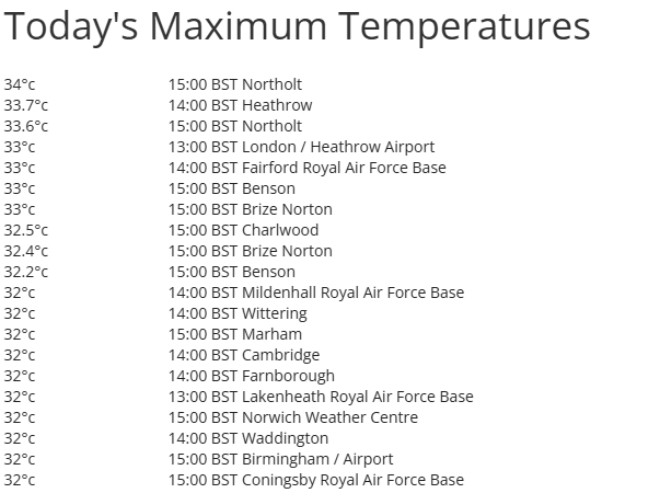
Last night set a new May record too - for highest minimum temperature recorded in May, with the temperature at Kenley Airfield on the southern edge of Greater London falling no lower than 19.4C overnight. It is likely that we may beat this record again tonight, with today being hotter than yesterday, if the temperature falls no lower than 20C tonight at any official station, it will be defined as a ‘tropical night’ temperature (no lower than 20C) – never recorded before in Spring in the UK.
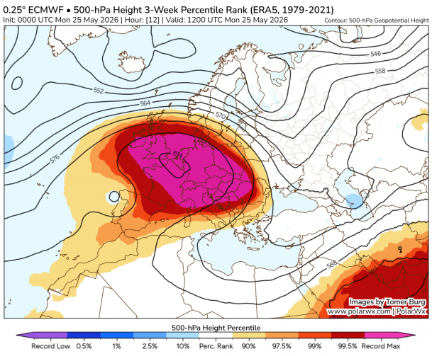
The reason for the unusually hot and record-breaking temperatures at the moment is partly down to unusually strong upper level ridge and subsidence leading to high air thickness and thus record surface temps. The high 500 hPa heights today (about 5.5km up), are potentially highest on record, across SE England there forecast to reach 594 dam. 850 hPa temps are near record too. The EC Extreme Forecast Index for 2m temperatures shows values above 0.8 signifying that very unusual or extreme weather (surface temperatures) is likely.
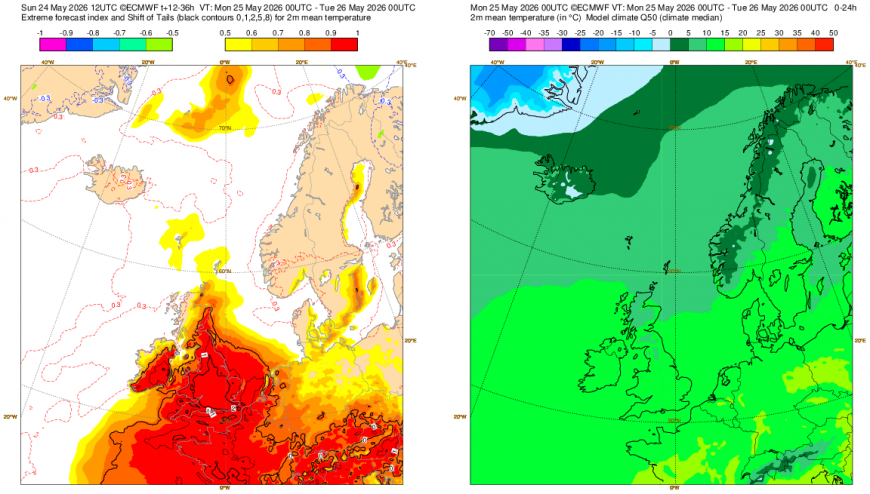
But also, climate change and generally warmer temperatures in the oceans and source regions of the airmass we are in today are likely to contribute to the high temperatures.
While an exceptional record-breaking May heatwave is gripping large parts of England and Wales, northern Scotland and parts of Northern Ireland remain cloudier and much fresher with patchy light rain, temperatures here reaching 17°C to 22°C.
Although most of the UK will be dry on Tuesday, exceptionally hot across large parts of England and Wales, there is small risk of a thunderstorm developing across central and northern parts of England in particular.
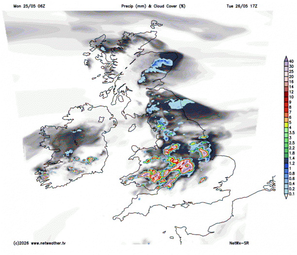
The rest of the week looks to remain largely dry on the whole, however, high pressure will reposition to allow a northeasterly flow to develop on Wednesday, which will mean eastern areas will turn fresher, with the heat transferring to more western areas for a time.
It won’t be dry everywhere all the time though, some showers, perhaps heavy and thundery, may move in across SW England, Wales and perhaps parts of Ireland during Wednesday evening, before spreading erratically north-eastwards overnight and through Thursday morning, but tending to fizzle out before reaching Scotland and eastern areas of England. High pressure builds back in across most areas through Thursday and Friday, so generally becoming dry for most and temperatures back up again towards the east, perhaps reaching 30C in the London and widely in the high 20s Celsius across central and southeastern England away from coasts.
Not so hot on Friday, as winds turn more westerly off the Atlantic, but still above average generally over England – reaching 22-25C.
Loading recent activity...