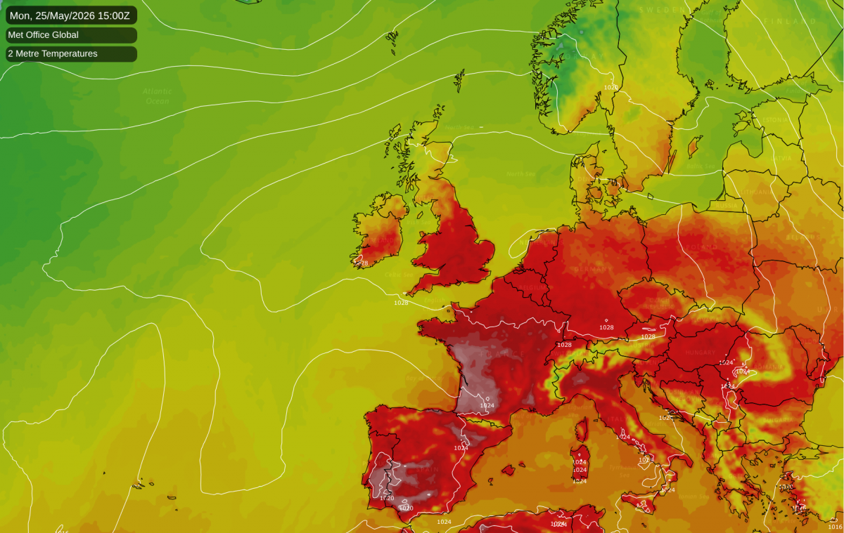
For much of the country, this Bank Holiday weekend is emphatically forecast to run counter to the image of Bank Holiday weekends generally coinciding with cool cloudy wet weather. The all-time May temperature record is under threat and has a fair chance of falling on Monday or Tuesday.
The record is 32.8°C, set at Horsham (Sussex), Tunbridge Wells (Kent) and Regents Park (London), on the 28th in 1944. There was also a reading of 32.8°C at Camden Square (London) on 22 May 1922, but this is more questionable due to the non-standard nature of the site. A higher reading of 33.4°C at Rickmansworth (Hertfordshire) in 1947 is also generally discarded as a suspect reading.
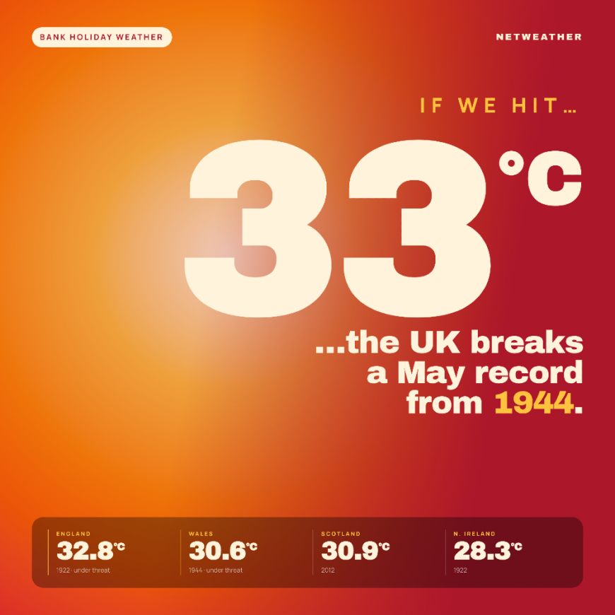
The weekend will be hot for most of the UK, but not record breaking, although much of Scotland and Northern Ireland will see less remarkable temperatures, due to some cooler air coming in via a westerly flow. The heat will peak in the southern half of England through next Monday and Tuesday. Looking at the current forecast model runs, the high resolution UKV is suggesting highs of 33°C in parts of southern England on Tuesday. The European ECMWF model is also suggesting temperatures that could be high enough to break the record on both Monday and Tuesday. However, the American GFS model is suggesting temperatures a couple of degrees lower than the ECMWF model, which may result in top temperatures falling a degree short, peaking at 31-32°C.
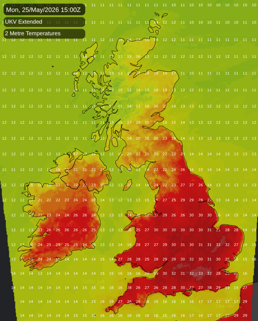
Thus, as is often the case in these situations, it is "touch and go" regarding whether the temperature record will fall. One notable exception was on 19 July 2022, when temperatures were generally forecast to reach or exceed 40°C somewhere in England (some model runs even predicted a record high of 42 or 43°C, which turned out to be overdoing it), which was set to smash the previous all-time UK temperature record.
Around the middle part of next week, cooler weather will spread south through eastern Scotland and north-east England, so it is probable that eastern Scotland will miss out on the hot weather completely. However, the hot air masses over southern England will track northwards through Northern Ireland and western Scotland, giving those regions a hot spell - not as hot as in southern England, but temperatures could widely hit the high 20s Celsius.
We are heading into an El Nino event, and there are growing questions about what the summer of 2026 will be like. Notable previous years during which we headed into a strong El Nino were 1966, 1982, 1997 and 2015. It is worth noting that 1966, 1982 and 1997 all had a warm/hot and sunny spell at the end of May. The Junes of 1966 and 1982 were both fairly unusual in that they were warm but wet. They were both dull months over much of Scotland and northern England, where there were numerous slow-moving frontal systems, but particularly in the case of 1966, sunshine totals were widely close to normal in the south. Both Junes were also notably thundery, especially in the case of 1982 in the south. The first half of June 1997 was widely warm and thundery, and quite sunny in some regions, but turned dull, cool and wet after midmonth, especially in the last week.
However, 2015 was a completely different story to the other three years - most regions had a cool cloudy wet May, dominated by low pressure and westerly winds, and then the weather settled down in early June, which ended up cool but dry and sunny for most.
This year is looking set to follow the 1966/1982/1997 analogues into early June, with a breakdown to changeable but still rather warm weather, associated with an east Atlantic trough and mainly south-westerly winds. Longer range outlooks at present are not suggesting that we're in for a particularly wet June overall, however. The ECMWF 42-day forecast has high pressure building back in across the country towards mid-June, while the Met Office outlook for the first half of June is suggesting a northwest-southeast split, with mainly south-westerly winds and potential for some very warm or hot spells.
The forecasts also point towards potential for us to end up with a June similar to that of 2003, which had a persistent east Atlantic trough/Euro high setup which kept the weather rather changeable but also very warm, and sunnier than average for most regions, particularly England and eastern Scotland. Generally the potential for substantially cooler than average weather in early June has receded considerably, with the breakdown looking set to come via an east Atlantic trough rather than a Scandinavian trough.
Loading recent activity...