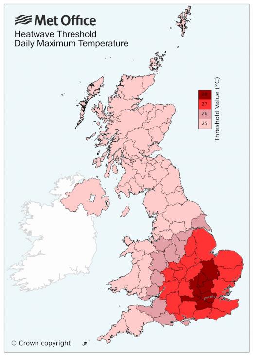
It is likely a late-May heatwave starting on Friday and lasting through into early next week could push temperatures into the high twenties or even 30C in the south. Three or more consecutive days meeting heatwave temperature threshold, see map below, will meet heatwave criteria, likely across large parts of England and Wales.
But also, will temperatures break the all-time UK May record of 32.8C set back on 29th May 1944?
We are likely to see a significant jump in temperatures on Friday, as high pressure builds in from the near continent and a plume of warm air spreads northeast from Iberia into the south. Temperatures look likely to reach the mid-to-high twenties celsius in the afternoon.
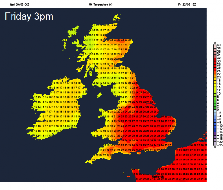
The weekend is looking largely dry and sunny, so it will remain very warm or locally hot across England.
Saturday may see more in the way of cloud building across SE England and East Anglia, with a risk of isolated thunderstorms - as a high Wet Bulb Potential Temperature plume (850 hPa theta-w temps of 18C) and elevated mixed layer (EML) spreads up from Iberia & western France. 00z ECMWF model run showing a plume of CAPE / steep mid-level lapse rates spreading northeast, which suggests a conditionally unstable airmass, though a lack of forcing and rising heights aloft make it a low risk of storms forming. But with perhaps more in the way of cloud - not as hot as Friday here, but still reaching the mid-20s, where sun does come out long enough, perhaps high 20s locally.
Hotter more widely on Sunday across the south of the UK - with clearer skies, prolonged sunshine and increasing air thicknesses from the south pushing temperatures upwards to perhaps reach 30C across SE England and East Anglia.
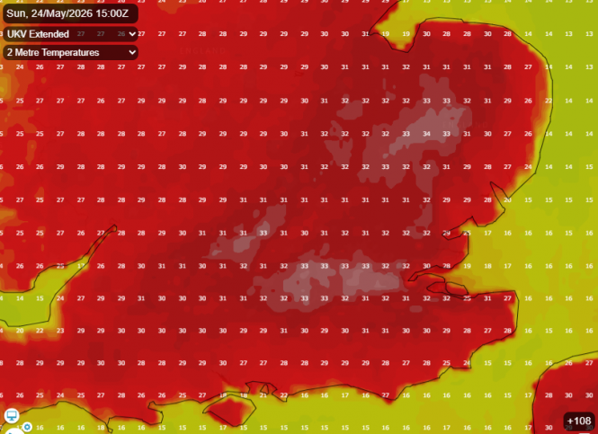
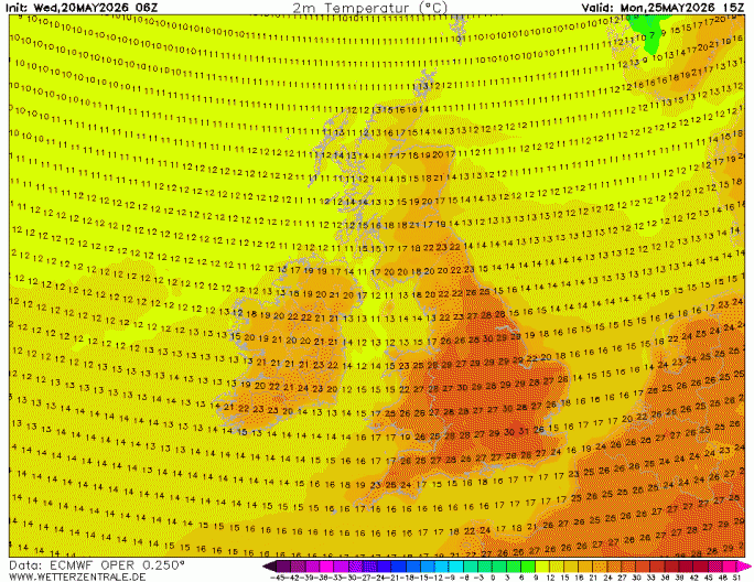
03z UKV even shows temperatures reaching 34C on a gridpoint in East Anglia, 33C in the general area and also in London and Thames Valley. These temperatures would break the UK May maximum temperature record of 32.8C set in a few SE England locations way back on 29th May 1944.
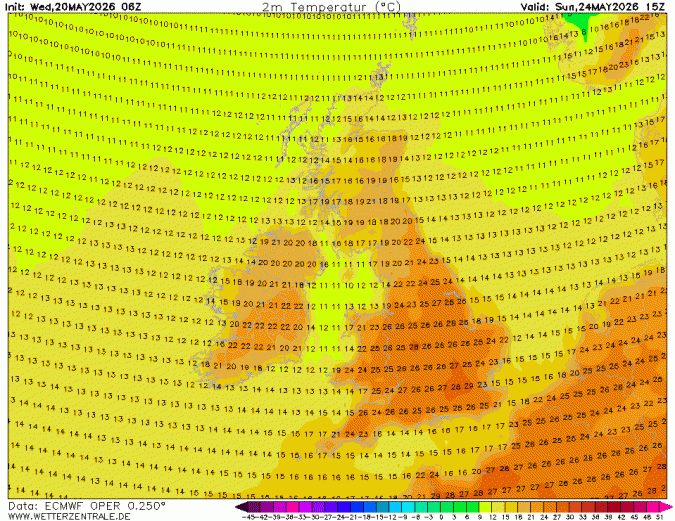
However, we think UKV may be over estimating temperatures by a few degrees at least. 06z ECMWF & other models not as hot Sunday, going for 28C. Appears that UKV may have a bias to overestimate temps at range compared to other models, especially when strong subsidence of dry air from aloft to surface is involved
06z EC does show 31C in the capital on Bank Holiday Monday, as a strong blocking upper level ridge and surface high pressure rapidly builds north across southern UK and the near continent. Strong subsidence of dry air from aloft will create cloud-free skies across southern UK, with strong sunshine allow temperatures to soar towards 30C.
Much of the UK will have a dry, settled, sunny and warm Friday and Bank Holiday weekend, thanks to high pressure in control. It will be very warm or locally hot across central, southern and eastern parts of England and south Wales. The exception will be across northern Scotland, where Atlantic weather fronts and breezier conditions will bring cloudier skies, patchy rain or drizzle and cooler feel.
Loading recent activity...