There is rain in the forecast for this weekend with warmer air to the south but colder air in the north. This cooler flow will reach right down through the UK to end the weekend. It will bring the risk of frost to southern England by Sunday night. Temperatures will range from 16 to 20C, possibly into the low twenties on Saturday, in the south, but only 10 to 15C further north. May could do better.
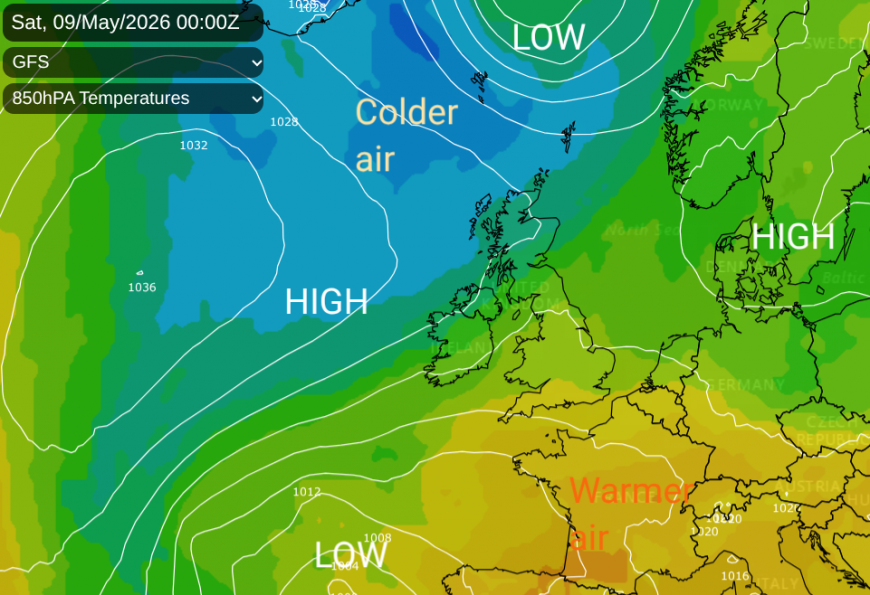
We start the weekend in a synoptic no-man's land, a col. This is the area in between two high pressures and two low pressures where the weather is often rather slow.
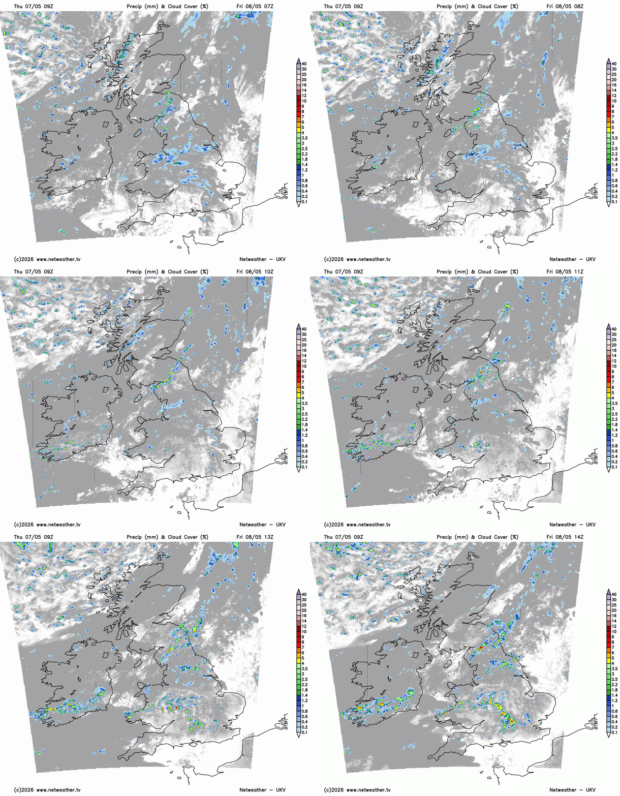
We also have a frontal boundary, which will bring cloud and rain but divides the warmer continental air to the south and the colder air from the Arctic. There will also be showers, with the potential for thunderstorms on Saturday afternoon. Wales through the Midlands up towards the Humber looks to be the prime zone.
A low pressure west of Iberia is steering the warmer air towards southern Britain, and the current low pressure near NW Scotland will move away over the Norwegian Sea as high pressure slips in from the north Atlantic. The frontal boundary will slowly sink southwards over Britain, clearing from Essex by Sunday lunchtime. Meanwhile, a new low pressure will develop south of Iceland and head towards Scotland later on Sunday, followed by more chilly air for the start of next week.
Friday evening
As the weekend starts, there will be warm air and light winds over England and Wales. Temperatures will be around 15 to 18C with up to 20 or 21C possible for London. By the evening, there will still be a scattering of heavy showers but plenty of bright or sunny spells. Further north, it will feel cool, especially as the sun disappears and the breeze turns to the N or NW. Expect a chilly night for Scotland and Northern Ireland
Saturday
With the frontal boundary close to the Scotland/England border, there will be more cloud and outbreaks of rain coming into NE England and at times eastern Scotland. A brisk northeasterly wind will pick up and add to the grim feel to the day with a chilly breeze, grey dampness and outbreaks of rain. On Saturday morning, this zone could be from Fife, over SE Scotland and NE England down to the Humber, perhaps reaching over the Pennines to the Yorkshire Dales early on. Think of the damp zone stretching NE/SW with plenty of cloud and outbreaks of rain. This cloud could edge into Aberdeenshire with showery outbreaks of rain for central and southeastern Scotland.
In Edinburgh on Saturday the city's Tartan Parade begins at 1pm. Starting on the Royal Mile and weaving its way to Princes Street Gardens. It is not going to feel warm, so you might be glad of some woollens but hopefully the cloud cover won't bring rain for the afternoon.
Northeastern England could see the wettest weather around lunchtime before the band begins to edge southwards to the North Yorkshire Moors. For northwestern England, there is the chance of some lee breaks and warm sunny spells later in the afternoon. There will be showery outbreaks of rain for north Wales, gradually into Cheshire.
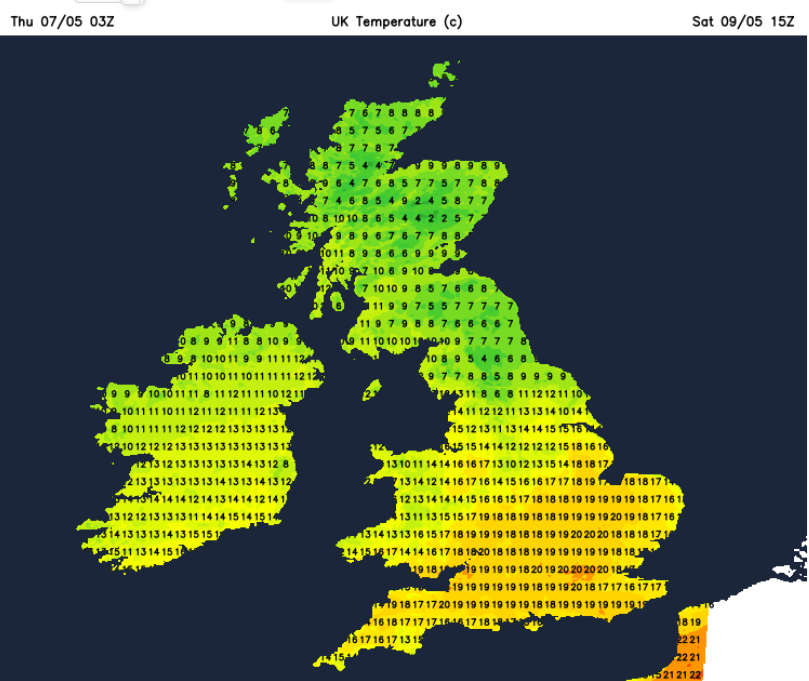
Further north, there will be a few lighter showers with bright spells and the cooler air. To the south of the band, there will be some fine, warm weather but the low pressure off Portugal will throw some unsettled weather towards northern France and across the English Channel. So there will be more cloud and showery outbreaks for SW England, the Channel Islands and perhaps along the south coast of England by Saturday afternoon. Some uncertainty for the southern counties of England, around when these showers will arrive. In between this southern band and the main frontal band, there should be a zone of fine, sunny weather. Here the temperatures will rise into the high teens and there will be the risk of a few heavy and thundery showers in this sunny zone. Any developing showers here will be slow-moving and bring hefty downpours with gusty winds.
The Royal Horticultural Society (RHS) Malvern Spring Festival will be in full swing by the weekend. Saturday does look to be the better day of the weekend but both day should be fine. Saturday should have lighter winds and more sunshine, up to 19C.
The RHS spring festival "heralds the season with inspiring gardens, spectacular blooms and shopping for all your gardening needs" at the Three Countries Showground, Malvern, Worcestershire.
Northern Ireland looks fine and sunny with a cool north wind and a small risk of a shower in the east later on Saturday. For the North West 200 event in Portstewart, the organisers will be glad of fine, dry weather this weekend for the motorcycle racing and many other events.
"Enjoy the Vintage and Classic Bike Run, Vintage and Classic Car Run, spectacular fireworks, Meet the Riders sessions, Paddock Walkabouts, live music, and a host of hospitality events, all set against the breathtaking Causeway Coastline. Northern Ireland is the heart of motorcycle racing on closed public roads".
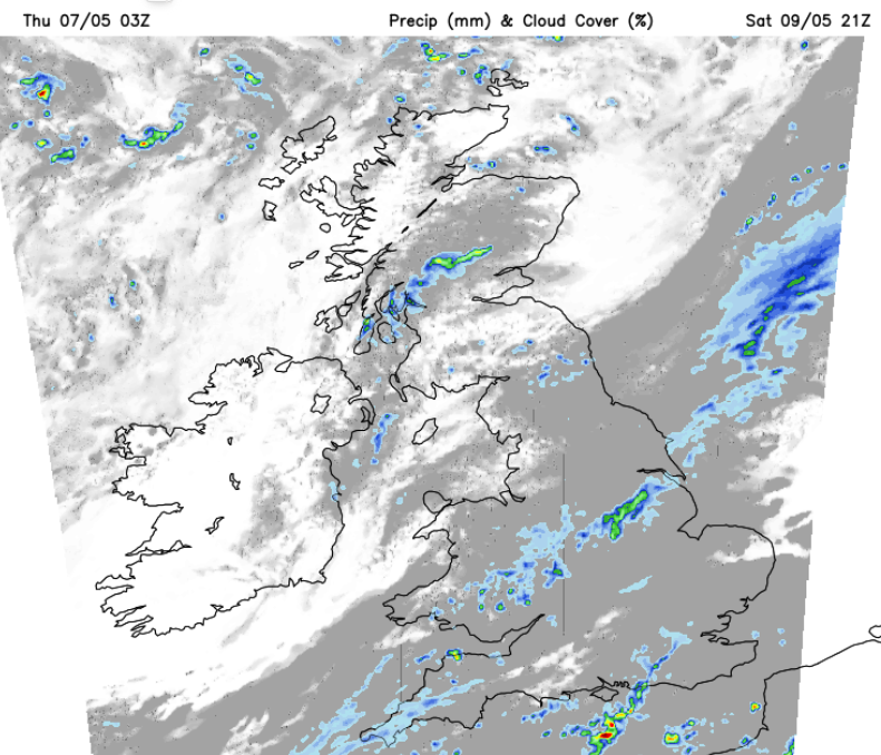
To the north of the frontal band, it will be a cold night with a northeasterly wind. Outbreaks of rain and cloud will continue along the band from Lincolnshire to south Wales. For southeast Britain, temperatures will dip to 7 to 10C in towns and cities as showers move over the far southeast of England during the night.
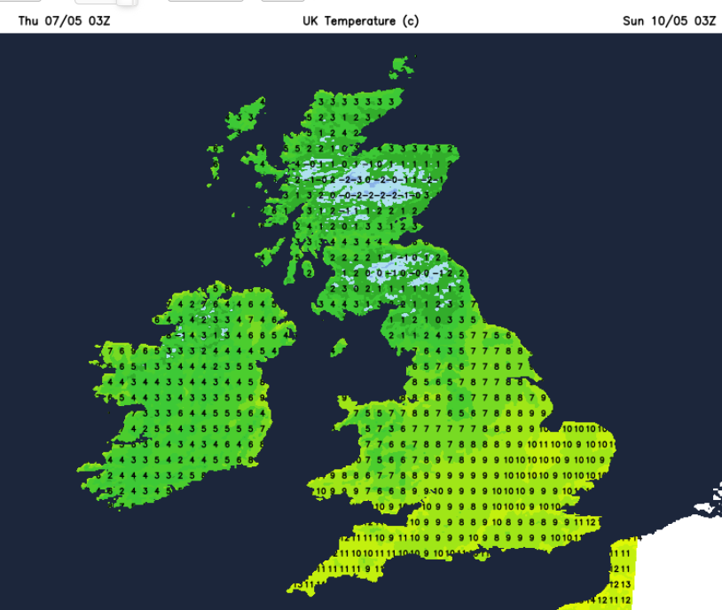
Sunday
The showery weather will still be over SE England on Sunday morning. For the north of the UK, it will be a sunny, bright start but feeling cool. Further south, there will be more cloud first thing, with occasional bright spells and a noticeable NE breeze off the North Sea.
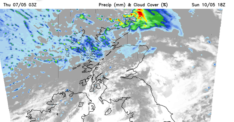
The Isle of Wight walking festival continues this weekend, now in its 26th year with events in May and also October. The weather could deteriote on Saturday as the showers move across the Channel but there is low confidence around this so it might just stay cloudy with a blustery east wind but warm at 18C. Sunday will feel cool in the northeasterly wind.
"An event for keen hikers, relaxed wanderers, and curious explorers alike, the festival is a friendly coming together in the great outdoors for all ages, offering a chance to meet new people, learn and discover the many wonders of the Wight."
Overall, there will be a lot of fair weather on Sunday with bright spells and then the next low heads in from the north with showers to end the weekend over northern Scotland.
Loading recent activity...