There is a Bank Holiday weekend coming up, and the UK weather is set to change. You knew it wouldn’t hold. High pressure over the UK this week is bringing a lot of settled, dry and sunny weather. By the weekend, that high will have slid away over central Europe, and there will be showers, frontal bands and cooler air mixing with the bright or sunny spells. It’s not a complete washout, but it will be a change from this steady, often sunny setup, and after a peak of warmth on Friday, the air will feel cooler.

Warmest day this week on Friday before a change at the weekend. Northern Ireland could see it's highs on Thursday with 18 or 19C
At this time of year, the sun’s rays are strong and UV levels are higher now. In any sheltered sunshine, you can suddenly feel much warmer, too hot even and have to peel off layers of clothes. It can be tricky to get our outfit right, even crossing the road from sunshine to shade can make a difference. We will have some warmer air to end the working week, which will mean that Friday evening will stay warm and it won’t feel as chilly after dark, or when the sun disappears.

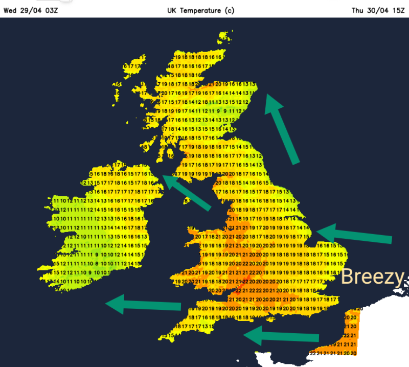
Thursday into Friday, our air will be coming off the continent with the high centred over Denmark and a S/SE flow. Through the weekend the flow veers to a westerly and then even to the northwest by Monday. A cooler air mass.
There is potential on Friday for temperatures to move up to 23 to 25, even 26C. By Monday, many will be around 13 to 16C but perhaps peaking at 20C for a few spots.
Today
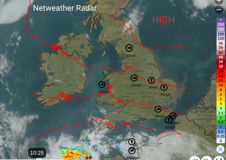
For most of the UK, it will be a fine and sunny day. We have clear skies under the high pressure away to the northeast but a brisk easterly wind across England into Wales. The east coast has been plagued by chilly winds off the North Sea, with occasional low cloud, while western and central Britain has enjoyed warmth and more sunshine. The brisk wind will continue through the day across the southern half of Britain, with only 14C for coastal East Anglia and Kent. Aberdeen and Newcastle only 13C today but with lighter winds. Manchester and Birmingham up to 18C.
On the satellite and radar image from Wednesday morning, you can see some patches of cloud, the top ten wind speeds after 9am and rain away to the southwest. At 10:25 there were two sferics showing on the radar, two lightning strikes so perhaps a flash of lightning visible out over the sea this afternoon. A few showery outbreaks of rain are expected over Cornwall, perhaps just reaching Dartmoor with ragged cloud for the Channel Islands and far southwest England.
Tonight
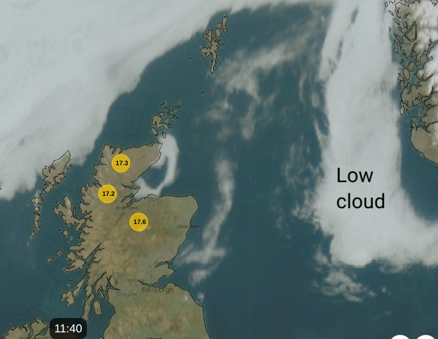
A low pressure over the Bay of Biscay will throw showers and bands of rain towards southern Ireland. Rain should reach Cornwall around midnight but the main focus is towards the southern counties of Ireland. Under the cloud cover in the far southwest, it will remain mild and for SE Britain near the coast with the stirring breeze off the sea. For most, it will be a clear, cool night with a touch of frost in places and murky conditions in eastern Scotland and Northumberland as the patch of low cloud in the North Sea arrives.
Thursday
Tomorrow will start off fine and sunny for most of Britain, although there could be haar/fret into northeast Britain from that patch of North Sea cloud. The easterly wind will still be noticeable for southern Britain but not as much as today. There will still be a risk of showers for Cornwall with more cloud, and this showery weather will edge up through Ireland into County Fermanagh by Thursday evening.
The cloud in the west will keep temperatures from falling away on Thursday night with just a scattering of showers. The winds will ease, and temperatures will fall for much of Britain, again with the chance of frost, particularly for northern Britain away from western coastal counties.
Friday
By Friday, there will be the flow of warmer air, lighter winds and plenty of sunshine warming the ground. Northern Ireland will still see patchy cloud with a few showers as will the coast of western Scotland, parts of Wales and SW England, but there will be bright spells too. The cloud will just hamper the temperature climb.
Widely, temperatures will be in the high teens and low twenties, perhaps reaching 24 to 26C. Kew Gardens saw 26.6C on the 8th April earlier this month.
Outlook for the Bank Holiday weekend
For Friday evening and the weekend, there will be more cloud and a higher chance of seeing some showers. Showers are always tricky because they are hit and miss; some places see the downpours and just along the road won’t. If your weather app has showers symbols, this is a risk of showers, not guaranteed rain.
The breeze will shift, there won’t be as much sunshine and there will be further showers so the glorious sunshine and warmth that many will experience on Friday won’t be around for the long weekend.
Loading recent activity...