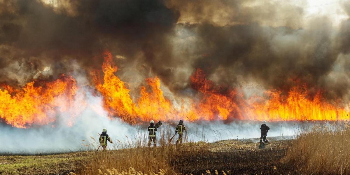
The UK is currently facing a surge in wildfire activity, with fire risk alerts issued for parts of Scotland and significant incidents reported across England. A spell of dry and windy weather following a warm spring so far has created an ideal environment for wildfires to develop and spread.
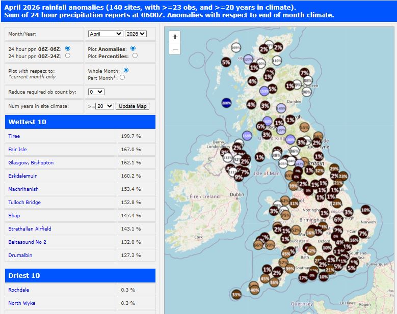
Very dry across large parts of the UK, looking at rainfall anomalies up to the 23rd April courtesy of Starling Roost Weather
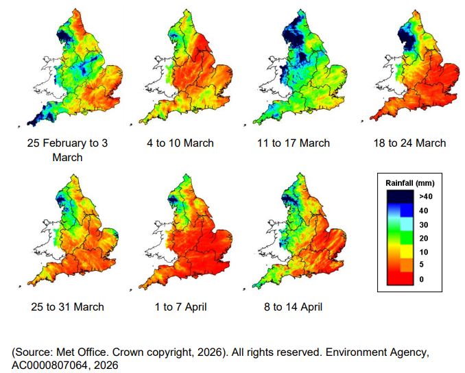
Wildfires are starting earlier in the season and typically lasting longer due to prolonged higher temperatures than the historic average. Following a wet end to the winter, then followed by the joint tenth warmest March and warm start to April, an early growing season this year has meant extra vegetation combined with increasingly dry and windy conditions have dried new and old growth producing ideal conditions for wildfires to quickly spread.
The National Fire Chiefs Council said that 2025 broke UK records for the most reported incidents of wildfires, surpassing the previous record in 2022. In Spring 2025 (March to May), the UK experienced a record-breaking wildfire season, largely driven by the driest spring in over 100 years and the warmest spring on record. English fire services recorded at least 12,454 wildfires between March and May 2025, a more than fourfold increase compared to the 2,621 incidents in spring 2024.
After a warm spring so far, and dry conditions with little rain across many parts over the last few weeks, there have been over a dozen reported wildfires across the UK this week, primarily concentrated in Scotland, the Peak District, and Surrey. Fire services have issued "extreme" and "very high" risk warnings as unseasonably dry conditions persist, with fires spreading quickly with strong easterly winds with low humidity.
The Scottish Fire and Rescue Service has placed Western Scotland under an "extreme" risk alert from Friday, 24 April, through Sunday, 26 April. Central and Eastern Scotland are under a "very high" risk warning. Most wildfires in Scotland occur in the early spring period - when dead grass has yet to ‘green up’ and so is a ready available fuel during dry and windy periods.
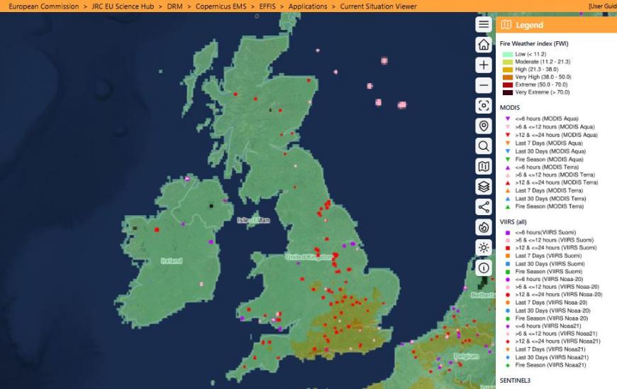
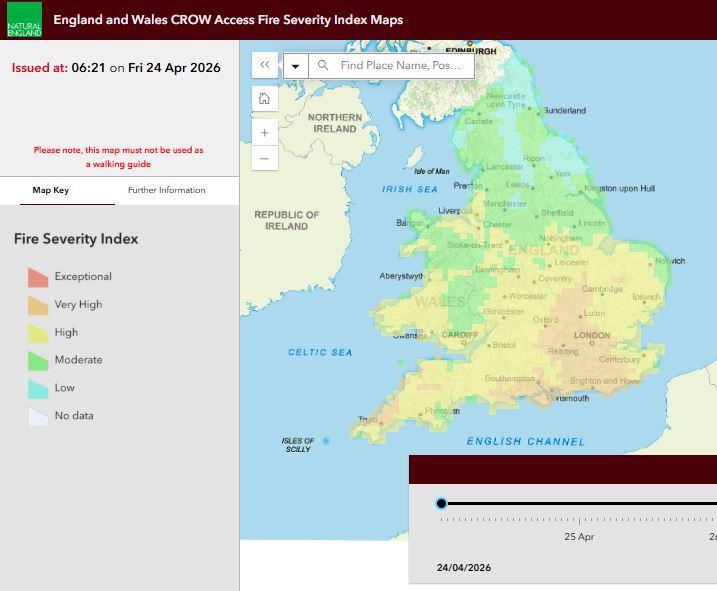
Dry conditions will prevail across England and Wales too over the next few days, with fire severity index high or very high across southern areas of England according to this site
Some of the wildfires over the past 7 days include:
So when may there next be a chance of rain to dampen chances of further fires? The weekend is looking largely dry across the UK, though Sunday may see a few light showers across parts of Scotland and N. Ireland. There could be a better chance of rainfall on Monday, at least some brief dampening of the ground in parts of England from showers. The weather models show a mid-level upper low drop south & deepen as it reaches the south later in the day, this could trigger some heavy & perhaps thundery showers Monday afternoon across parts of England. But this is a brief blip before high pressure builds back in next week
Heavy and thundery showers possible on Monday across parts of England, but high pressure and dry conditions return from Tuesday through to the weekend.
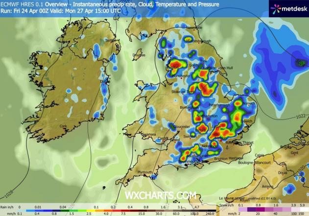
Rainfall chances early next week, then drier until rain chances return over Bank Holiday Weekend
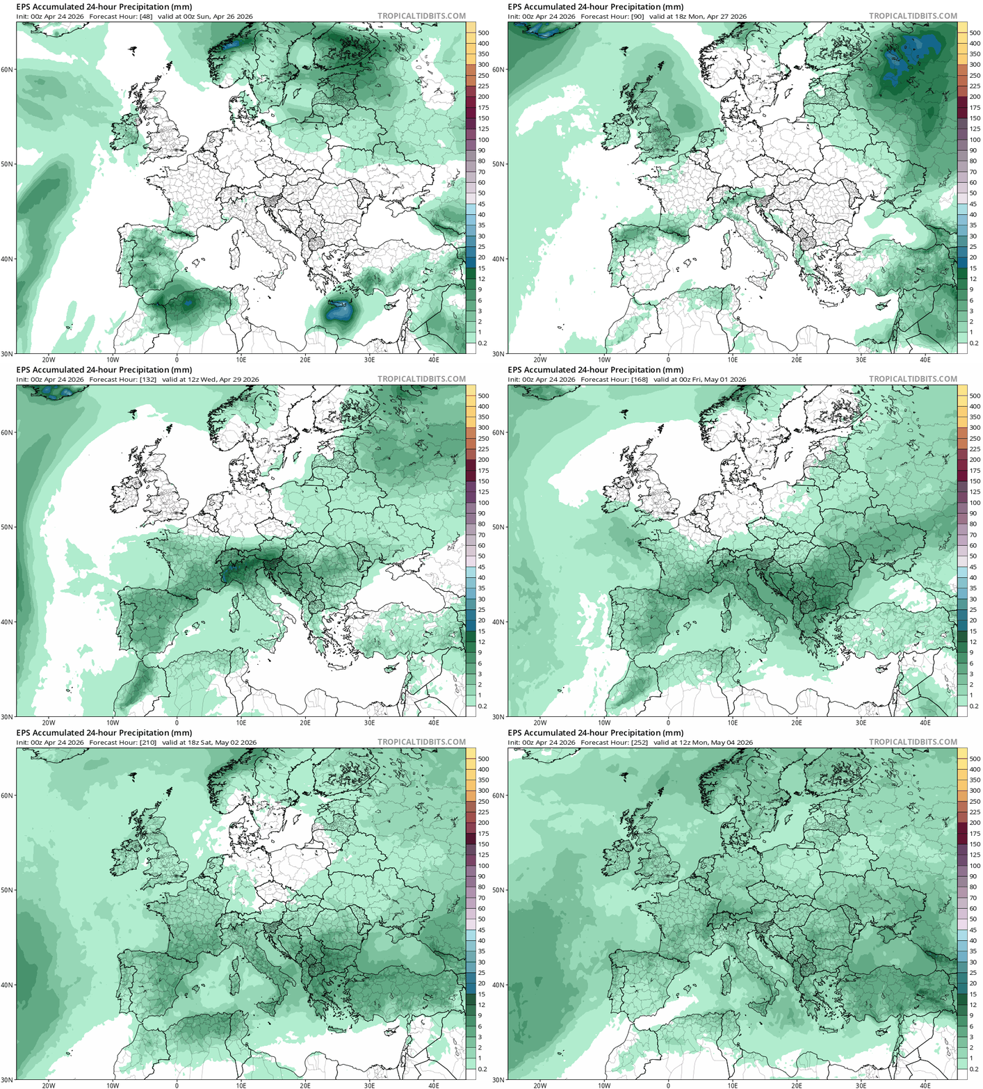
However, there are hints it could turn unsettled over the early May Bank Holiday Weekend, with high pressure relaxing and low pressure with showers or longer spells of rain and cooler conditions taking over.
Loading recent activity...