




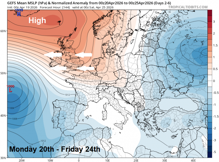
Blocking high pressure will dominate the weather across northern Europe, including the UK, during the coming 7 days or so, bringing mostly dry and settled weather this coming week. Though cloud will affect some areas of the UK, particularly the northeast and east, it will be often sunny on the whole. But an easterly breeze developing, particularly strong and gusty across the south on Wednesday, will make it feel on the cool side. Clear skies at night will also mean it will turn chilly at night, with a risk of frost in rural areas.
It will be a cooler feeling day today after a chilly start - with an early frost in places in the north and west. However, it will be a dry and sunny morning for many, especially for England and Wales, cloud will bubble up through the afternoon to bring a few isolated showers, but still sunny spells. More in the way of cloud across northern and eastern Scotland will bring more showers here. Temperatures reaching 11-13C in the north, 13-16C in the south.
Turning cold again overnight under long clear spells, with a touch of ground frost possible in rural areas, more in the way of cloud across the northeast - bringing further showers here.
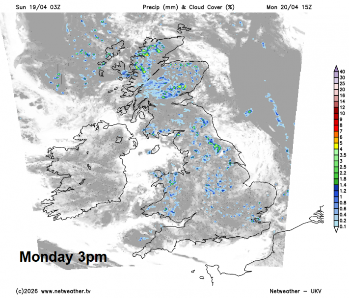
High pressure over the UK on Sunday will drift further north on Monday, allowing an easterly wind to develop, which will bring more in the way of cloud across northern and central areas, with showers developing across Scotland and northern England - which will drift into the Midlands and North Wales too. Best of the sunshine across southern and southwestern areas. Temperatures reaching 10-13C in the north, 13-15C in the south.
Perhaps starting cloudy on Tuesday with a few light showers across southern Britain, but cloud generally clearing west to leave most with a dry and sunny afternoon, a brisk easterly breeze will make it feel on the cool side out of the sun though. Temperatures ranging from 11-15C, highest in the south.
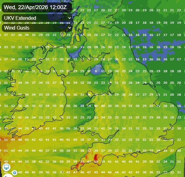
Becoming quite windy across the south on Wednesday, the easterly wind gusting to 40-50mph across SW England, 30-40mph possible elsewhere over hills and coasts. Dry and mostly sunny, though it will be cloudier across the northeast and also, later in the day, the far southwest - where a few showers can’t be ruled out by early evening.
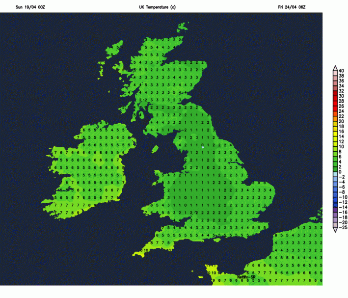
Dry with plenty of sunshine for most on Thursday, though cloudier towards eastern coasts, still a brisk easterly breeze in the south. Winds easing across the south on Friday, with high pressure in control bringing another dry and mostly sunny. Feeling warmer by day in the south later in the week, temperatures reaching the mid to high teens by Friday. However, it will still turn cold at night under clear skies, with a widespread frost possible Thursday night.
Next weekend
Next weekend looks to remain dry and bright or sunny - with high pressure in control, close to the north, a northeasterly wind may develop though - which may introduce more in the way of cloud to northeastern and eastern areas and making it feel on the cool side.
Loading recent activity...








