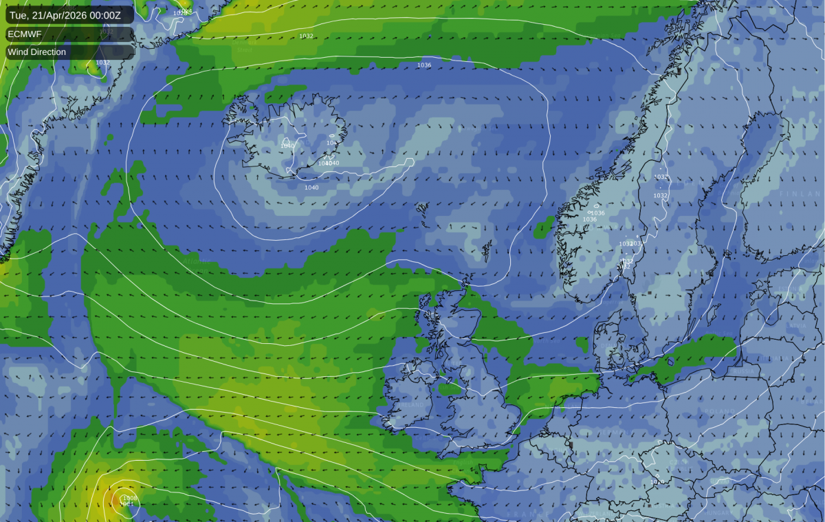
The upcoming 10 days or so look set to feature mainly easterly and northerly winds, which means that they will often be on the cold side. High pressure will often be dominant, which means that it will often be dry, and it will generally be sunny in western Britain as well, though with more variable cloud cover in the east. This means that there could be some damaging frosts after a spell of generally warm weather starting in mid-February.
I had wondered if it had been a while since we had this sort of pattern in April or May given that we've just had two record warm springs in 2024 and 2025, but in fact April 2024 had persistent northerly winds in the second half. They were not generally cold enough for snow at low levels, although it happened locally in the heavier showers around the 17th, but they brought a persistently cool spell of weather. However, as the first half of April was very warm, the month still ended up warmer than average.
April 2021 was particularly dominated by northerly winds, but with high pressure often placed in such a way that it brought limited amounts of cloud in off the North Sea, most areas had a very dry and sunny month as well. It was a rare example of a 2020s month that was substantially colder even than the 1961-1990 average, a period which contained a number of cold Aprils.
Northerly and easterly winds tend to be most common during the spring months and during the first half of June, as this is the time of year when westerly winds are traditionally at their weakest. This is the reason why much of western Scotland, Northern Ireland and north-west England, on average, has May as the sunniest month of the year. Typically as we head towards high summer (July and August), the westerlies become more frequent and deliver cloudier weather to these regions. Conversely, eastern England often sees sunnier weather in the main summer months, as the proneness to northerly and easterly winds in April and May often results in cloudier weather coming in off the North Sea.
There is a slight chance that we could get a northerly that is cold enough to deliver wintry showers, especially in north-eastern Britain, although if we do get one, it probably won't last long. It isn't very common nowadays, but snow near the back end of April did happen in three consecutive years in some places in 2015, 2016 and 2017.
In April 2015, at the end of what was generally a sunny and quite warm month, it was mainly north-east Scotland that had a spell of snow on the 25th. Most of England and Wales only had hill snow, but there were some widespread overnight frosts. In 2016, a potent northerly delivered wintry showers widely between the 25th and 28th, and parts of Yorkshire dawned with a snow cover on the 29th. The northerly on 24-26 April 2017. which followed a very warm first half of the month, was not quite as potent, but some areas still saw wintry showers to low levels, especially in the north.
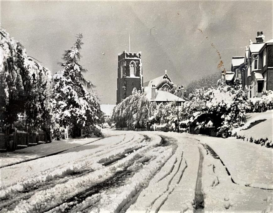
Looking much further back, two of the most notorious examples of late April snow happened on 24-27 April 1950 and 24-26 April 1981. The snowfalls of 24-26 April 1981 were particularly noteworthy, associated with a slow-moving frontal system. Some areas, especially on high ground, were cut off due to a combination of snow and strong winds, while lying snow penetrated widely to low levels for a time, with even Exeter in Devon for example getting some. The first half of April 1981 had been very warm, and so the month's mean temperatures were not far from the 1951-1980 normal that was the standard benchmark for the 1980s (but they were below the 1991-2020 normal).
Snow photgraphed in April 1950
The chances are that in late April 2026, high pressure will be too close by to the north-west for us to get a northerly that will be cold or showery enough to deliver widespread sleet and snow, but it cannot be ruled out completely.
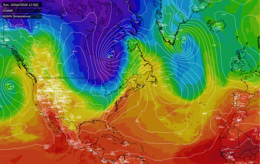
The winter of 2025/26 was record warm in the west of North America but was colder than average in the east, due to frequent northerly blasts in the eastern half of the country. The north-east of North America could well see some late snowfalls during the next few days, as another northerly blast heads in through the northern half of eastern North America. Temperatures will also predominantly be cold in the eastern half of Canada, where snow is likely in some regions.
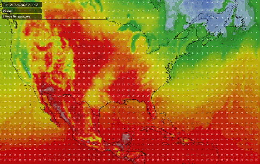
Conversely, it will get unusually hot in the western USA around Tuesday and Wednesday of this coming week, and this heat will spread into the east of North America, probably by Thursday or Friday. Temperatures can be especially variable in North America at this time of year, due to the large land mass which means that warm and cold air masses are less moderated than is the case in an oceanic climate such as in the British Isles.
Loading recent activity...