Low pressure looks to remain close to the northwest of the British Isles during the second half of this week, so there will be further showers around on Thursday, more organised rain spreading northeast across northern and western areas tonight, followed by a band of rain clearing east on Friday, followed by sunny spells and showers in the northwest.
Further showers are possible for the north on Saturday, but pressure will be building from the southwest, with drier, sunnier and warmer conditions in the south on Saturday spreading across all parts on Sunday, as high pressure builds across the UK and Ireland.
Low pressure close to the NW to end the week moves away and high pressure builds in over the weekend, with blocking high pressure taking control close to the north next week
A blocking area of high pressure looks to build close to the north of the UK over the NE Atlantic early next week, pulling in easterly winds into next week, dry conditions will prevail across most or all areas, though feeling cool in the breeze. Then the blocking high looks to drift northwest or retrograde to the Greenland area, with the possibility of colder northerly winds developing towards the end of next week and into the following weekend.
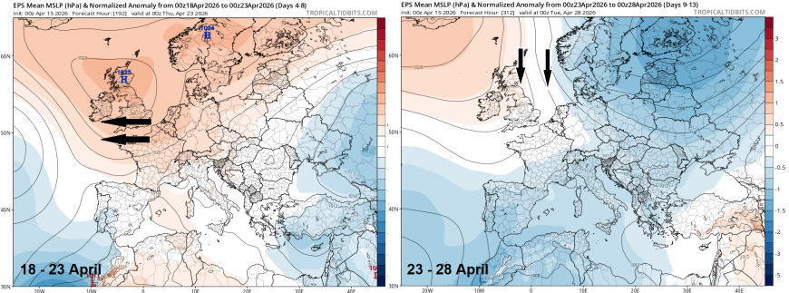
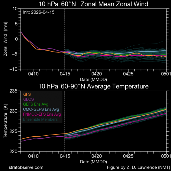
The appearance of blocking high pressure to the north is likely related to the Final Stratospheric Warming recently, which is the annual springtime transition where the stratospheric polar vortex collapses, shifting from westerly to easterly winds in the stratosphere, which is eventually mirrored in the troposphere - where our weather happens. It can be a slow, radiative process or an abrupt, dynamic disruption, often causing lasting changes in spring weather patterns, including high latitude blocking - which looks to occur from the weekend.
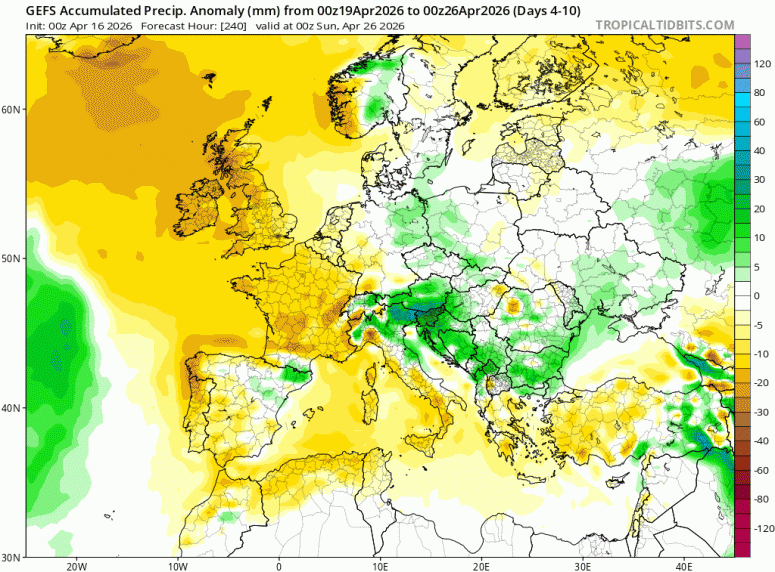
With high latitude blocking close to the north and eventually northwest dominating the weather over NW Europe, it’s looking a very dry picture from the weekend through to at least the 28th April, with very little rain for many.
Anomalously dry from Sunday 19th through to Sunday 26th
For now, still a fairly unsettled second half to the week, with low pressure close to the northwest. For today, after a bright or sunny start, scattered showers will develop, these most frequent and heaviest towards the northwest, lighter elsewhere, some sunny spells between the showers. Feeling warm in sunny spells towards eastern England, with temperatures reaching 16-17C.
Scattered showers today, rain spreading NE tonight across the north and west, clearing east tomorrow
Tonight, a frontal system will move northeast ahead of low pressure centred to the west of Ireland, bringing outbreaks of rain northeast across northern and western areas overnight, mostly dry if cloudy for central, southern and eastern England.
Friday sees overnight rain clearing northeast from Scotland while a weakening band of rain clears east across England followed by sunny spells but also some blustery showers in the northwest, windy here too. Temperatures reaching the low to mid-teens, warmest in the east.
Saturday looks to see sunny spells and scattered showers across the north, mostly dry and sunny in the south. Mostly dry and bright on Sunday with high pressure building in - highest temperatures in the south - reaching the mid-to-high teens.
High pressure in control on Sunday
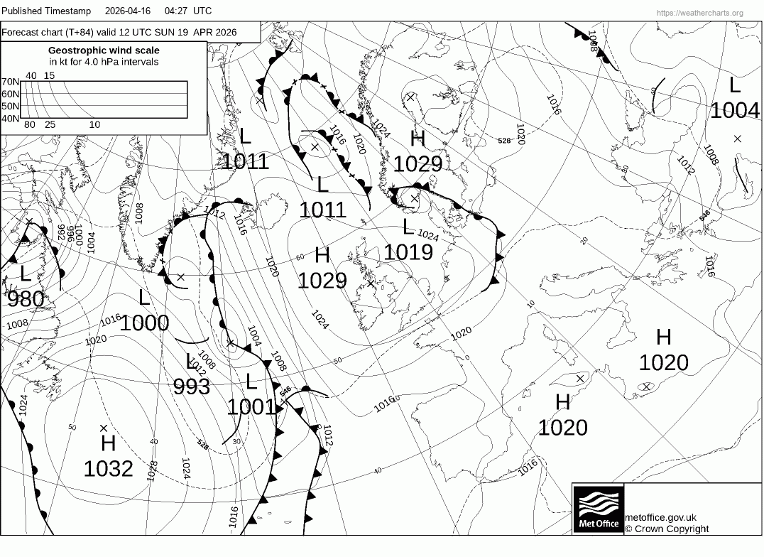
The dry and settled picture setting in on Sunday looks to continue through much of next week, but with an easterly wind picking up, it will be on the cool side, especially towards eastern coasts with the wind off the still cold North Sea. Highest temperatures likely across the west, where sheltered from the wind and where unbroken sunshine most likely, cloudier at times and cooler towards the east. Temperatures generally only reach the low teens at best, perhaps mid-teens with any prolonged sun and sheltered from the wind, i.e. west of high ground in the west. There is a risk of ground frost at night in rural areas where skies clear too, so gardeners beware if you’ve put out delicate plants.
It could turn colder the following weekend if the northerly develops, as models that got that far out currently advertise, with temperatures struggling to get into the teens, a risk of widespread overnight frost and some wintry precipitation, even snow, falling over high ground in the north. But the cold northerly is by no means certain to come off for now, but has support from ensembles.
Loading recent activity...