Isn't it mild! Such a change from what we have encountered so far this year. The southerly flow is bringing warmer air up from the Bay of Biscay and France. With sunny skies for much of southeastern Britain by lunchtime, the temperatures will respond today. Even further north and west, where there is more cloud and outbreaks of rain along a weather front, it will still be mild.
Temperatures before 8am were at 11C after a mild night across the UK. Temperatures today are expected to be around 14 to 17C in the sunshine. London and the Home Counties could see 18C today. Under the grey skies, it will be 10 to 14C which is still above average for the time of year.
The UK record for February is 21.2C from the 26th February 2019 at Kew Gardens (London). In that week, it was the first time that the UK had recorded over 20C.
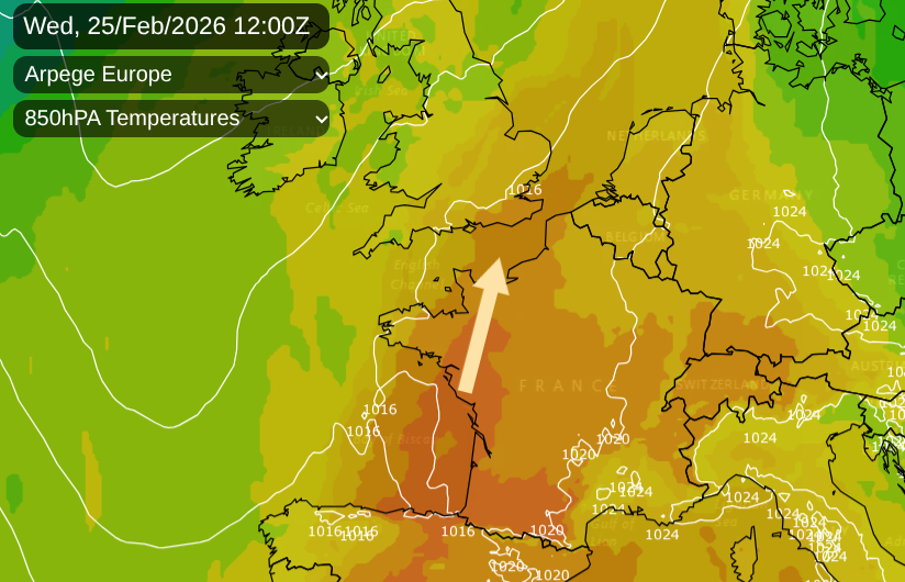
In this very mild air, southern England has seen over 16C already this week. The Canary Islands have reached 33C this week with a Calima (hot and dusty wind) from NW Africa. Yesterday, Spain reached 28.2C in Cantabria, 26.9C in Bilbao. In France by day, stations passed the 25C mark, which is more like May. 27C in Biarritz, 28.3°C in Orthez (Pyrénées-Atlantiques station opened in 1994, surpassing the 27.1°C recorded on February 16, 2020, which is 14°C above normal) as St Gladie, SW France, reached 29.6C.
Some weather stations in SW France also saw their highest minimum temperatures ever recorded for the month of February, at 11 to 12C.
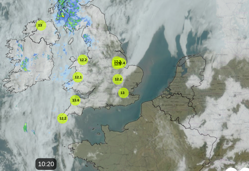
Netweather Radar and satellite showing clear skies, and so sunshine, over France, Belgium and SE Britain
Paris is forecast to see 20C today, which is 10C above average. For the UK, London could reach 18C in the sunshine, which would be eight degrees above average, maybe somewhere tipping to 19C today. Tonight, Northern Ireland and Scotland will be around 7-9C which is closer to their average daytime temperatures.
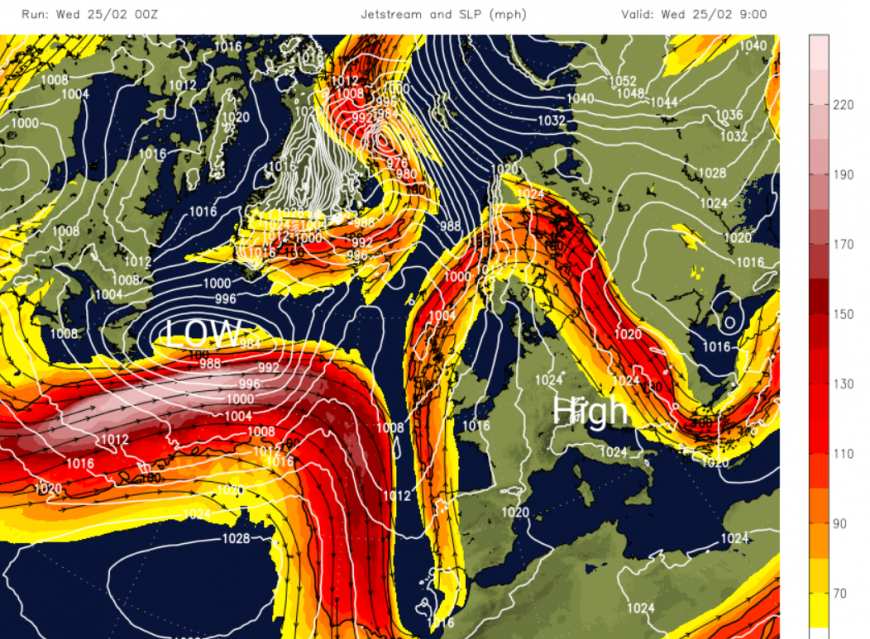
With high pressure over central Europe and a great meander in the jetstream, the frontal band running north south over Ireland and western Scotland will only make slow progress eastwards into Wales today. A stronger jet will head our way, helping a cooler westerly flow arrive at the surface behind rain on Thursday. Temperatures will fall later this week for the UK.
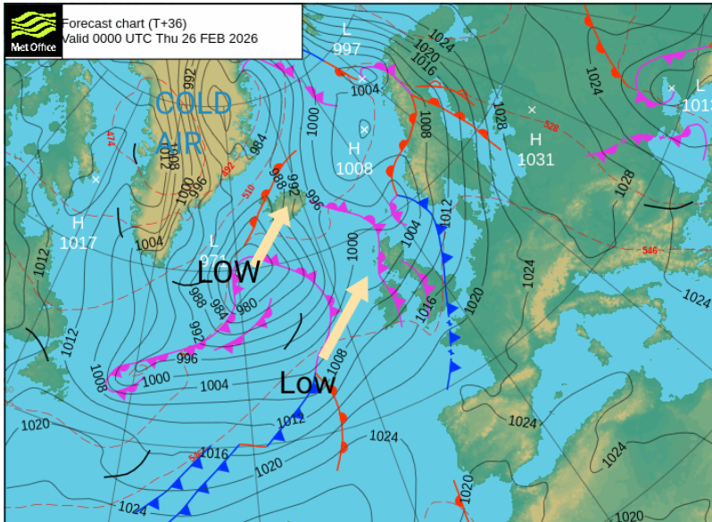
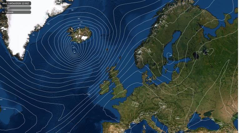
The low to the north of the jet core is the Nor’easter winter storm, which dumped three feet of snow over Rhode Island and Massachusetts.
This is heading towards Iceland and won’t directly affect our weather but as it continues northeastwards, it will pull cold Arctic air (from Greenland) over Iceland and towards Scotland for Friday. This will help lower the temperatures across the UK by the weekend with a frost on Friday night for northern Britain and Northern Ireland.
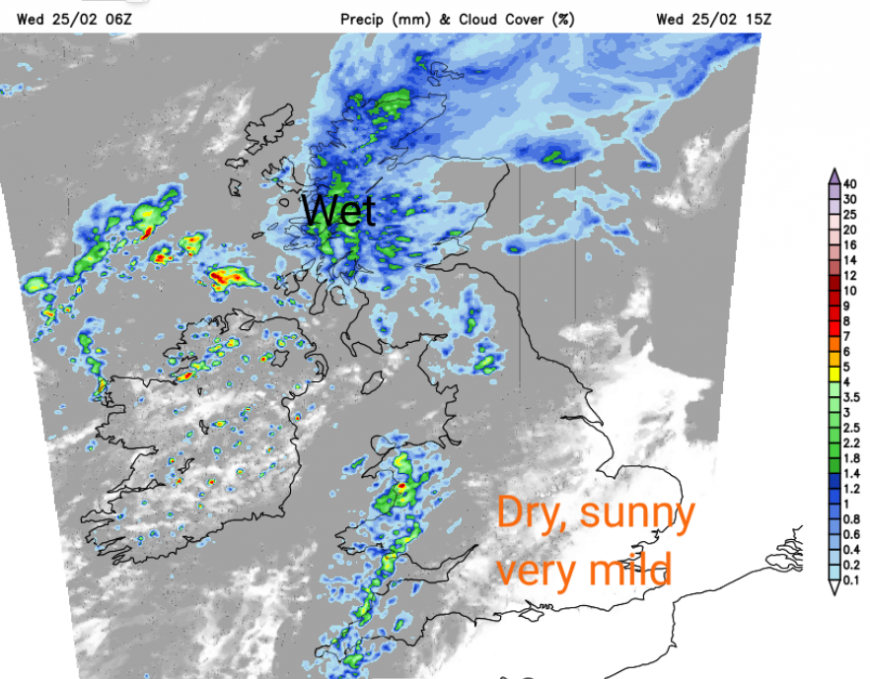
A low centre to the northwest of the UK today will continue to bring unsettled weather from the Atlantic with cloud and frontal rain, even though it is mild and the winds will be light. The wet weather will keep feeding into western Scotland today but also reach northern Scotland, Northern Ireland and gradually across the Irish Sea to Cumbria, Wales and down to SW England this afternoon, the Dales and Peak District by this evening. It will be blustery along this cold front later today, but Northern Ireland will change to bright spells and showers with a southwesterly breeze.
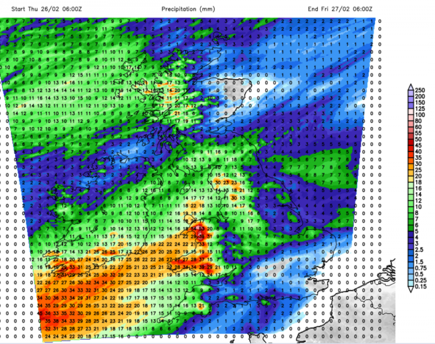
Remember that powerful jet, that will help the next incoming weather system. The southwesterly winds will pick up for Thursday morning as frontal rain arrives over Ireland. The very mild air in the southeast of Britain will be shoved away as Thursday becomes a windy day. The rain band will start over Northern Ireland and western Scotland early in the morning. The band pivots southeastwards over NW England and Wales, where it will become rather wet. Northwestern Scotland will see more rain but Moray and parts of Grampian could see sunshine in the shadow of the mountains. The frontal band over Wales and England will continue to rain over Wales with another pulse of wet and windy weather for SW Britain during Thursday night. A new low will be forming and heading up from the Western Approaches.
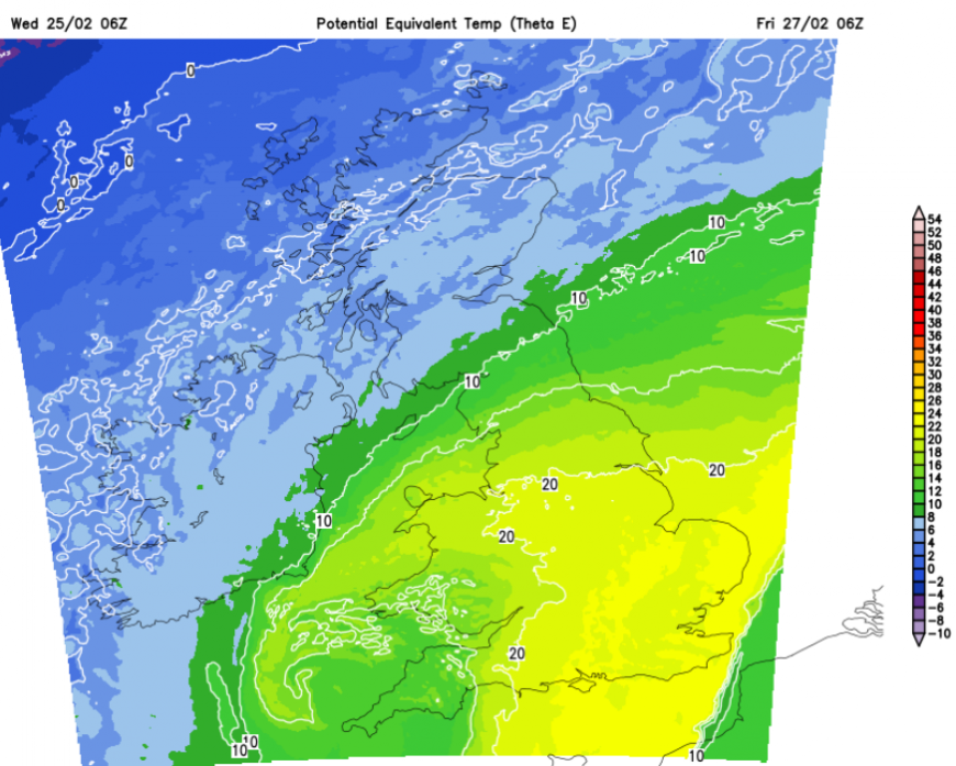
By Friday, the frontal rain will be across a central swathe of Britain with fresh winds wrapped around the low for southern Britain. Today is the peak of the temperatures but England and Wales will have another mild start on Friday.
Loading recent activity...