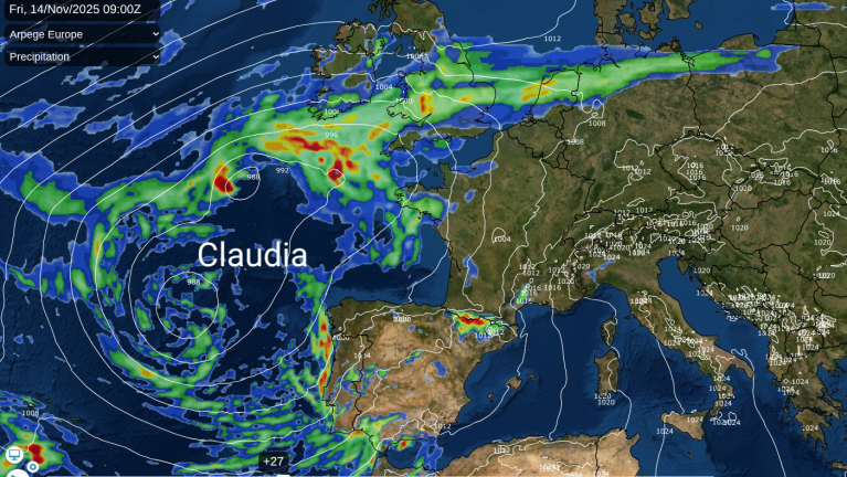
Wet and windy weather is expected to cause disruption on Friday as Claudia (a Spanish named storm) combines its rainbands with ongoing rain over the UK. Southeastern counties of England should miss the worst of the rain and continue with mild conditions but further north, Arctic air has reached Scotland with a dusting of snow in the north. This cold, brighter and drier airmass will reach down through all of the UK next week.
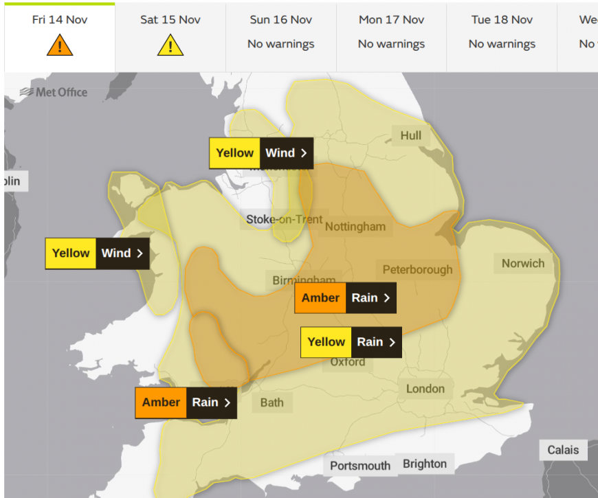
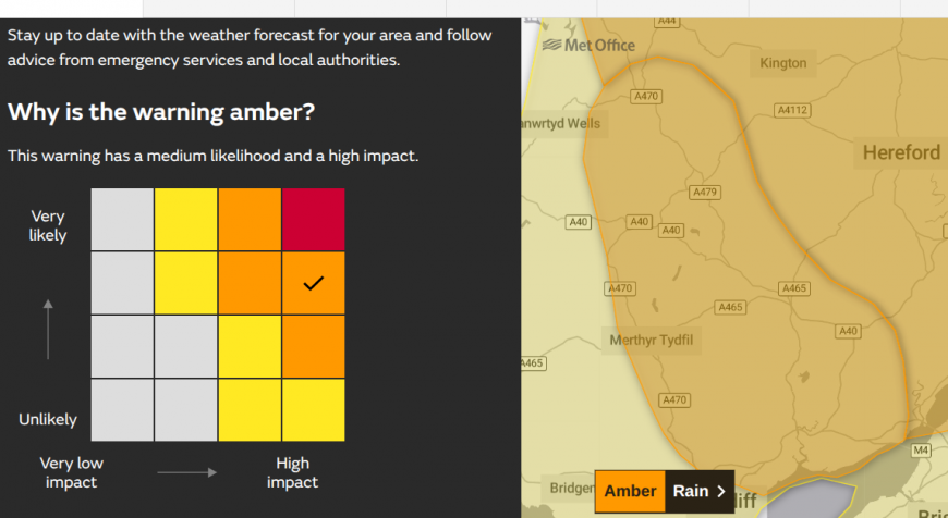
There is a strange mix over Wales and England with some areas seeing saturated ground after a week of downpours, and ongoing official drought at the start of November in Yorkshire, the Midlands and parts of SE England. The weather warnings combine the amount of rainfall expected, the existing conditions on the ground and the probable impacts from the severe weather. The Met Office discuss all this with the environment agencies before decreeing which level of weather warning, yellow, amber, red is created.
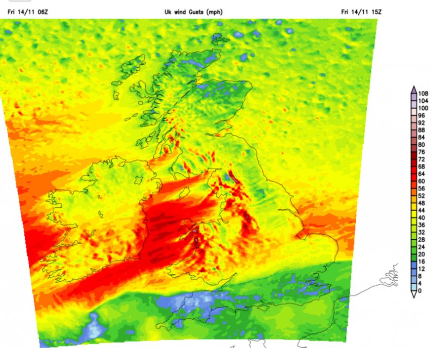
There is a strong easterly flow around the top of the low pressure (Claudia) and this is an unusual direction for heavy rain. Our prevailing winds in the UK are from the southwest and this easterly flow will dump heavy rainfall onto windward upslopes as wild lee gusts develop. There are wind warnings for NW Wales and NW England as these lee gusts develop. The UKV model shows red and white areas to the west of the Pennines, the Peak District and Snowdonia/ Eryri.
There is a risk of surface water flooding, river flooding and travel disruption. There is a wide yellow rain warning over England and Wales but a sizeable Amber warning highlighting a medium likelihood and medium impacts from The Wash across the Midlands, S.Yorkshire into north Powys. There is a smaller area of particular concern over SE Wales.
“Storm Claudia is expected to bring very heavy rain, leading to flooding and disruption on Friday”
This amber warning relates to the likelihood of HIGH Impacts. These relate to the risk of “Danger to life, Prolonged disruption to day-to-day routines and activities, Prolonged strain on emergency responder organisations. Long travel delays.”
Natural Resources Wales “Widespread flooding is probable from rivers and surface water in the south-east of Wales today (Friday) where many properties could flood, and conditions may be dangerous to life. Whole communities could be affected. There could be disruption to travel and essential services.”
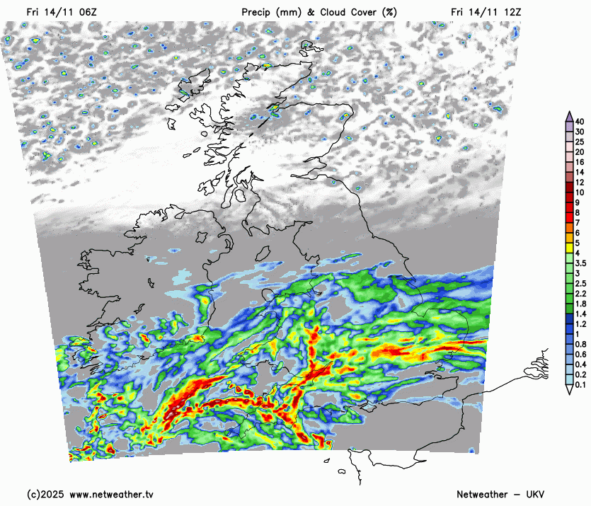
We’ve had two bands of rain combining on Friday, including Claudia’s warm front from the south. The cold front will arrive from the southwest during Friday afternoon with some embedded intense bursts. The UKV has very heavy rain around the Bristol Channel by mid-afternoon. The frontal band continues to bring rain across parts of Wales and central/eastern England as heavy, even thundery showers appear from the southwest. These will move over southern England up into the Midlands and then The Wash this evening and overnight.
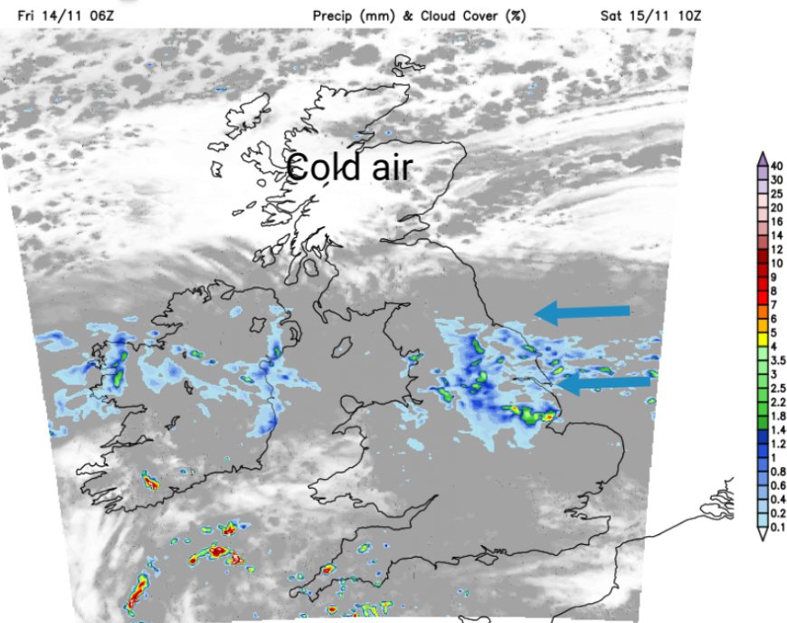
By Saturday, there will be a grey band over eastern England with the easterly wind still bringing damp weather and patchy rain. Lee gusts will continue for NW England in this zone across Britain. To the south it will be much improved with drier and brighter conditions. To the north, it will be chilly but with sunny spells for some.
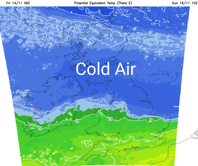
Sunday looks drier and sunnier but it will feel cold as a northerly flow brings Arctic air right down to all parts.
Further discussion and chat about Storm Claudia and the heavy rain on the Netweather community forum.
Loading recent activity...