After exceptional sun & dryness, late May brings a wetter turn for the UK. Southern Europe, however, is expected to see temperatures rise significantly toward month's end.
Spring 2025 has so far been exceptionally sunny and dry for much of the country, and up until Friday, May had also been exceptionally dry, with much of the country having had less than 5mm of rain, and a scattering of sites having recorded no measurable rain, including some in the west and south-west of Scotland.
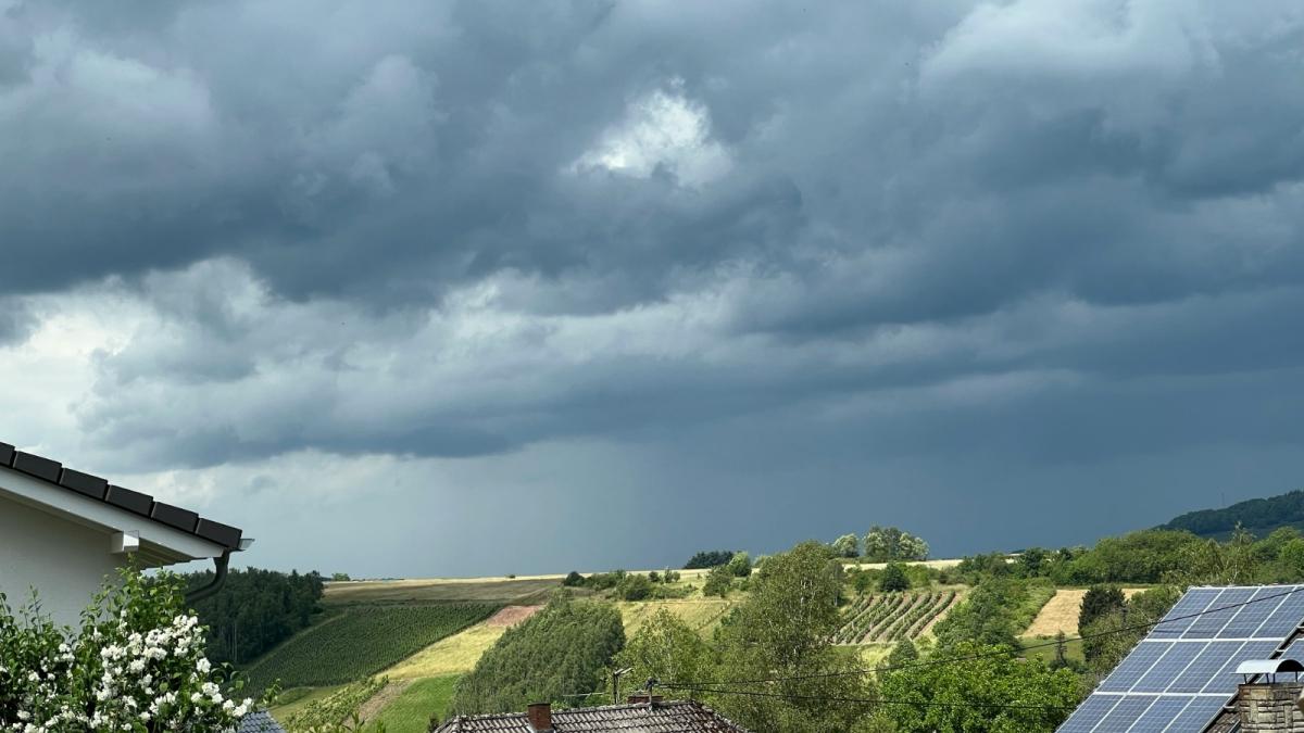
But the breakdown has arrived in time for the Bank Holiday weekend, and the rest of May looks set to be somewhat wetter and also cloudier at times. Some regions, particularly parts of eastern England and eastern Scotland, have potential lo record their driest spring on record, but this is now looking less likely than before, with some active rain belts forecast to move across the British Isles, often associated with tropical maritime air and a humid west to south-westerly type.
As is often the case in these situations, the forecast models had gone with an all-out change to a wet and unsettled spell of weather, dominated by low pressure, but then over-reacted to another signal and had high pressure rebuilding from the south after a few days with low pressure dominating, which could have resulted in some regions having their driest spring on record. The models have currently settled into a more "middle ground" scenario with high pressure building to the south during the next few days and sometimes ridging into southern Britain during the last few days of May and into early June, but with Britain generally staying in a west to south-westerly flow.
Another potential milestone is seeing the sunniest spring on record. So far in May 2025, according to Dan Harris's Starlings Roost Weather, the sunniest region has been north-west Wales and around the Isle of Man, with several sites having had over 260 hours of sunshine - an average of well over 10 hours per day. Eastern England has generally been the cloudiest region, due to frequent north-easterly winds which have sometimes brought cloud in off the North Sea - this is in contrast to March 2025, when eastern England was generally the sunniest region. But most places in eastern England have still seen above-average sunshine so far this May, with close to 200 hours in the first 23 days of the month.
It is looking probable that sunshine totals will be much lower generally during the last week of May, with a lot of cloudy and humid weather. Some brighter, showery days, including this coming Sunday and Monday, will add to the current sunshine totals, but we are probably looking at daily sunshine totals of between 6 and 10 hours for most of the country on these showery days, rather than well in excess of 10 hours as has been common recently. Ultimately, for much of the country May 2025 will probably not be as exceptionally sunny as the Mays of 2020 and/or 2018, except possibly for the aforementioned area of western Britain around the Isle of Man, but it still has potential to end up sunny enough to result in some parts of the UK having the sunniest spring on record in 2025, because of how exceptionally sunny March and/or April were in many areas.
Prevailing pressure patterns, with high pressure often over north-western Britain and northerly winds affecting a large part of Europe, have not generally been conducive to heat in southern and eastern Europe so far this May, and at times western Scotland has ranked highly among the warmest parts of Europe. But with the upcoming change in weather patterns, some hot air is forecast to build from north Africa into Spain and Portugal during the last week of May. There is uncertainty over how hot it will get, but there is a high likelihood of daily maximum temperatures getting into the high 30s Celsius across a wide area, and towards the end of May there is potential for temperatures to reach or exceed 40C, most likely in inland parts of southern Portugal and south-western Spain.
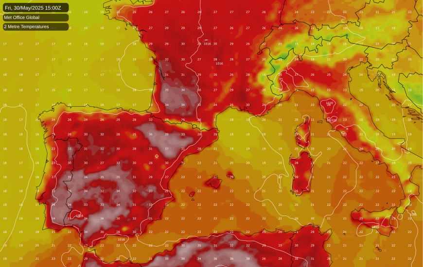
It will also warm up in other parts of southern Europe, but away from Spain and Portugal, notable heatwaves do not look likely to develop during the rest of May, with the heat over Spain and Portugal looking unlikely to spread eastwards across southern Europe until at least the early part of June.
Generally the westerly type over Britain with high pressure to the south and south-east looks set to sustain well into early June, but the ECMWF 42-day forecast model is going for high pressure building northwards over Britain as we head towards mid-June, and there is also a weak signal in that direction appearing on the longer ranges on the American GFS model.
Loading recent activity...