It’s been a very dry, sunny and warm May so far, and most of spring too, and the coming 6 days look to follow in a similar vein, thanks to high pressure in charge much of the time.
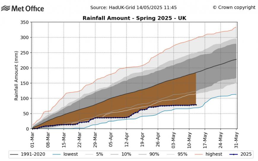
This spring so far has even seen more sunshine than last summer! This spring (so far) has seen 507 hours, while summer 2024 saw 492 hours. It’s also been a very warm spring so far, with the mean temperature for the UK this spring up to 13th May standing at 8.77°C, which is 0.69°C above the seasonal average. This places it as the 8th warmest spring since the series began in 1884. It’s also been a very dry spring, May has been particularly dry compared to the average so far, as the graph below shows:
However, there are signs of a change on the way by the Bank Holiday Weekend to cooler and more unsettled conditions, as high pressure finally retreats to allow areas of low pressure start to move in from the west off the Atlantic. This change to unsettled conditions could last through to the end of the month.
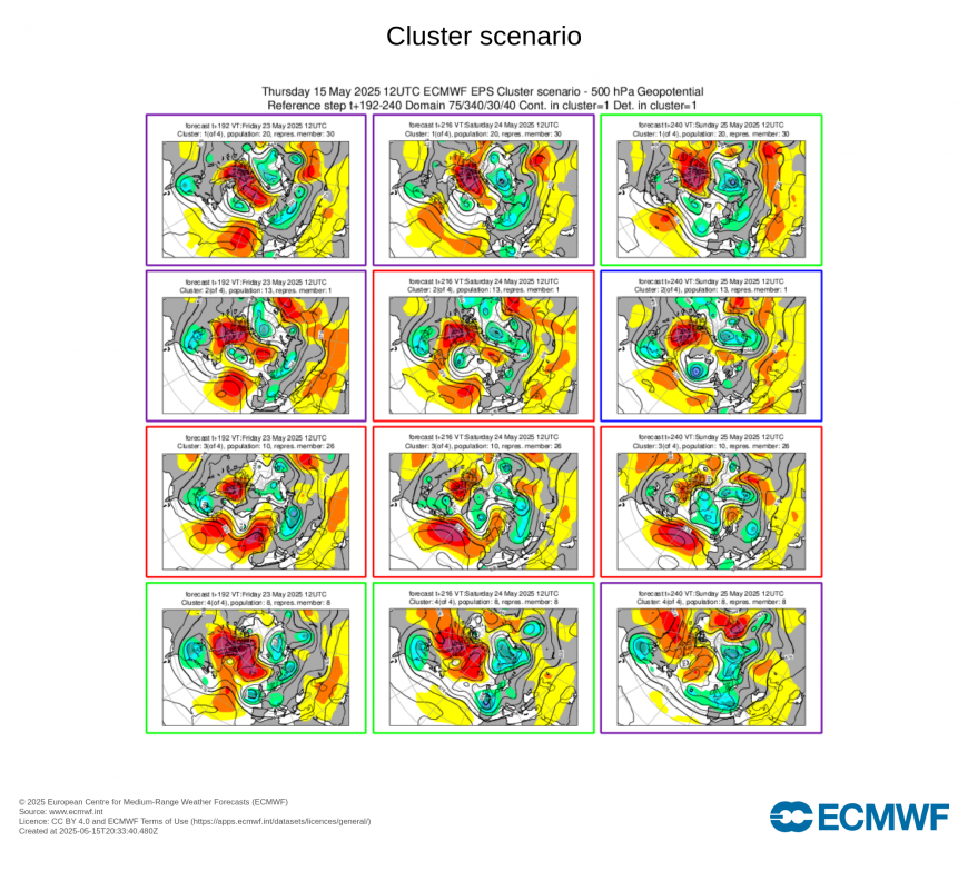
EPS clusters (12z run yesterday) favoured low pressure taking control through the BH Weekend as most likely outcome
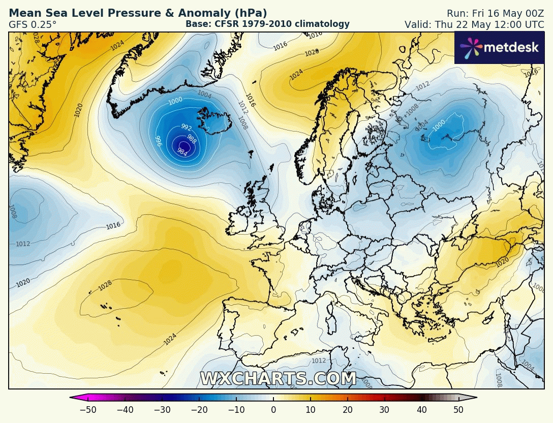
High pressure gives way to low pressure through the Bank Holiday Weekend:
The change could be coming about because the long-lasting effects of the unusually early final stratospheric warming that occurred in early March are finally beginning to wane. Since the reversal of winds from westerly to easterly in the polar stratosphere at 10hPa 60N on the 9th March, the polar vortex has never recovered. Thus the polar front jet stream has been weak and meandering, allowing blocking areas of high pressure to build with ‘dripping down’ of easterly winds in the stratosphere in to the troposphere helping to maintain these blocking areas of high pressure for prolonged periods.
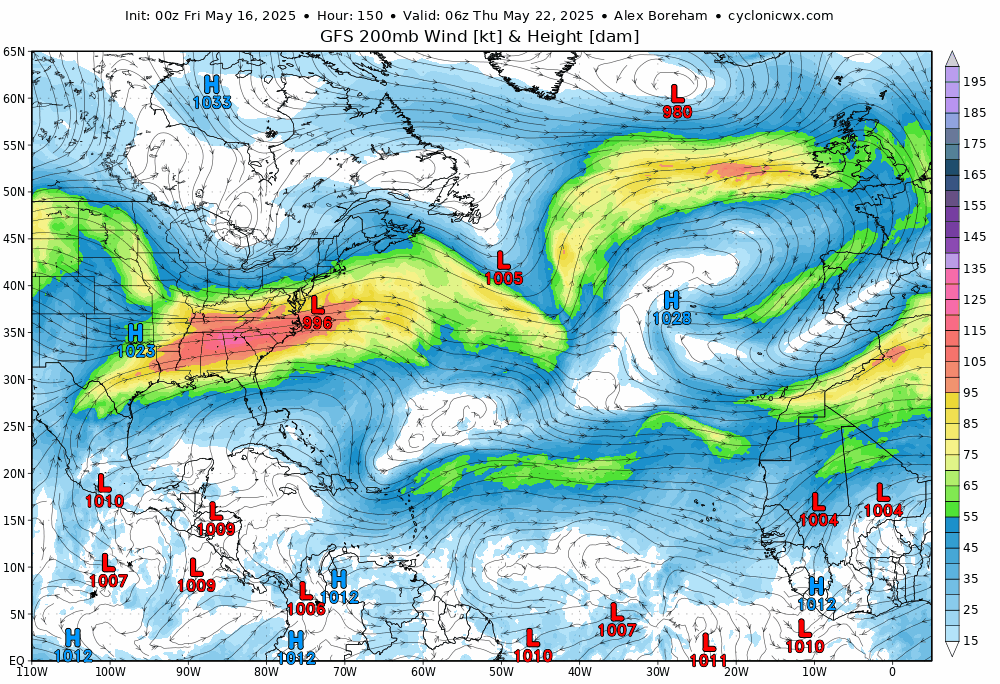
Jet stream pushes east across NW Europe through the BH Weekend, heralding more unsettled conditions
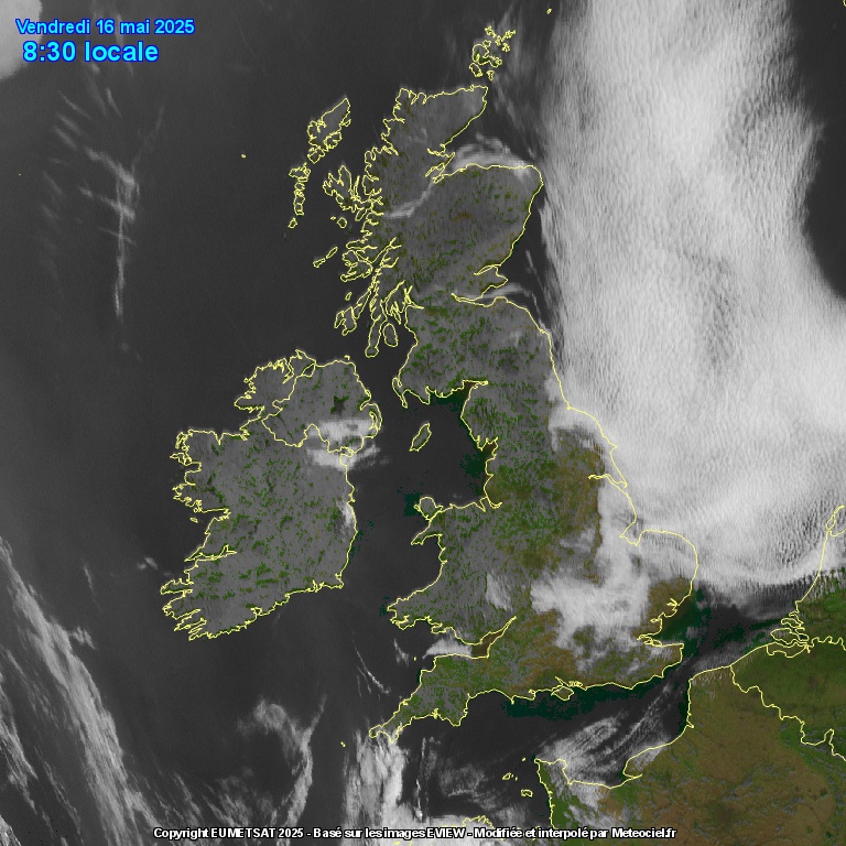
But before the change to unsettled conditions, although it will continue to be dry and settled over the next 6 days, it may not be sunny everywhere. Yesterday saw cloudy skies for much of the day across eastern England. This is because high pressure centred just north of Scotland has been feeding in a cool northerly breeze - bringing cloud off the North Sea. High pressure will tend to drift to be centred to the northwest of the UK over the weekend, so winds will turn northeasterly, so air a little less cold and perhaps cloud less likely to linger towards the east. Eastern areas may start cloudy in the coming days, but hopefully the cloud will burn back to the coasts more readily.
Cloud off the North Sea could plague eastern areas at times over the next few days, with an onshore breeze
Because of the breeze off the North Sea, eastern coasts will be cooler, highest temperatures will be across southern, central and western areas, where temperatures look to reach the low 20s Celsius over the next few days, perhaps mid 20s for sheltered areas in the south and west.
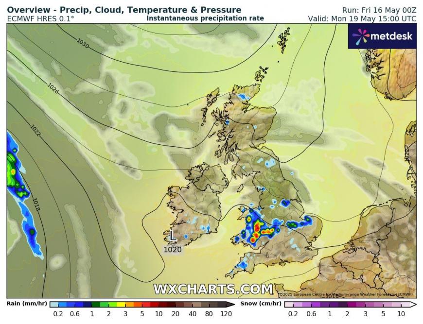
Early next week, an upper trough moving southeast from Scandinavia, as the high drifts to the northwest, could bring more in the way of cloud and some showers across parts England and Wales on Monday and Tuesday, but many will stay dry. Scotland and N. Ireland staying dry and sunny nearer high pressure.
Some showers possible in places early next week
Uncertainty grows from mid-week, but it looks like westerly jet stream pushing east across the North Atlantic will arrive across the UK later in the week, with low pressure moving in to the northwest on Thursday and a frontal system pushing east bringing rain to most areas, though heaviest in the north. Following, the GFS and GEM models show areas of low pressure moving in off the Atlantic, as a westerly jet stream establishes over northwest Europe, bringing further spells of rain or showers east across the UK through the Bank Holiday Weekend. Though hopefully some drier and sunnier spells in between the spells of rain and showers. The jet stream is signalled to shift south with time too, so lows tending track further south, with most rain across southern areas and cool everywhere too, being on the north side of the jet stream eventually.
00z ECMWF look particularly unsettled and windy through the Bank Holiday Weekend
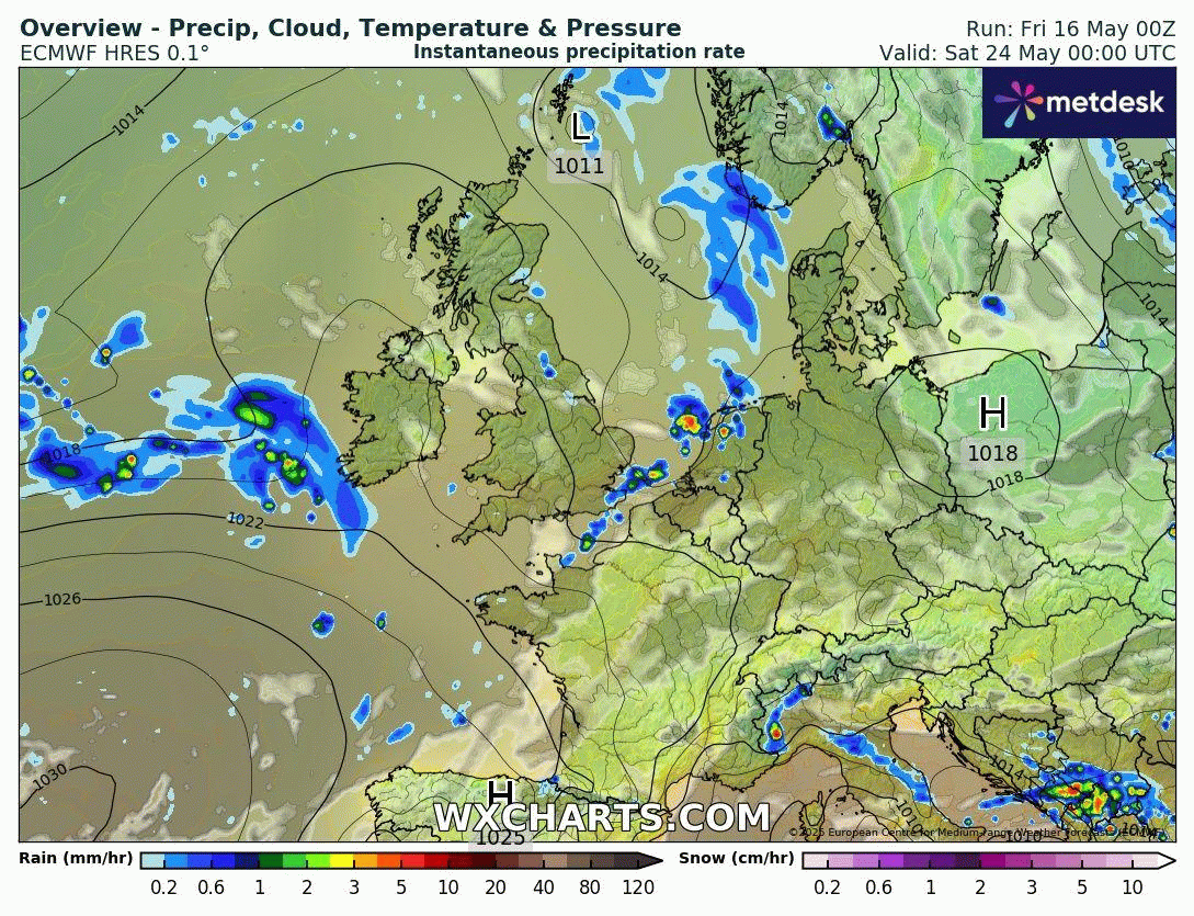
Extended model output suggests the unsettled conditions may last through to the end of the month too and perhaps into the start of June. But much less confidence on this for now.
Loading recent activity...