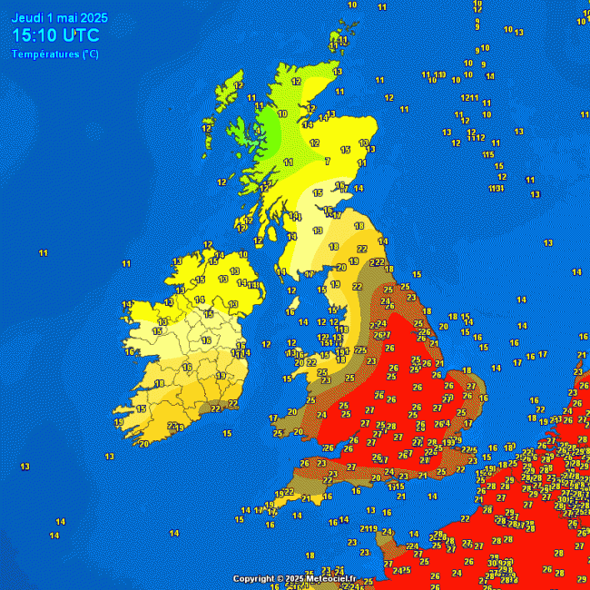
Wednesday's highest temperature of 26.7C recorded at Wisley in Surrey set a new date record for maximum temperature recorded in the UK for the 30th April. Today is even warmer and is the peak of the recent build of summer-like warmth or heat, with temperatures reaching 28C this afternoon at London Heathrow and Oxford, beating the previous date record for 1st May - which was 27.4C recorded at Lossiemouth (Moray) in 1990.
Update - Thursday 1st May 2025 Kew Gardens, London reached 29.3C
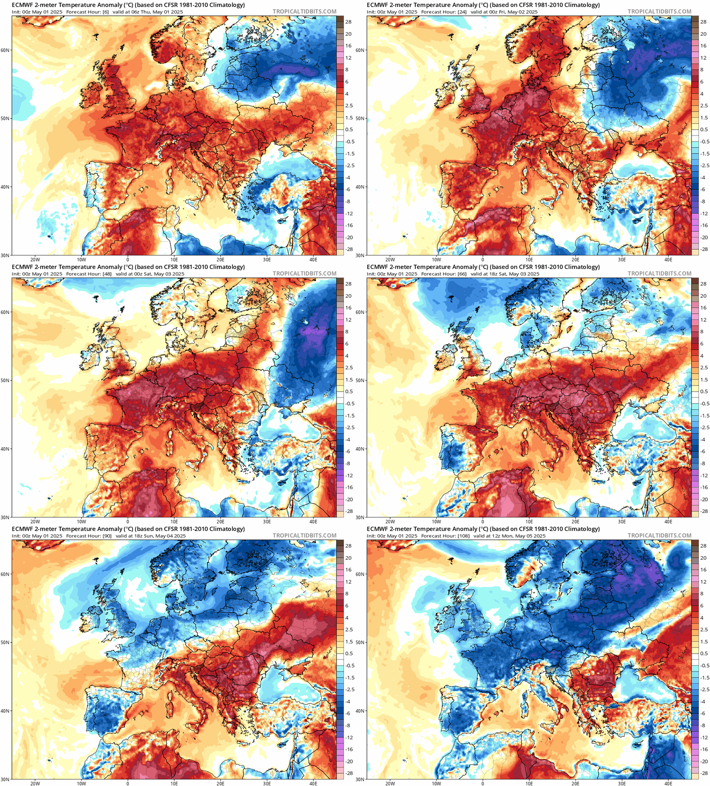
But, just as we are getting used to this very early taste of high summer temperatures more typical of July or August, it looks set to turn cooler over the Bank Holiday Weekend. Typical!
Cooler and fresher air on the way from the north over the Bank Holiday Weekend:
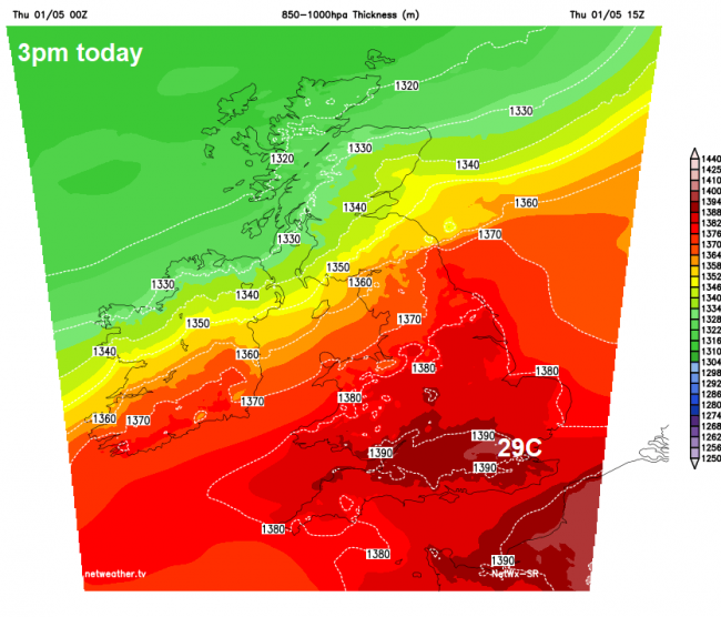
This week’s build of heat has come courtesy of a slack warm southeasterly flow off the near continent and a strong ridge of high pressure and associated subsidence generating higher air thicknesses, today seeing 850-1000hpa (partial) thicknesses around 139dam today in SE England, highest of the week, so temperatures peaking today.
850-1000 hPa thicknesses 3pm today, 139dam in SE England - indicating where highest temps will be:
Temperatures not as high on Friday, peaking in the mid-twenties Celsius across southern England, cooler further north, as cooler and fresher conditions move south behind a weak cold front moving south. Some warmth still hanging on across south Wales and southern England on Saturday, reaching the low twenties Celsius, but further north in the teens, low teens in the far north, as northerly winds feed in fresher and cooler air.
Cooler air, with low thicknesses, moving south over the weekend
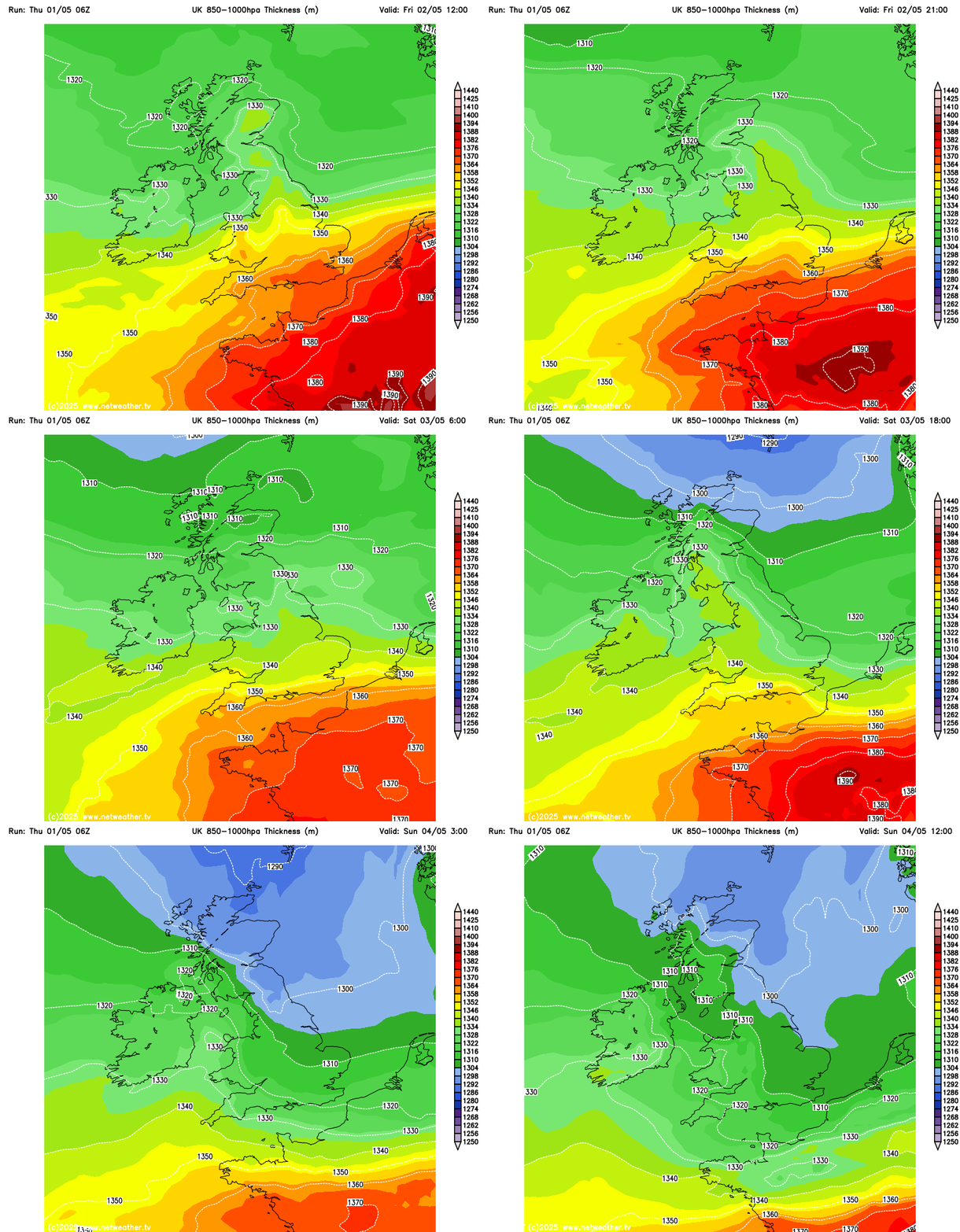
The cooler and fresher conditions moving down across central and northern areas will flood all parts on Sunday, with southern parts of Wales and England likely seeing a 10-14C drop in maximum temperatures on today’s values. Highs on Sunday reaching the mid-teens at best in the south, low teens in the north - in a brisk northeasterly breeze, perhaps only high single digits at best along North Sea coasts of Scotland and NE England.
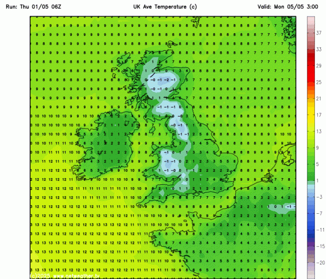
There could even be a rural frost across inland parts of Scotland, northern and western England, Wales and Northern Ireland Sunday night. Bank Holiday Monday is looking cooler still for all parts of the UK, highs currently forecast to reach 12-15C at best, cooler along North Sea coasts - thanks to the northeasterly breeze, which will be strongest here.
Turning colder air night from Sunday
The good news is, is that it’s looking mostly dry from tomorrow through the Bank Holiday Weekend, but it won’t be wall-to-wall sunshine like recent days, with variable cloud and some sunny spells, thicker cloud towards North Sea coasts could produce a few mainly light showers towards eastern England though. Also, there is small risk of some heavy, perhaps thundery, showery rain moving in across the far south of England on Saturday, before retreating back south, but low confidence on this.
Looking further ahead and any earlier signs over recent days of more unsettled conditions developing next week seem to have vanished on recent model runs, with the general consensus for a high pressure system to dominate out weather centred to the west out to mid-month. This does mean a cooler spell for all, with the flow from the north or northeast, but it will stay mostly dry and settled, with little or no rain for many parts of the UK, away from NW Scotland on the latest ECMWF run.
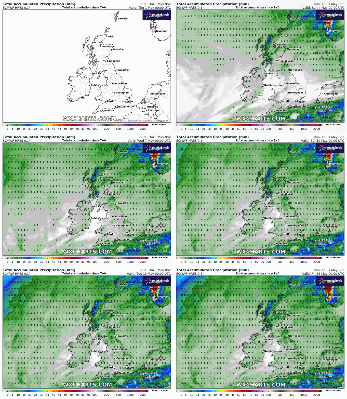
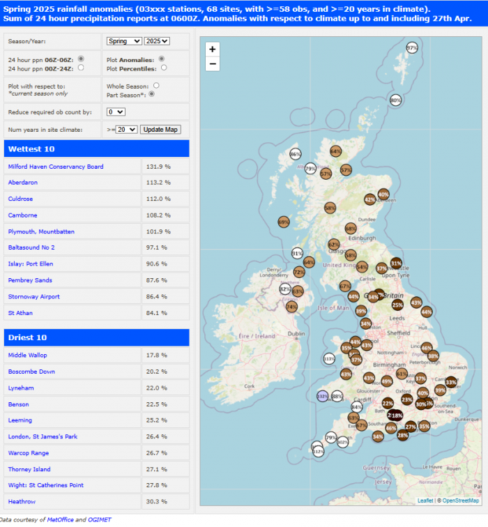
If this is the case of being mostly dry until mid-month and high pressure continues to dominate for the rest of the month, then we could be looking at a very dry spring for many parts of the UK, most acute across NE England. Parts of Yorkshire have seen the driest combined February, March and April for almost 90 years. Just 78mm (3 inches) of rainfall has been recorded at Sheffield's Weston Park weather station since the start of February - the lowest since 1938. The average rainfall for this period is around 184mm (7 inches).
The maps below, from Starling Roost Weather, show the deficit in rainfall across large parts of the UK this Spring so far - up to the 28th April. Central southern England seeing the lowest, as low as 18% the average rainfall and parts of Yorkshire 25% the average.
Loading recent activity...