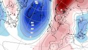
This week will be very warm with temperatures in the day rising widely into the high teens, low twenties on Tuesday and much milder nights. By Wednesday, more parts of England will be heating up to the mid-20sC. Thursday looks hotter still with temperatures increasing to 27 or 28C, perhaps even higher.
However, there will be a change from the north and that will affect where manages to hold onto this burst of spring warmth and there is some uncertainty around the timing of this. The outlook for the Bank Holiday weekend is back to normal and will feel more like how it felt last week.
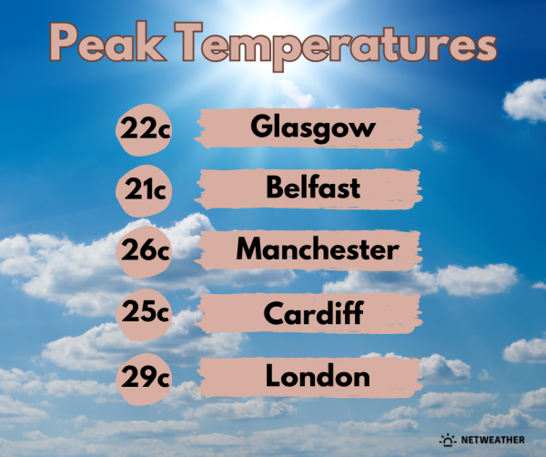
England will see real warmth developing this week 17 to 25 on Tuesday with an easterly breeze for the Thames estuary. Wednesday will feel very warm with hardly any breeze and plenty of sunshine, with temperatures around 19 to 26C. Thursday will feel very warm and also humid with temperatures from 21C for Devon and Cumbria but 24 to 28C for many parts of England, even up to 29C in Greater London or the Home Counties.
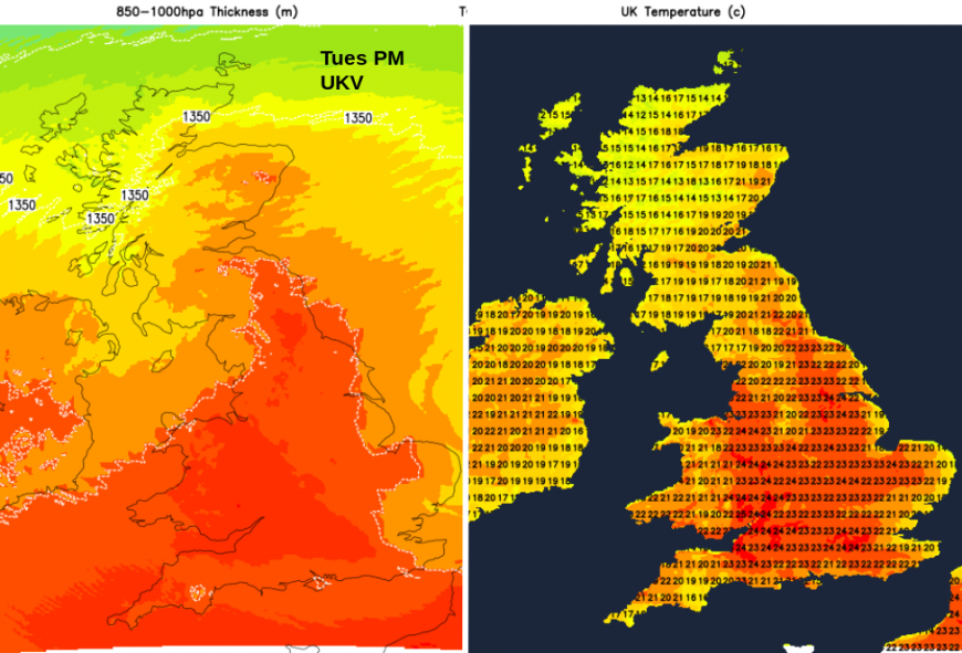
Wales Tuesday 18 to 22C with hardly any breeze and more areas moving into the low 20sC by Wednesday, a few reaching 25C. Very warm and feeling humid by Thursday with 21 to 26C.
Northern Ireland Tuesday 18 to 20C with hardly any breeze, Wednesday will be the warmest day with more areas reaching 21C (70F). Still warm for Belfast on Thursday at 19C but cooler in the north.
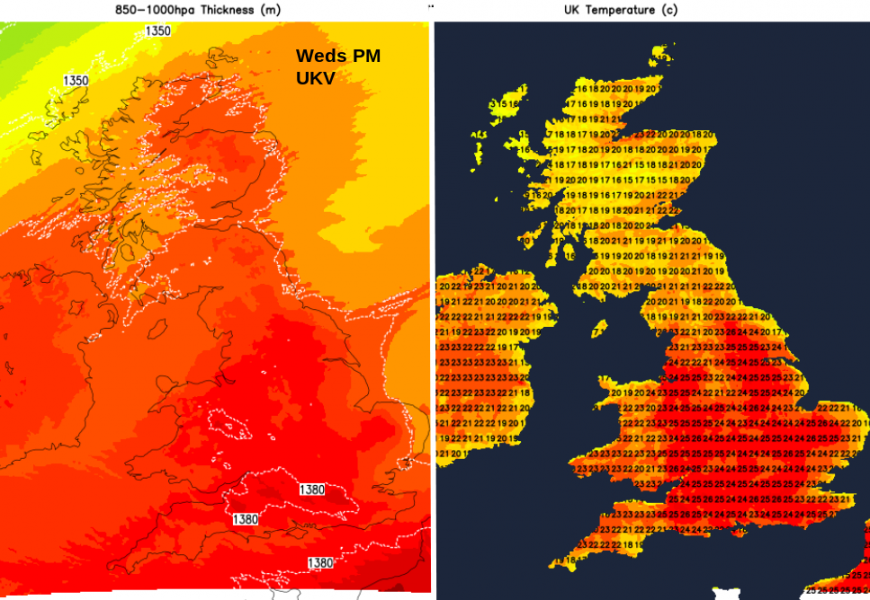
Scotland A W/SW breeze for the west coast on Tuesday and hazy high cloud. Wednesday will be the peak of the heat with many areas reaching 17 to 21C, even 22C in the east with a few spots along the Moray coast up to 23C. Later the SW wind will freshen as the cold front approaches from the northwest. Still warm for the Central Belt and southern Scotland on Thursday Edinburgh at 21C but cooler from the northwest.
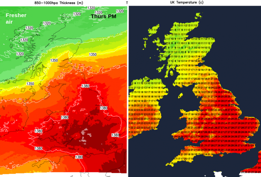
To qualify for an official heatwave you would be looking for temperatures widely above certain thresholds which vary by county across the UK “when a location records a period of at least three consecutive days with daily maximum temperatures meeting or exceeding the heatwave temperature threshold.” A few individual locations might technically reach these thresholds on Wednesday, Thursday, Friday but this is just a very warm spell with temperatures well above the seasonal average.
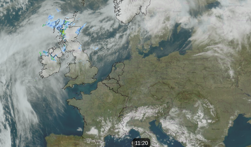
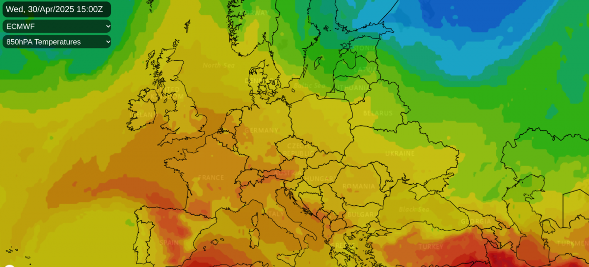
There is a large area of high pressure over mainland Europe with clear skies and sunshine. Around the western flank of the high, much warmer air is being pulled our way from north Africa, over Spain and France. That heat looks set to last into the weekend for southern Europe whereas we begin to see a cooler flow from the North Sea by Bank Holiday Monday.
With high pressure nearby there isn’t much rain in the forecast this week but two features will disrupt the fine, warm and sunny picture after midweek. Northwestern Scotland has been wet with an Atlantic weather front lurking nearby. This will meander about near to the Northern Isles but it’s a cold front arriving from the northwest on Wednesday night which will bring the main change for Scotland, northern Egnland and Northern Ireland with fresher air from the west in the following days. There will be more cloud and a few showery bits by Thursday in the north.
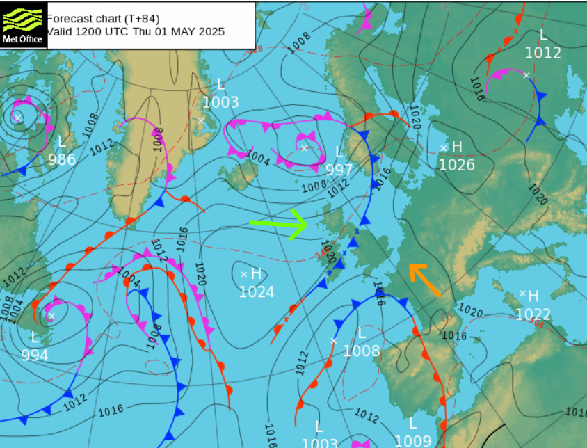
There is also another frontal system over the Bay of Biscay to watch. As this begins to influence our UK weather from the southwest on Thursday and Friday there could be a scattering of showers for Wales and England. Most places will remain dry but there could be a few sharp downpours, even elevated thunderstorms with hail.
The theme this week is building warmth; peaking on Wednesday in the north of the UK but intensifying for England and Wales on Thursday. Uncertainty though, about how long it will manage to hold on for southern England although the Bank Holiday weekend looks fresher.
Loading recent activity...