After a sunny start to April following a dry March, a change to cooler, wetter weather gets underway this weekend. This update covers the forecast, Easter outlook, and recent severe weather impacting parts of China.
For most of the UK, April began exceptionally sunny, with some locations nearing their average sunshine total for the entire month within the first 11 days. This follows a dry March that was also notably sunny for many areas—the sunniest on record in some regions. Consequently, issues such as parched ground, low river flows, and wildfires have arisen. Southern and eastern Scotland are forecast to be especially at risk from wildfires this weekend, with one currently blazing near Glasgow.
However, a change is imminent. Low pressure moving in from the west today (Saturday) and tomorrow will bring cooler, more changeable conditions. While most areas won't see significant rainfall until Tuesday, expect sunny intervals mixed with scattered "April showers" instead of constant sunshine. This pattern maintains a relatively high wildfire risk in southern and eastern Scotland. From Wednesday onwards, the potential for very wet weather increases.
Ironically, this year's late Easter appears poorly timed for outdoor activities across most of the UK. Low pressure is forecast near the south for much of the weekend, bringing periods of rain. Easterly winds will also draw cloud into eastern Britain.
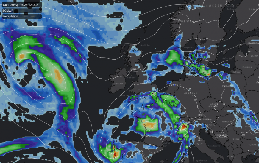
While many previous weekends this year, likely including this one, have been largely sunny and dry, Easter weekend is unlikely to follow suit for most. However, western and particularly northwestern Scotland may remain predominantly sunny and dry, sheltered from the easterly cloud and positioned away from the main rain belts tracking further south due to the jet stream's path.
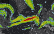
Meanwhile, a deep depression over parts of China is causing unseasonably strong winds. This system involves cold Arctic air on its western side and warm, moist southwesterly winds on its eastern flank. Beijing experienced strong winds on Friday and issued a rare orange alert for this weekend. Consequently, many flights and trains in northern China, including around Beijing, have been cancelled, and some tourist attractions and sporting events are closed. Reports suggest these winds could break April records dating back to 1951.
As of Saturday morning (April 12th), reports indicate toppled trees and vehicle damage, but fortunately, no injuries have been reported. The low-pressure system responsible is forecast to move eastward and weaken in the coming days, reducing the risk of strong, damaging winds after the weekend.
Returning to the British Isles, despite the shift towards dominant low pressure, damaging winds are unlikely in the near future. A key question is whether the upcoming cloudier, wetter spell is merely a temporary interruption or the start of a longer-term shift towards unsettled conditions for the remainder of April and potentially the spring.
While some earlier forecast models suggested a quick return to high pressure, it now seems probable that the cloudier, wetter weather will persist through Easter and beyond. However, there are indications that high pressure north of Britain might extend southeastward towards the UK during the last week of April, potentially bringing drier conditions. Even if high pressure returns, significant sunshine isn't guaranteed. Due to the UK's maritime location, the precise positioning of high pressure is crucial for delivering the kind of widespread sunshine seen earlier this month.
Despite the upcoming unsettled period, April is still likely to finish much sunnier than average for most areas. Given the sunshine accumulated so far, some places would need almost no further sunshine for the rest of the month just to reach average levels – an unlikely scenario even with dominant low pressure. While prolonged cloud cover associated with the low pressure could make April less exceptionally sunny than March overall, a fair amount of sunshine is still expected for most until Tuesday.
Loading recent activity...