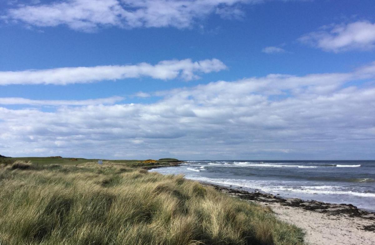
The UK has seen settled, often sunny, even warm weather for much of April. March was dry and sunny, and this recent weather continues with a lack of rainfall. The weekend looks fine for most, but there will be some changes. Atlantic weather fronts from the northwest will bring colder air on Sunday. Also worth watching will be outbreaks of rain from the southwest, linked to unsettled weather over Portugal and Spain. These should arrive later on Saturday, clearing eastwards early on Sunday.
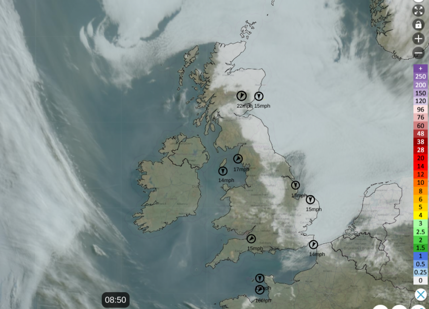 Satellite imagery on Netweather Extra Radar showing a blanket of low cloud (haar, seafret) over the North Sea and parts of eastern Britain early on Wednesday. Highest wind speeds also shown with clear skies and so sunshine further west.
There has been low cloud off the North Sea and a cold breeze here but otherwise the UK has seen a run of fine weather. School holiday weeks seem to vary a lot this year, with parts of the UK already broken up and benefiting from the sunshine and warmth. For others, you will be wondering, will it last into next week, even for the Easter weekend?
Belfast will change from 19C down to 11C on Sunday and for next week. Cardiff could reach 19 or 20C by Saturday but only 14C on Sunday. East coast Aberdeen has been chilly but will leap up to 20C tomorrow then down to 10C on Sunday with mention of wintry showers over the Scottish mountains for the start of the new week. London should reach the low twenties Celsius by Saturday in the sunshine but will dip to the mid-teens next week.
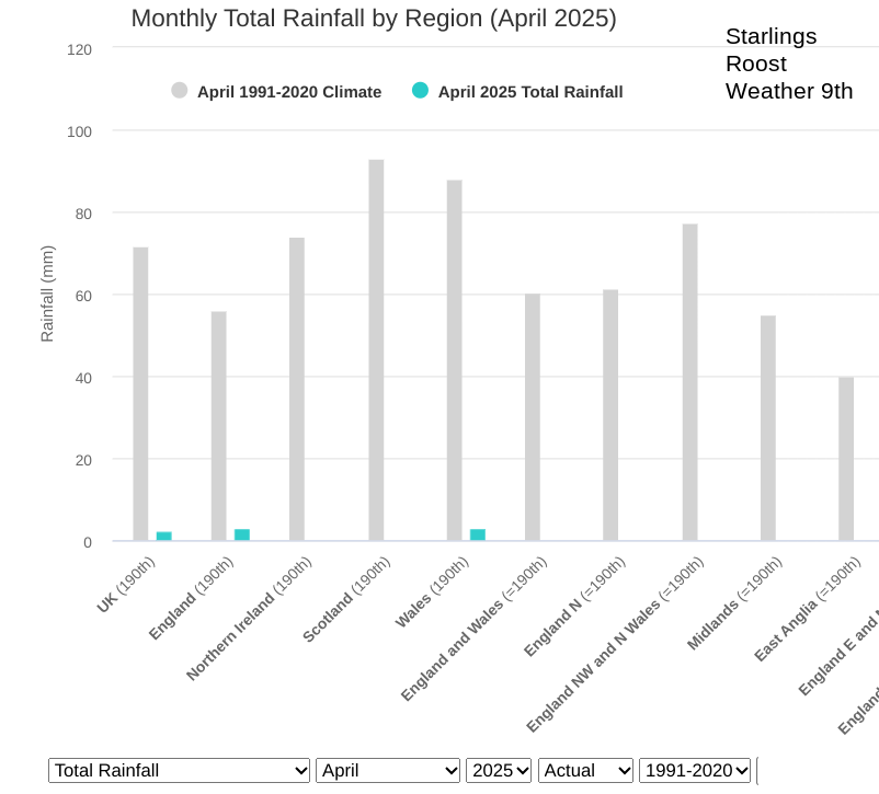
Nobody will want the kids stuck inside at holiday time with lashing wind and rain but it has been dry for a good while. The graph shows rainfall data so far this month, against the usual monthly totals. There has been very little rain and the risk of wildfires is still very high.
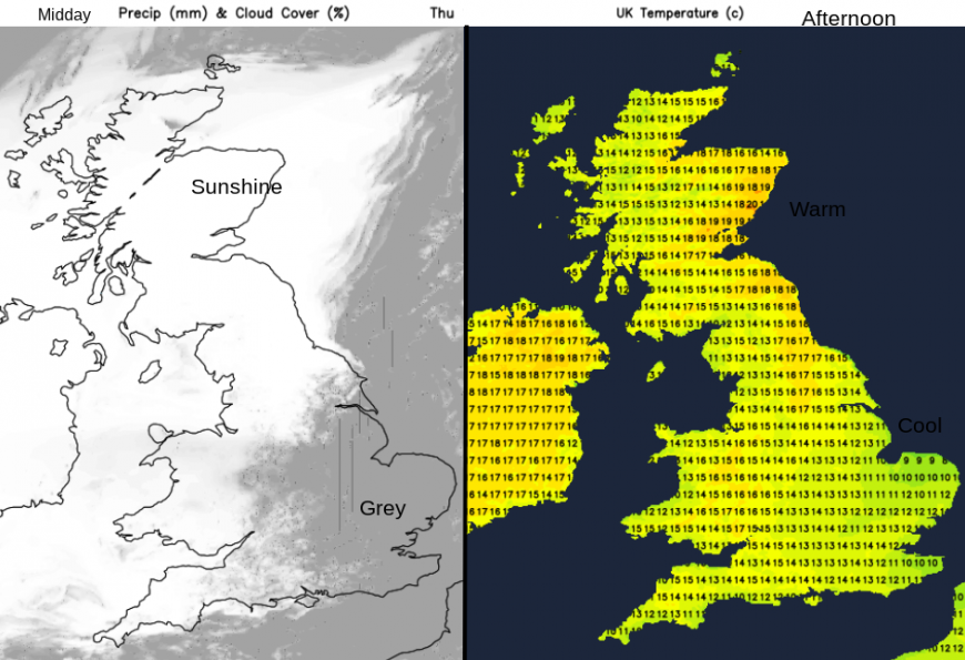
A slight change begins on Thursday with a westerly flow over Scotland, which will keep the haar and seafret offshore for eastern Scotland and northeastern England, finally. Here temperatures will respond in the sunshine and to the lee of high ground. 19 or 20C finally, after many days of only 8C along the east coast. Friday looks pleasantly warm for much of the UK in the high teens even 20 or 21C, although there will be early fog for southern England and perhaps for NW England along the M6.
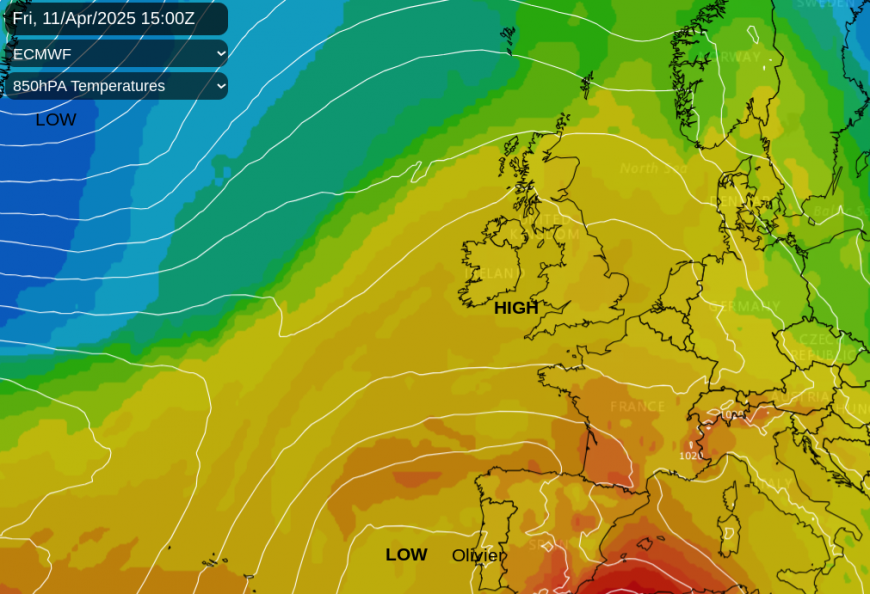
On Friday and Saturday, cold fronts appear from the northwest and it will be cooler for the NW Highlands. The fronts falter and slow as they come up against the resident high pressure. The westerly wind will continue on Friday with high cloud reaching mainland Scotland as frontal rain gets to the Western and Northern Isles for the end of the working week.
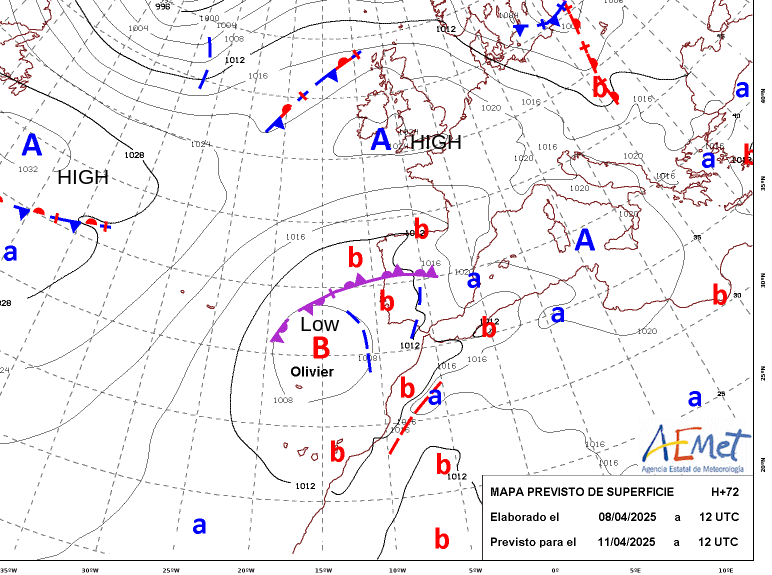
Another change will approach from the southwest. Spain and Portugal have seen miserable weather in recent weeks with a progression of low pressures bringing wet and windy weather. Storm 'Olivier' has just been named for Madeira and the Canary Islands with more rain reaching mainland Spain on Friday and Saturday. The looping jetstream has directed low pressures further south as our high pressure has acted as a deflecting shield. Our storm naming group is only up to E for Eowyn. The southwestern naming group, which includes Spain and Portugal has reached O for Olivier, there aren’t many names left before the end of August.
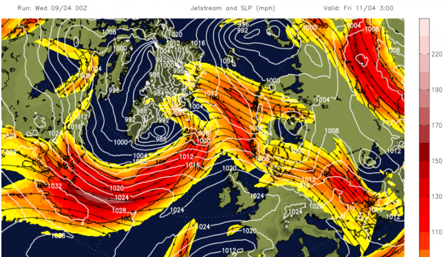
A brief, more zonal, jet tries to take aim at the UK for the end of this week and helps to disrupt the existing settled pattern. The northwestern fronts will make progress across the UK during Sunday.
A small low centre linked to Olivier will form in the Bay of Biscay and surge up towards Britain, bringing outbreaks of proper rain at some point this weekend. It’s not for everyone and the models vary. Whilst this pushes northwards over England, the fronts from the northwest will begin to push across the UK to the North Sea. As these two areas collide, it leaves Sunday more unsettled with areas of cloud and potentially early outbreaks of rain, followed by a peppering of showers.
The variations from the models relate to when the rain will reach southern Britain on Saturday. Saturday afternoon or evening or not amounting to much at all?
It is difficult to pinpoint where will see rain later on Saturday and even Sunday, but the risk of rain will be higher by then.
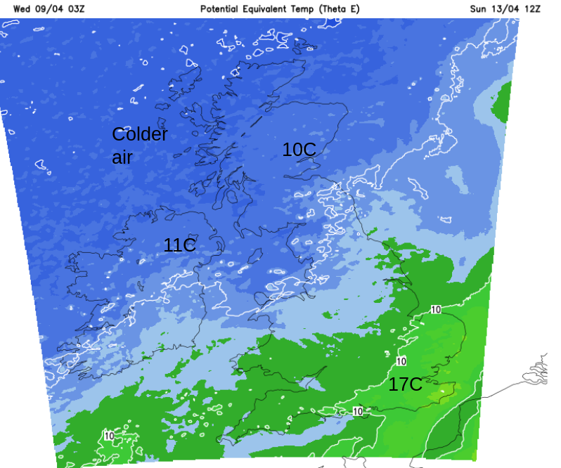
The main area of rain from the southwest looks to move across England on Saturday night and leave Sunday as a bright, breezy and showery day. The northwestern half of the UK will feel cooler with a real nip in the air but still with strong sunshine. There will be a scattering of sharp rain showers, also hail, even thunder. The southeastern half will have a fair day with pleasant sunny spells. Depending on the cloud cover, it might not have quite the warmth of Saturday.
Overall, there will be a good deal of fine, dry weather about this weekend but turning unsettled for Saturday night followed by cooler air from the northwest by Sunday.
Loading recent activity...