After weeks of high pressure generally in control with dry and settled conditions, a change is on the way from the weekend with unsettled conditions taking over - but will it last through to Easter?
Much of the UK has been blessed by days and days of sunshine this spring, it was the sunniest March on record for England, while April has started on a similar sunny theme. It has been very dry though and with the sunshine drying out the ground and vegetation, there is an increasing risk of wildfires. There’s already been fires breaking out over heathland and moorland, at the moment a wildfire has been ravaging large areas of the Galloway Forest Park in southwest Scotland.
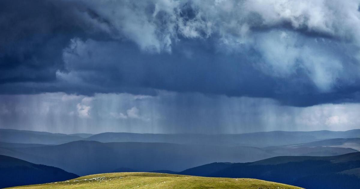
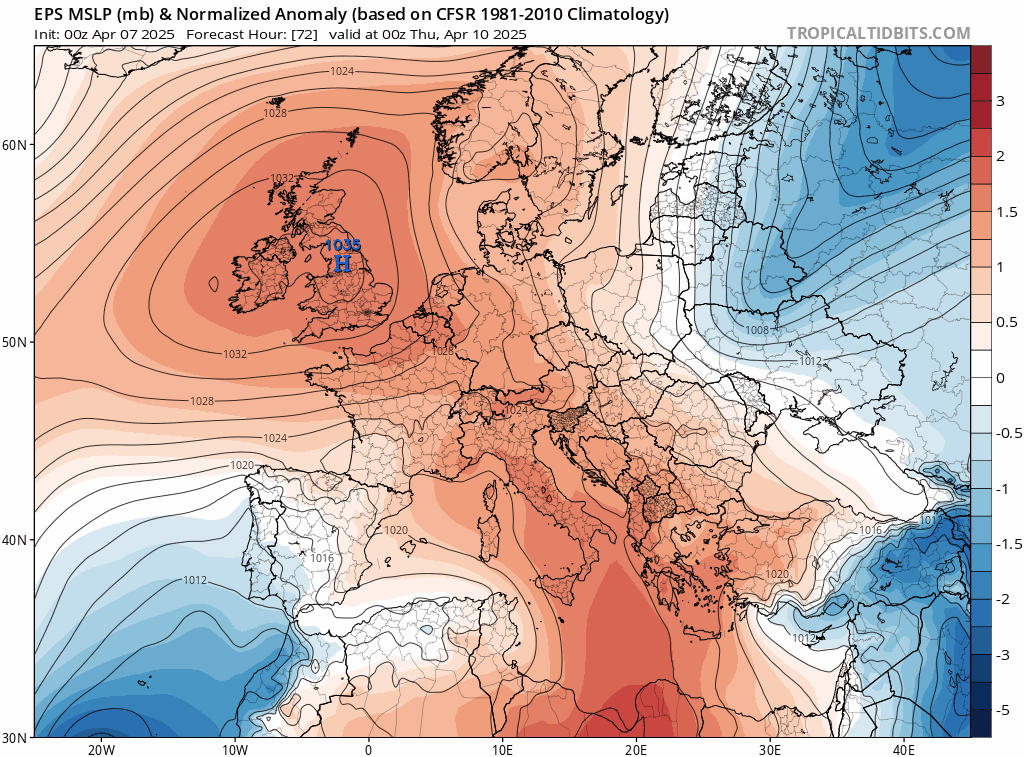
Most of the UK will see another dry and settled week with plenty more sunshine, but there are finally signs of a breakdown in the settled conditions that have prevailed for weeks as we head into the third week of April and in the run up to Easter. High pressure will give way to low pressure moving in from the southwest at the weekend, bringing outbreaks of rain to most parts and low pressure looks to stay close to the west through next week, continuing the unsettled conditions.
A change on the way this weekend as an omega block is shunted away and replaced by low pressure
It was a sunny weekend for many, though with a chilly breeze, thanks to cold air from Scandinavia crossing a still chilly North Sea. This week looks to remain dry and settled for all, with high pressure in control bringing, with plenty more sunshine for many.
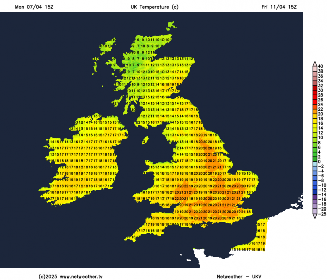
The chilly easterly breeze should ease early this week, as high pressure to the north of the UK sinks south across the country, bringing lighter winds. So temperatures will respond and will become increasingly warmer by day through the week. Temperatures will reach the low to mid teens early on this week, highest in the west, before reaching the high teens later in the week, perhaps 20-21C on Thursday and Friday across the south.
Warming up this week, low 20s Celsius on Friday
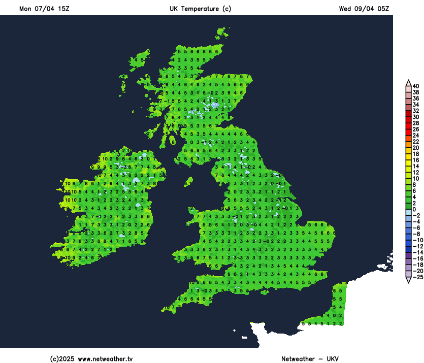
But gardeners beware, the air is dry - which means the nights will be chilly, with a risk of frost at night, quite widely inland. Though by the end of the week, the risk of frost should be more isolated.
Risk of frost at night this week
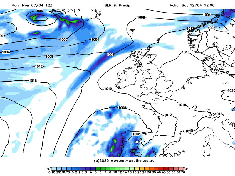
Next weekend will see the start of a change to more unsettled conditions that may continue through the Easter Weekend. Low pressure system centred just west of Portugal on Friday looks to drift northeast towards NW Europe over the weekend, though there is some uncertainty over track for now. But there is potential for cloudier skies with outbreaks of rain to spread northeast across parts of England and Wales over the weekend, perhaps Scotland and Ireland too, depending on the track of the low. But there should be some drier weather with some sunny spells around too, especially on Saturday, cloudier with greatest chance of rain on Sunday.
Change to more unsettled conditions from the weekend and through early next week
Into next week and the run up to Easter, more areas of low pressure look to move in from the west or southwest, as an upper trough becomes established and amplifies southward close to the west of Europe. So the weather looks to remain unsettled next week and possibly into the Easter Weekend, with spells of rain or showers, but also some dry and sunny spells in between. Temperatures look to be above average though, reaching the mid-teens, perhaps higher if the flow is southerly and the sun comes out.
Signal for low pressure from ensemble means and clusters into the Easter Weekend, but may change for the better
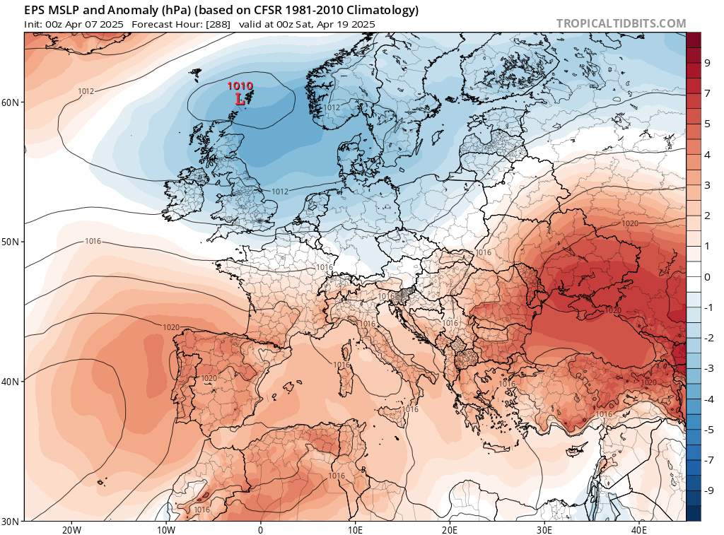
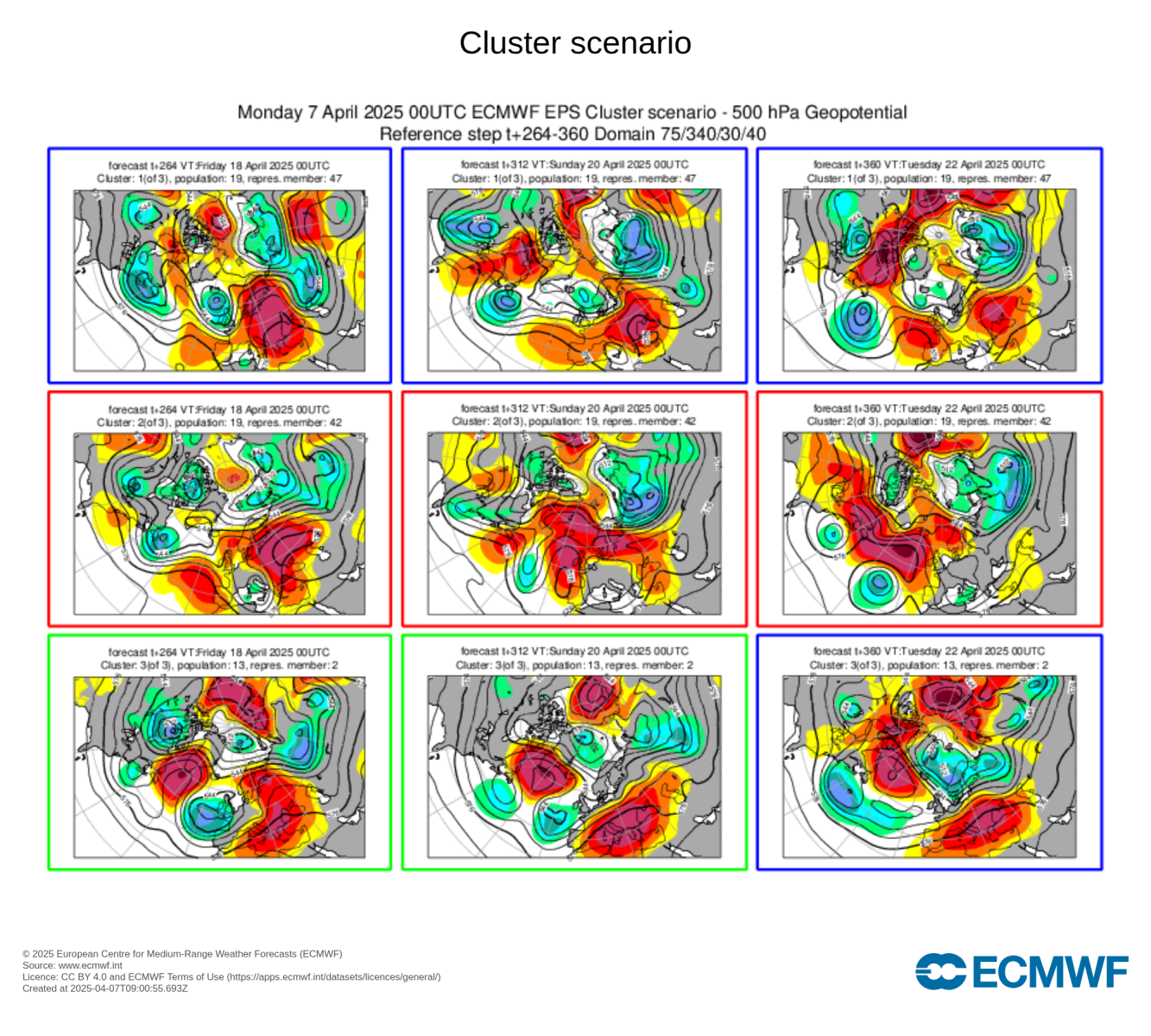
A look at the GFS and ECMWF ensemble means show an upper trough and low pressure in control of the weather over the Easter Weekend. However, there is a cluster of the ECMWF ensembles that represents 19 out of 51 members (over a third) that show high pressure, the other 2 clusters are more low pressure dominated. So low pressure is favoured for now to be in charge. But the Easter Weekend is still far enough away for weather patterns to change to more favourable conditions, but unlikely it will be wall-to-wall sunshine all weekend like we've seen over recent days.
Loading recent activity...