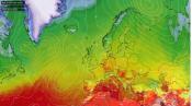
High-pressure influence is likely at the beginning of the month, bringing some dry days and perhaps warm temperatures by day and cool nights. But after around the 10-12th, it may turn more unsettled, then autumnal weather truly takes over by mid-month, with weather models predicting a high probability of low-pressure systems bringing spells of rain, perhaps heavy, and possibly wind storms from the Atlantic Ocean towards the UK late in the month. As a result, rainfall will eventually end up above average after a dry start.
Temperatures likely to be above the 1991-2020 long-term average. Rainfall more likely to be above average for the UK as a whole, though with some regional variations with rainfall greatest towards the south and west.
The wet weather starting in October likely continues in November. A persistent westerly flow will ensure a succession of lows bringing spells of rain along with generally gloomy, changeable weather. Potential for some deep lows, with named storms which will bring gales and heavy rain. Early wintry spells seem unlikely for the time being due to the dominant mild flow off the Atlantic.
Temperatures likely to be above the 1991-2020 long-term average. Rainfall more likely to be above average, with greatest departures in the north and west.
After a record-breaking warm and exceptionally dry summer, September has continued the warmer-than-average theme, with the UK average temperature some 1.8C above the 1991-2020 average, the Met Office Hadley Central England Temperature for September is currently running at 2.6C above the 1961-1990 average. Meanwhile, rainfall has been average across the UK as a whole, but with regional variations of being drier than average towards southern and eastern England and wetter towards the north and west.
The good news is that we are predicting a wetter-than-average autumn across the UK, but also warmer-than-average - thanks to anomalously warm oceans surrounding Europe after a record-breaking hot summer.
The September update of the ECMWF seasonal forecast points to an unsettled, wet but mild October and November.
The Super El Niño which is currently developing, will be one of the factors that influences our forecast. Some forecasts are predicting sea surface temperatures in the central and eastern Pacific reaching 4C above normal in December, which will make it the strongest El Niño ever recorded - this is likely to influence weather patterns around the world this autumn, including here in the UK.
We also look at the weather patterns that occurred in past autumns with a similarly strong El Nino, using reanalysis of pressure patterns in those years and making a composite of those autumn months.
Atlantic sea surface temperatures will also be analysed, as we think the marine heatwave of seas around Europe and also a ‘cold blob’ over the far northwest Atlantic may have some bearing on weather patterns through autumn.
According to the ECMWF sub seasonal forecasts recently, which are updated daily, high pressure looks to build and dominate through to the 12th, but thereafter low pressure looks to become more of an influence through to the end of the month.


For October and November, the ECMWF seasonal forecast suggests these two months will be dominated by low pressure, bringing sometimes wet and potentially stormy weather. We really need this after this dry summer. Looking at the pressure anomalies, we see a fairly low pressure over Northwest Europe, which would be associated with a succession of depressions off the Atlantic aimed towards the UK. Correspondingly, the precipitation charts show above average rainfall, anomaly greatest towards the southwest.


The general trend from seasonal models is for the autumn of 2026 to be milder and wetter than normal. After the record-warm and dry summer, the northeast Atlantic has anomalously high sea surface temperatures. Because warm seawater releases a lot of moisture and heats the air, an onshore wind will ensure relatively mild temperatures in the coming months but also provide extra fuel for heavy rainfalls.
The NOAA says there’s a 90% or greater chance we see a very strong El Niño between September 2026 and January 2027. As of 31st August, sea surface temperatures (SSTs) are above average across the central and eastern Pacific Ocean.

A very strong 2026 El Niño is intensifying, with Niño 3.4 hitting +3.0°C (mid-Sept) and subsurface heat surging. All 22 forecast models agree it will strengthen further, staying “very strong” through winter 2026–27. El Niño probability is 100% through Feb 2027, dropping to 61% by mid-2027. Could rank among the strongest El Niño events on record. Some models suggest sea temperatures could potentially rise to about 4 °C above normal. There is also a high probability that El Niño will persist into early 2027. An El Niño usually brings higher global temperatures. The excess heat in the Pacific Ocean eventually enters the atmosphere. This causes warmer global temperatures. However, the rise in temperatures often has a lag time of a few months.
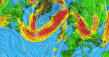
Although El Niño originates thousands of miles away from Europe, in the Pacific Ocean, the phenomenon can also influence our weather. Due to much warmer sea temperatures than normal of the central and eastern tropical Pacific typical of El Nino, the areas where many tropical showers and thunderstorms form change. Consequently, the major air circulation over the tropics also changes. This air movement is called the Walker circulation. These changes can subsequently influence major air currents and air pressure patterns around the world. These can travel over long distances. Ultimately, this can also cause the jet stream to change. The jet stream is important to us because it largely determines where disturbances, rain, and mild or cold air migrate. For North America this is fairly predictable. For Europe, this is much more difficult, as our weather is also strongly influenced by other factors, such as the North Atlantic jet stream, the sea surface temperatures of the Atlantic Ocean; the polar vortex and also the amount of sea ice around the North Pole. That is why El Niño can cause very different weather in Europe in different years.
For autumn, the situation is therefore somewhat more complicated. There is no simple rule that “El Niño automatically means a wet autumn.” - as many forecasts have been hinting at. However, with a strong El Niño, the jet stream in the subtropics can become stronger - which can be reflected in a strong jet stream over the North Atlantic. Current seasonal forecasts show that the influence of El Niño may become increasingly evident later in the autumn.
The historical picture of autumns in the past that featured a strong El Nino is a bit more mixed though. Which highlights the caveat to the general consensus made thus far that a strong El Nino doesn’t automatically mean a wet autumn throughout.
What is noticeable about years featuring a strong El Nino is the dominance of high pressure in both September and October and low pressure in November. The ECMWF seasonal forecast has a low pressure signal for October. However, as already mentioned, El Nino is not the only driver of weather patterns, so a forecast can’t be based on reanalysis of autumns with similar ENSO states as is forecast this autumn. Though recent model forecasts do suggest that early October could see high pressure influence before more low pressure influence takes over from mid-month or a little earlier.
Octobers and Novembers with a super El Nino developing


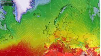
Atlantic surface temperatures are currently experiencing historic highs, while average global extra-polar sea surface temperatures are reaching a record-breaking 20.96°C. In early September 2026, the global average sea surface temperature hit 21.11°C, marking the warmest period since data collection began in 1979.

Widespread marine heatwaves are heavily affecting the oceans adjacent to Europe, with intense heat concentrated along the European Atlantic coast and the Western and central Mediterranean. Concurrently, scientists continue to track a persistent anomaly known as the "cold blob" south of Greenland—a localised cooling trend linked to the weakening of the Atlantic Meridional Overturning Circulation (AMOC) conveyor system. This cold blob has been linked to enhanced baroclinicity (low pressure development) over that area - which in turn promotes stronger ridging downstream over Europe in summer - with intensification of severe heatwaves over western Europe, as seen this summer. In the autumn and winter, should the cold blob persist - it could promote stronger North Atlantic SST gradients, enhancing baroclinicity and promoting cyclonic formation. So, the Atlantic SSTs could play their part along with El Nino - in driving a stormy weather pattern later in autumn, while the anomalously warm SSTs around southern UK, Bay of Biscay and North Sea will likely keep air temperatures this autumn elevated above normal.
The Atlantic Hurricane season has been unusually quiet so far and expected to remain so over the next 7 days or so. And so far, it's been the quietest Atlantic hurricane season on record in the Satellite era and beyond, thanks to strong wind shear typical of El Nino over the development area of tropical Atlantic - which hinders formation.
However, over the North Atlantic, the tropical storm or Hurricane risk could increase from October, as pulses of convection moving out of west Africa tap into largely untapped ocean warmth.
Later in autumn, sometime in October, the increasingly warm eastern tropical Pacific by then will likely strengthen the subtropical jet stream, leading to increased storminess across southern USA, with frequent storms along both the East and West Coasts — this storminess stretching to Europe too.
Stay upto date with the long range forecast throughout the year with the Month Ahead Forecast - Updated Every Monday.