The weekend brought warmth and sunshine with temperatures tipping past 19C on both days. Cumbria was very warm at the weekend, with the top UK temperature on Saturday recorded at Bridgefoot with 19.1C. Crosby, Merseyside on Sunday up to 19.7C as Cambridgeshire reached 19.5C and the western side of Greater London saw 19.3C.
The air quality has been poor in southeastern England today, with High air pollution recorded in five of DEFRA's monitoring regions; Eastern, South East, East Midlands, Greater London, Yorkshire & Humberside before 2pm. The warm, steady setup from the weekend allowed air pollution levels to build up and this has continued into Monday. Although many will miss the brief spring warmth in the southerly flow, this change to colder northerly air does mean that the air quality will improve.
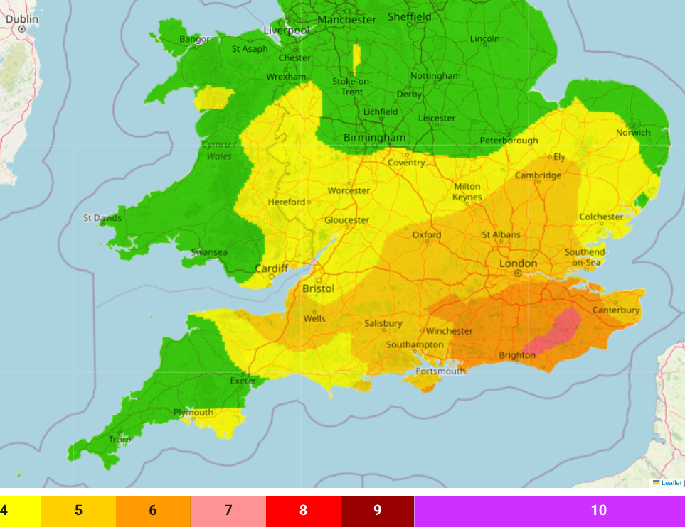
"Areas of Moderate air pollution are expected...perhaps locally High in the Southeast, with easterly winds having brought in continental European air which will help add to locally-generated sources of pollution here. In northern UK, more unsettled and breezier weather conditions will arrive and progressively introduce Arctic-sourced air, leading to mainly Low air pollution levels here. Tomorrow ...cleaner Arctic-sourced air across the UK." DEFRA
Everywhere you look there are headlines about it being the warmest day of the year so far. Well that’s what happens in spring. It was a lovely weekend with plenty of fine weather, sunshine and welcome warmth after the long winter. However, it soon felt nippy after dark, reminding us that it is still only early March. The much talked about shift back to cold air is beginning to take hold.
There were areas of thick fog, haar or sea fret on Sunday which made it feel chilly and damp. Often in valleys where it had been colder overnight and the air was still or over the cold sea near the coasts.

Today there is a brisk NW wind for Scotland accompanying the cold front from the north with cloud and rain. Clearer skies and sunshine follow in the far north. Across a central swathe of Britain there are lighter winds with sunshine for northern England and north Wales. Across southern Britain there is also more cloud, patchy rain linked to unsettled conditions over northern France, and a breeze from the northeast. Some parts of the West Country will see a damp start to the working week but gradually the cold front in the north will move right down through the UK allowing the cold Arctic air to reach all parts. Skies will clear with a frost in the north.
Tuesday
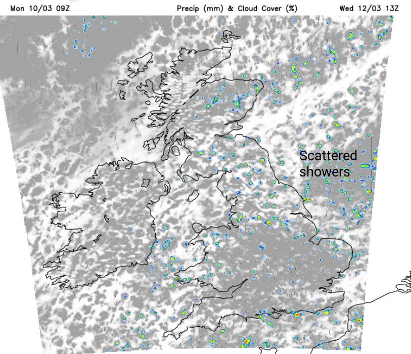
The south coast of England will have some early cloud cover but everything continues to move southwards. There will be plenty of sunshine, a colder start for many and a chilly northerly breeze. Although most of the UK will be dry and bright, there will be a scattering of showers for NE Britain in the morning and then over Scotland and Northern Ireland from the north through the day. These will turn wintry over the mountains. Temperatures will be around 6 to 9C. For most there will be a light breeze from the north but this will freshen in northern Scotland.

Showers appearing in the colder flow from the north/northeast
During Tuesday night, a scattering of showers will work down through the Midlands and there could be sleety bits and for the North Yorkshire Moors and the Welsh Mountains. Snow showers will fall over the Grampians and temperatures will widely fall down into single figures. There will be a low risk of ice for areas that have seen showers by day.
Wednesday
By Wednesday, no-one should be holding out hope of warmth, nor dressed in their weekend sunshine outfits. It will be a shocker for some by Wednesday morning. When heading to school or work, there could be a cold north/NE wind, and for a few regions, wintry showers with flurries of sleet, a bit of snow or icy rain. For most, it continues with the chilly fair weather and bright spells but with a few more showers over England by the afternoon. Temperatures will be around 7 or 8C and the nights will be chilly.
High pressure south of Greenland will quieten shower activity for Northern Ireland and ease the winds down through Thursday. Showers will continue to run down eastern Britain and the cold flow of air from the Arctic remains.
Loading recent activity...