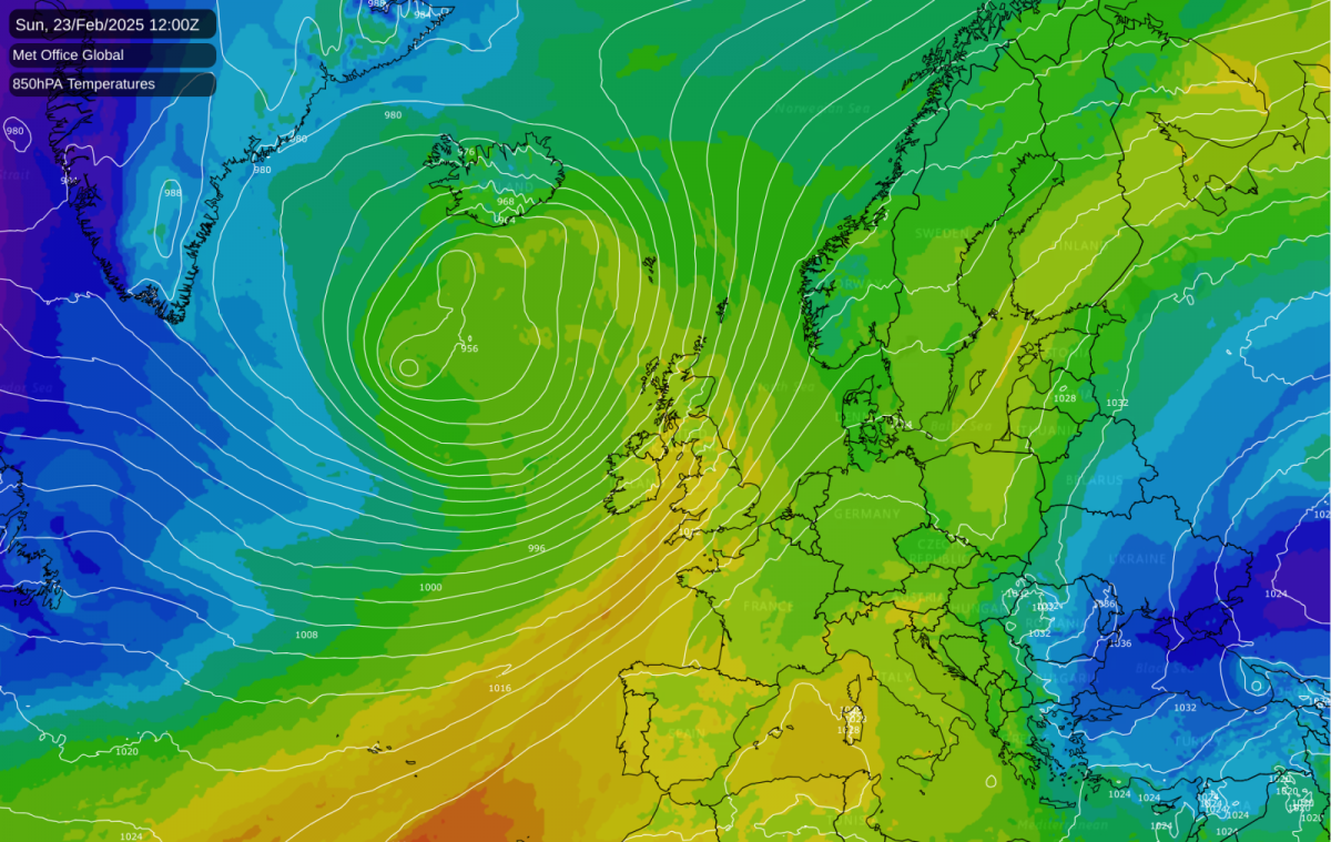
While persistent westerlies finally establish themselves across the British Isles, bringing milder conditions typical of a La Nina winter, this weather pattern arrives later than expected in the 2024/25 season.
The winter of 2024/25 has not followed the usual script of La Nina winters, where typically the weather is dominated by mild and changeable westerlies, especially late in the winter, while the Decembers typically feature a higher frequency of colder northerly and north-westerly winds. January 2025 was colder than recent averages and close to the old 1961-90 average, and although February 2025 looks set to be a mild month overall, there has been a prolonged spell around midmonth with a strong blocking high over and to the east of Greenland and Iceland. The last two days have seen unusually high temperatures for February, although not threatening the record February high of 21.2C set at Kew Gardens on 25 February 2019.
The anticipated mild and changeable west to south-westerly type is finally set to take hold around the British Isles, but later than most anticipated. Low pressure is forecast to become increasingly dominant to the north and north-west of Britain, bringing persistent westerly and south-westerly winds and frequent frontal systems from the North Atlantic. Although traditionally the prevailing westerlies often weaken during late winter and early spring, it is relatively common for westerly winds to dominate the early part of March in a La Nina year.
Although it will generally become wetter, sunshine totals are likely to pick up in many areas of the country, especially eastern counties, due to the mobile nature of the weather pattern and spells of brighter weather between the rain belts. However, it looks unlikely to prevent February from being a notably dull month in most parts of the country, in contrast to January, which was generally sunnier than average except in central southern and south-eastern England.
During the easterly spell that delivered little other than cold grey weather to Britain, there was an intense cold air outbreak over eastern Europe. As mild south-westerlies take hold in north-western Europe, that cold air mass has been heading into south-eastern Europe. In Greece, the resulting notable cold snap has been named Coral. Consequently, many media outlets have noted that much of Britain is warmer than much of Greece at present. The mild west to south-westerly type is forecast to gradually push into eastern Europe during next week, with high pressure developing over south-eastern Europe, pushing the cold air away to the east.
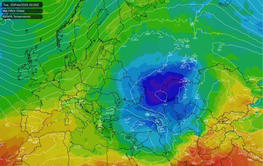
There is potential for snow in parts of south-eastern Europe during the early to middle part of next week as fronts come in from the North Atlantic and push against the cold air mass. Despite articles about south-eastern Europe seeing snow while Britain misses out, the long-term trend is for decreasing amounts of snow in south-eastern Europe, but snowy spells remain possible if the region picks up a sufficiently cold northerly or north-easterly.
The USA has had a very notable cold air outbreak during the past week, affecting most eastern and central parts of the United States. This is currently ending, and next week looks set to be predominantly mild over most of the USA. More cold air will likely accumulate over eastern Canada towards next weekend, which has potential to bring further cold air outbreaks into north-eastern America as we head into early March. It is currently uncertain whether the cold air will penetrate far south – it may not reach central eastern parts of the USA, but there is potential for this to happen in about 7-10 days' time.
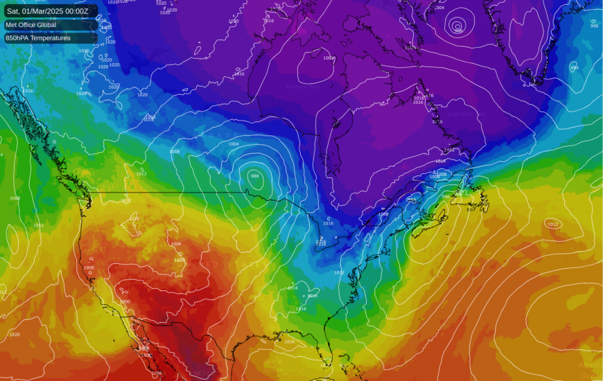
Readers might wonder why Britain's cold air outbreaks are often tame compared with those in eastern Europe or the USA. The main reason is that the British Isles are surrounded by seas which modify these cold air masses, and higher sea surface temperatures around Britain in recent winters have increased the extent to which cold air masses are neutralised. In many areas of Eurasia and North America, Arctic air masses can arrive without passing over any substantial expanses of sea, meaning they receive little modification and remain almost as cold in the affected regions as when they were building north of the Arctic Circle.
Although colder weather is likely to return to some extent in north-eastern North America, it is set to become much warmer than average in the western half of North America for the foreseeable future. Temperatures will widely exceed 10C in the southern half of the country and will widely reach the mid to high 20s Celsius in the south-west.
Loading recent activity...