February last was the warmest on record for England and Wales. However, this year is looking colder, at least average but perhaps below average, if it turns much colder from mid-month - as models increasingly suggest.
"As the days grow longer, the cold grows stronger” – this old weather lore is quite often proved right. Just as the mornings and evenings seem to be getting lighter, with thoughts of spring round the corner, the weather can still remind us it’s still winter late in February or bring a reminder of winter well into Spring. Long-term temperature records show that January is the coldest month of the year on average, followed by February, though across some western and southwestern coastal spots February is often colder. The seas surrounding the British Isles are at their coldest in late February and early March.
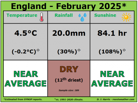
Last February was the warmest on record for England and Wales, while for the UK it was the second warmest on record. The average temperature in England was 7.5°C, topping the previous record of 7.0°C set in 1990. While Wales saw an average mean temperature at 6.9°C for the month, marginally ahead of 1998’s record of 6.8°C. In the CET series, Feb 2024 saw an average temperature of 7.8C, the second mildest on record, beaten only by 1779 (7.9C),
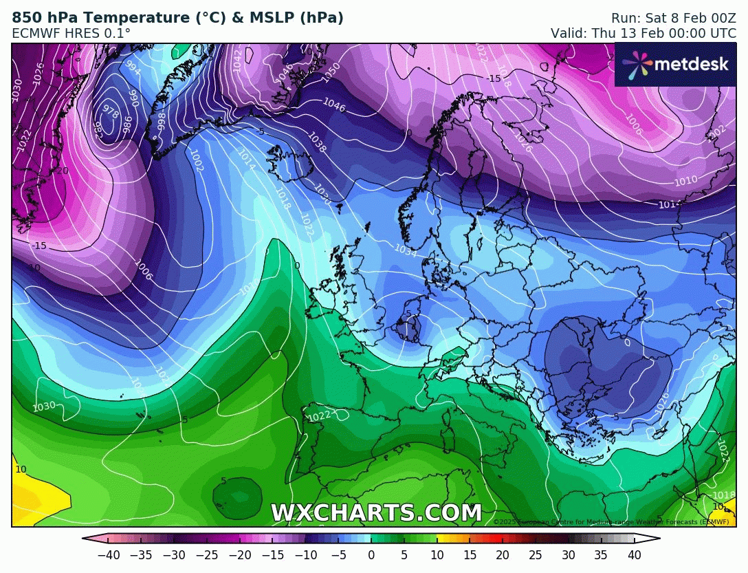
However, this February, looks like it won’t be anywhere near as warm as last February. Certainly, the first half of this month looks like it will wind up around average temperature wise for the UK overall, perhaps slightly below for England. High pressure over Scandinavia in the coming new week will continue to bring a chilly flow from the east or southeast through to mid-month.
Temperatures around or slightly below average over the UK through to mid-month (next weekend)
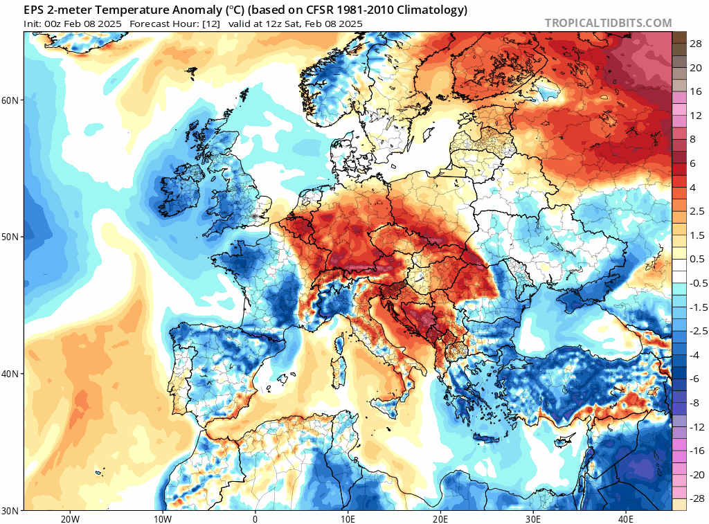
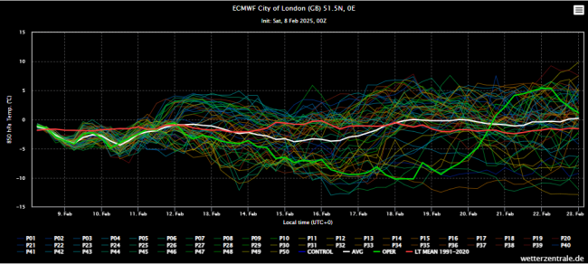
Currently there appears to be a 50:50 split on EC & GFS ensembles for next weekend between tapping into a very cold easterly flow aka Beast from the East, bringing increased risk of snow, or Atlantic low pressure taking over with milder air and rain. It's hard to call which way the pendulum swings, though there has been an increase in ensemble members going very cold on most recent runs.
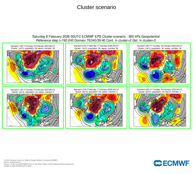
The potential for much colder air comes about from the Scandinavian ridge migrating northwest towards Greenland. This allows very cold arctic air dropping south on the east side of Scandi high over Scandinavia and NW Russia to go under the high drifting NW and on towards NW Europe, including the UK. But at the same time, Atlantic trough/low pressure tries to push in from the southwest. Which will win is the BIG question! Could be some battelground snowfall before either mild or very cold airmass wins out.
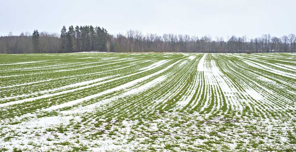
February has been the one winter month in recent years that has mostly been above average temperature-wise and we have to go back to 2018 for the last below-average February. That month saw the infamous Beast from the East arrive later that month – which really pulled down the average temperature for the month. Maximum temperatures on the 28th February and 1st March were widely below freezing, with only a few locations that saw temperatures creep above freezing on either day - even St Mary’s (Isles of Scilly) recorded a maximum of only +0.8˚C on the 28th February. On the 1st March, a new UK national low maximum temperature record of -4.7˚C was set at Tredegar, south Wales.
A year later, late February 2019 saw the other end of the temperature spectrum for late February. Although it was not a record-breakingly mild month on average, it was very mild overall and there were some exceptionally warm and sunny days late in the month. February maximum temperature records were broken in England, Wales and Scotland. On the 21st, Scotland's record maximum (since 1897) was broken, with 18.3C recorded at Aboyne (Aberdeenshire). On Tuesday 26th the thermometer reached an exceptional 21.2C at Kew Gardens in London, a new UK record maximum for February, while 20.8C was recorded in Porthmadog (Wales).
At the other end of the scale, one of the coldest February’s of the 20th century was 1986, with a Central England Temperature of -1.1C CET second coldest February after 1947 – which had a CET of -1.9C CET. The usual Atlantic systems that dominate UK weather were completely blocked by a high centred over northwest Russia, which brought some very cold air from the east. Winds were easterly for 23 days.
If we see the very cold air arrive from the east and northeast from next weekend, as half the ensembles suggest, then the February average temperature could end up below average, though this depends on how long the very cold air establishes. Maybe a few days, could be longer. But if turns milder, from next weekend, we may February temperatures turn out close to the average in the end.
Loading recent activity...