As what still remains of ex-storm 'Herminia' now in the North Sea continues to weaken and pressure rises strongly from the South West through Thursday, most parts can look forward to some sunshine tomorrow.
For the remainder of Wednesday afternoon, many will notice an improvement, but Northern Ireland and the North and East of Scotland in particular will see showers that will be wintry on hills. Elsewhere you have a better chance of it staying dry with sunny intervals, but there will be a few showers dotted about and some cloud occasionally.
We also have this afternoon the added complication of a depression heading for the Bay of Biscay that has already brought some rain to the far South West and the Channel Islands, where gales are likely for a while. Parts of southern England, mainly towards the coast, will also see some rain that will be spreading to Sussex and Kent later.
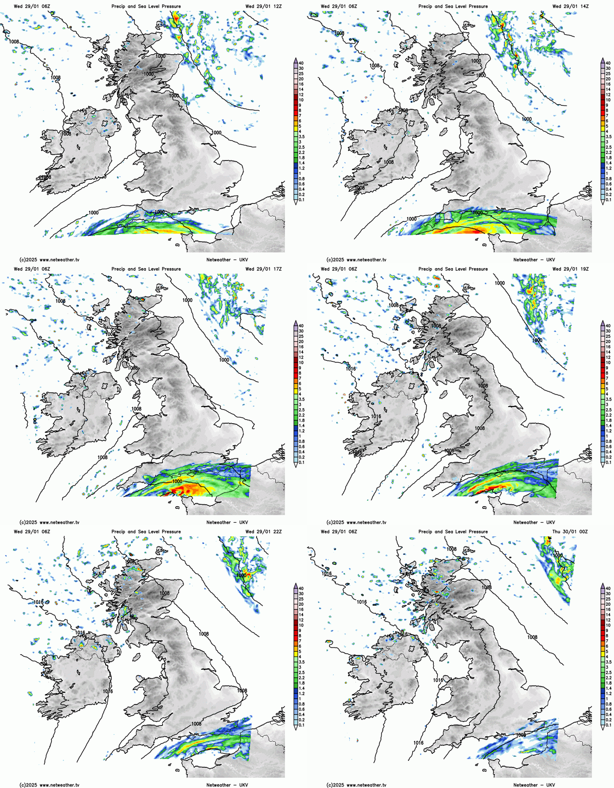
Top temperatures 4 or 5C in the North to 7 to 9C further South in light or moderate breezes mainly between West and North.
After dark, any rain across the South East will eventually move away, but a cold North or North Westerly wind will continue to bring a few showers to the North and East. These will be mainly towards the coast and could be wintry in the North, giving hill snow. Elsewhere, clearing skies will lead to a fairly widespread slight frost, with lowest temperatures across the board by morning in the range -2 to +4C.
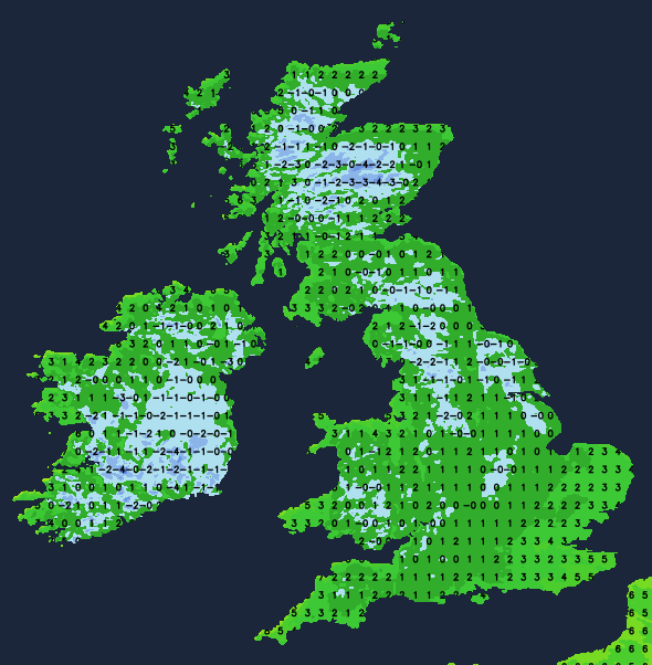
There may be some wintry showers over the North and East of Scotland with a few along the Norfolk coast and towards the South East at first, but for most, Thursday will be fine as a transient ridge builds across the country. After a cold start, the frost and any mist or fog patches will lift, leaving most places with a good deal of winter sunshine, the only exception being Northern Ireland where cloud may be increasing from the West towards dusk. Despite the sunshine, it will feel cold in a North West or Westerly breeze with temperatures no higher than 3 to 5C in the North and 7 or 8C in the South.
There will be some rain across Northern Ireland into the evening, but as the advancing front comes up against higher pressure further East, it will weaken. Nevertheless, western areas will be seeing cloud and patchy, mostly light rain before morning. But in central and more especially eastern areas, clearer skies for much of the night will lead to another slight frost and maybe a few mist or fog patches by dawn. A South West wind will freshen across Northern Ireland and in the far West, where temperatures shouldn't fall below 4 or 5C, but further East, -1 to +2C is more likely.
Most parts become grey and misty on Friday with some patchy, mostly light rain or drizzle. Although brighter at times, especially in central and eastern areas, much of the weekend could be similar, but with pressure quite high and intensifying next week, the early part of February should become mainly dry for the southern half of the UK at least.
Loading recent activity...