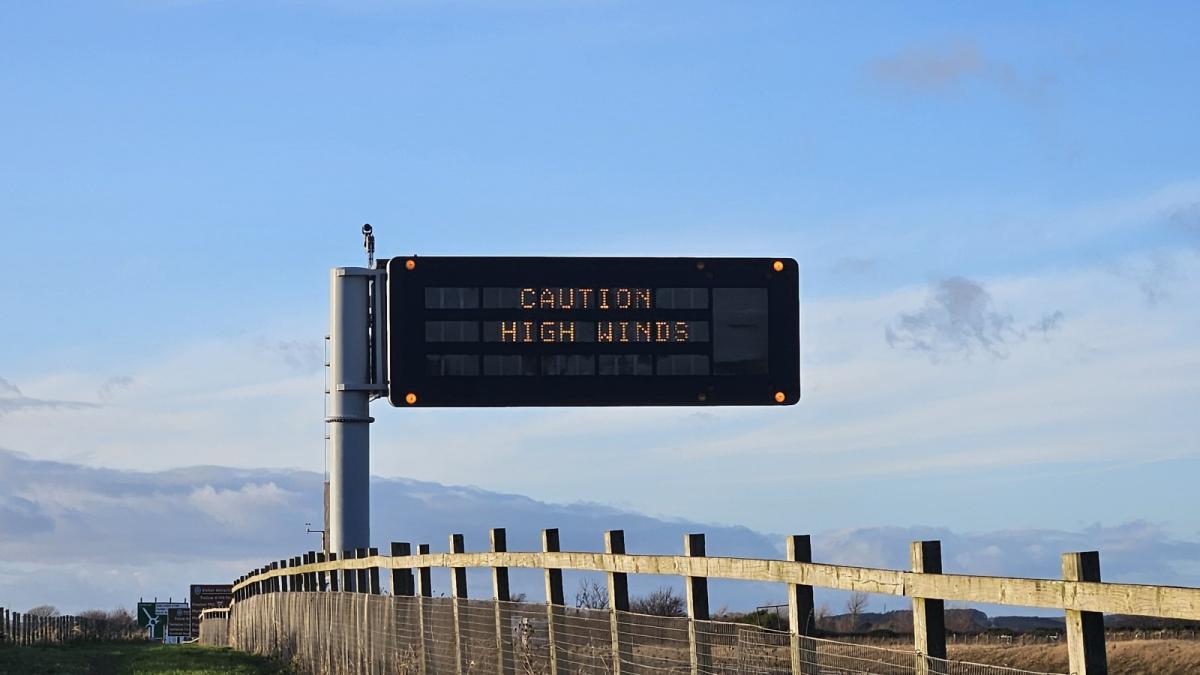
This week will see lots of lively weather, unlike the quieter, often grey and foggy Christmas week. It’s Monday today and tomorrow is New Year’s Eve. Both days look blustery with bouts of strong and gusty west/southwesterly winds for parts of the UK. There will be distinct areas of rain although these stay away from southern England until New Year’s Day (Wednesday), so a dry, mild start to the week here. The far north of Scotland will be in colder air with easterly gales for the start of Tuesday which could impact Hogmanay ferry travel to the North Isles. And there will be sleet and snow for the far north of mainland Scotland in the next day or so before colder Arctic air plunges southwards through the UK for the start of 2025.
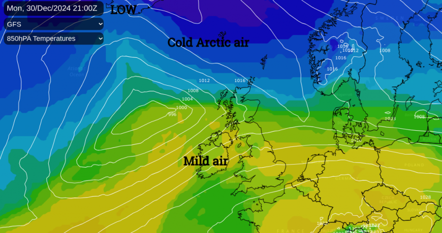
There is an airmass divide extending from the north Atlantic, across Scotland and away over eastern Europe. To the north of this is the colder air that will take hold later this week and to the south is the milder air that we’ve experienced for much of the Christmas break. Small low pressure centres will run along this boundary, waving the pulses of heavy rain our way. At times, there will be snow for northern Scotland as the rain hits the cold air. Strong winds and high gusts will accompany the lows until high pressure topples in on Thursday night leaving the UK quiet and cold.
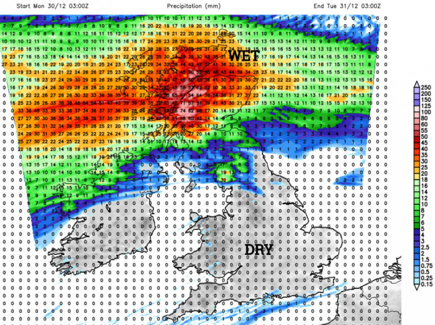
Monday 30th
It’s already windy in Northern Ireland and parts of northern Britain which isn’t ideal if this is your recycling day. There will be a lot of scampering to grab those bins quickly rather than lose them off down the street. Southern England will have light winds and temperatures around 8 to 12C. There is a large area of high pressure over southwest and central Europe bringing quiet weather but fog issues to inland Spain, Portugal and northern Italy as the UK’s fog disappears in the breeze.
The rainband over Scotland will sink southwards towards the Central Belt and north coast of Northern Ireland this afternoon. An old occlusion will continue to bring rain and hill snow to the far north of Scotland with the cold air close by.
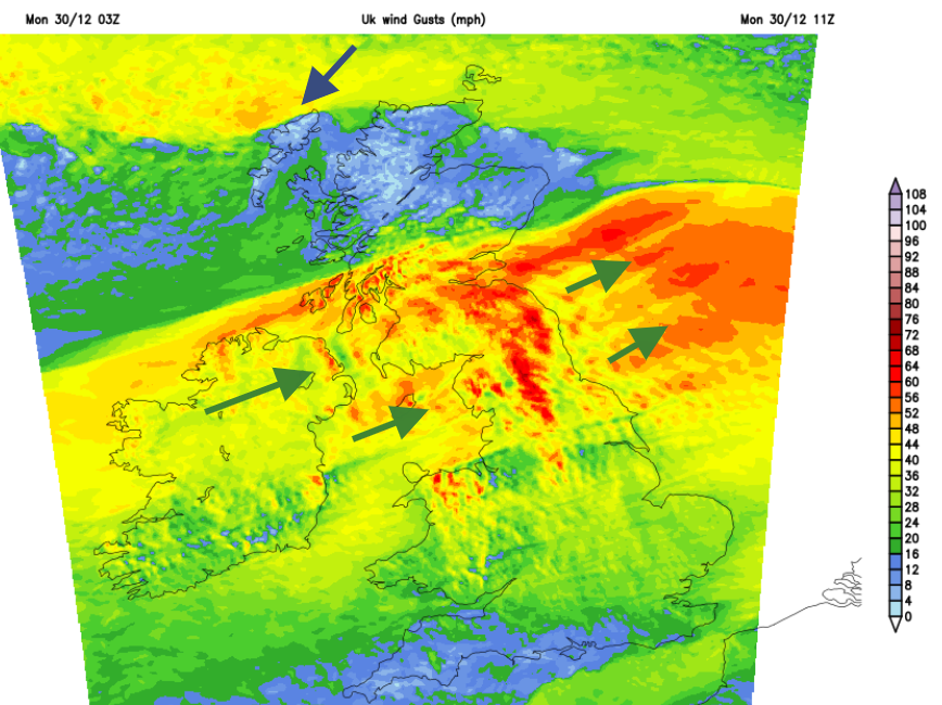
There is a swathe of strong and gusty winds across Scotland (away from the northern mainland) Northern Ireland and northern England. Exposed routes could see impacts with the winds easing down this afternoon but that will take a while for Cumbria and trans-Pennine routes into NE England. The rainband will wave back into western Scotland and hit the cold air in the north with snow for the Scottish mountains tonight.
We do have these significant broad areas of cold air in the far north, mild and blustery weather for most but there will be uncertainty around the aim of these frontal pulses arriving from the west. A bit further north or south, where might see snow over northern Scotland.
Tuesday 31st New Year's Eve
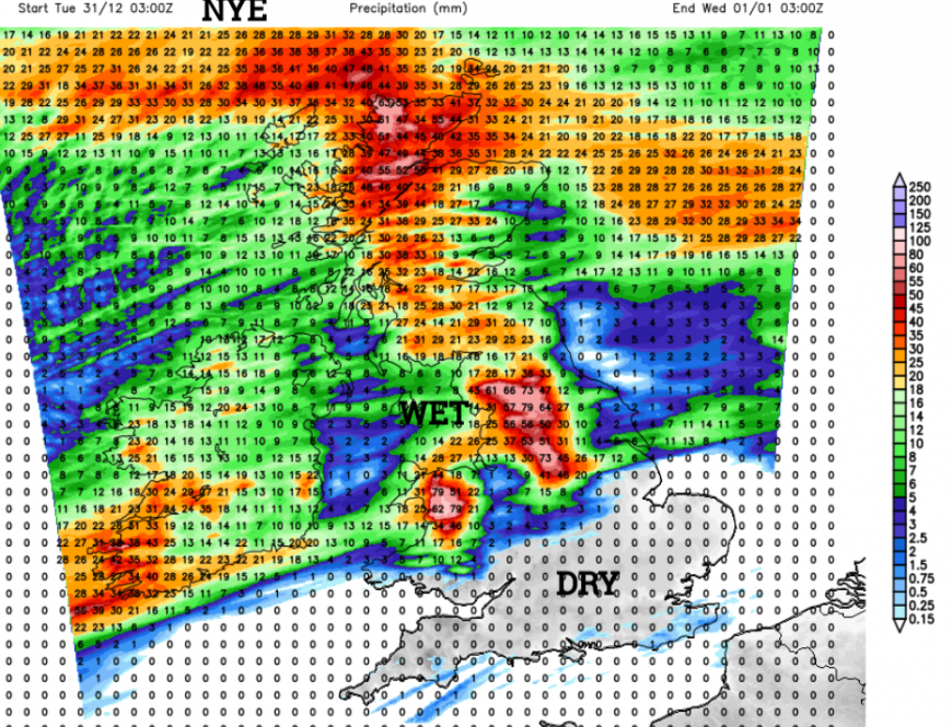
Tonight more wet and windy weather will arrive over Scotland on a warm front with the cold front reaching Northern Ireland early on Tuesday. Orkney could see severe gales from the east after early wet snow. Much of England and Wales will start off fair with a light southwest breeze and stay mild. The main frontal band will edge over northern England into north Wales and the Peak District as Scotland sees bright spells and rain showers. The frontal boundary will move southwards through Britain as a cold front later on Tuesday and bring rain for the bells at midnight.
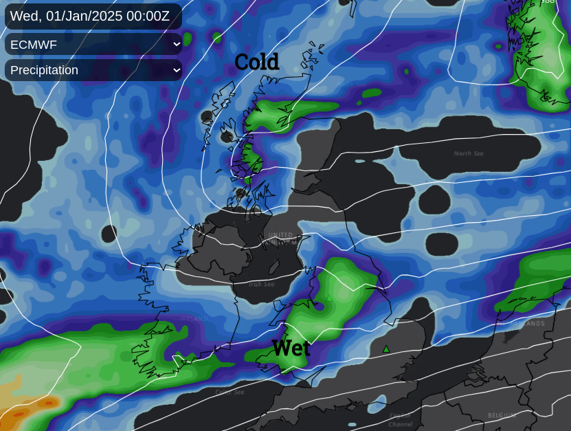
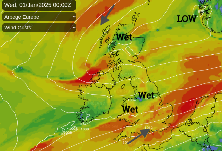
Many weather models show heavy rain over Wales, the north Midlands into Yorkshire but its positioning may change. There will be blustery winds from the southwest for most but the colder, showery weather in the far north of Scotland. Even some midnight snow for the NW Highlands.
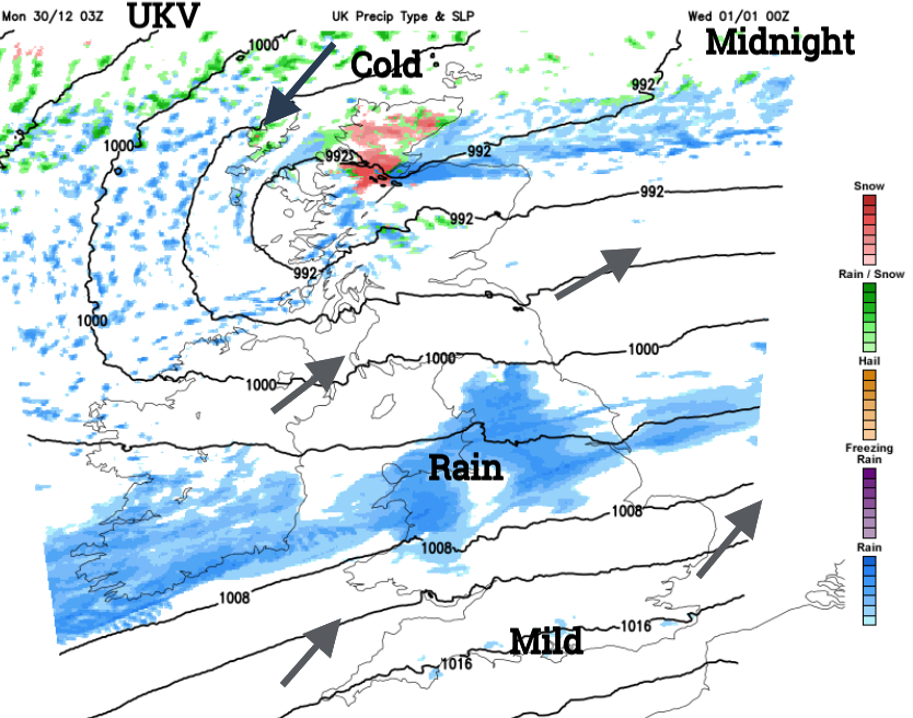
Wednesday 1st New Year's Day
This cold air and snow showers will spread over northern mainland Scotland as the first footers get going. The frontal boundary rain is showing signs of line convection, sudden heavy downpours with squally winds. This is forecast to move from Wales, southeastwards during Wednesday (New Year’s Day) with wet and windy conditions to start 2025. As the rain band and strong SW winds clear away from London and the Home Counties later on Wednesday, the cold air from the north will take hold. Northern Scotland will start the year with daytime temperatures of only 3C whereas London will start at 12C but struggle to 6C on the 2nd with a cold even frosty night in between. It will feel more like mid-winter. It has been strangely mild for too long.
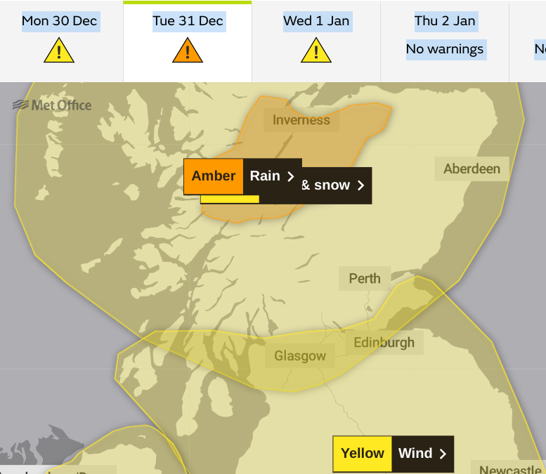
There are a collection of wind, rain and snow warnings from the Met Office for the next few days. It’s going to be a strange week as some people head back to work, others are travelling and some enjoying more holiday time. The warnings show that there could be impacts from severe weather; disruption to travel and power supplies, flooding or drifting snow with icy roads.
In the Scottish Highlands, Scotrail have already seen problems after persistent rain, “We’ve had to close the Highland Main Line at Kingussie, due to river levels on the Gynack Burn rising above safe limits” “
NetworkRail “We’re responding to flooding at Glenfinnan station. We’ve closed the line in both directions until we can inspect the location – the water coming off the hillside is fast flowing and risks damaging the track.”
The Environment Agency in England says -
“Local flooding is possible from rivers and surface water in parts of the North of England and the West Midlands on Wednesday and into Thursday. Local coastal flooding is also possible …for parts of the East Coast of England. “
As two low centres whizz by midweek, there will be a push of water down the North Sea in the cold northerly flow behind them.
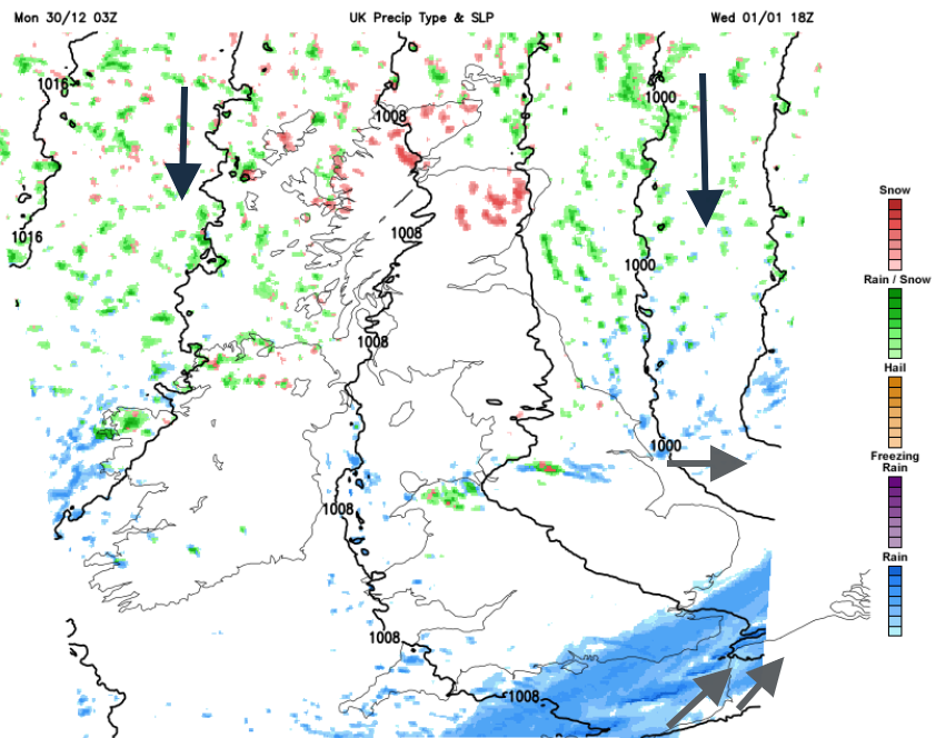
Many areas will be dry and chilly but there will be sleet, snow and hail showers piling into northern Scotland. Other clusters will move south giving wintry flurries to Northern Britain as the new year begins. By Thursday, there will be winter sunshine with showers catching exposed coasts. Daytime temperatures will be in single figures and sub-zero by night. Quite a change.
Loading recent activity...