The vestiges of fog and gloom that have been delaying flights both here and over parts of North West Europe have now largely lifted from England and Wales, with just a few 'pockets' remaining into this afternoon in the South as winds begin to freshen. As a result, it'll be easier to make out the players if you're going to the football this afternoon or watching it on television, making today feel more like a Saturday than a Sunday afternoon.
Expect it to be brighter for most, with some experiencing their first sight of the sun since Christmas Day. Cloud amounts will continue to vary, particularly in the South, where a few places could well remain dull, misty and rather cold. However, across much of the country, it'll be a mild afternoon in a south-westerly breeze, with top temperatures mostly ranging from 8 to 12°C. Most parts will stay dry, the exception being the North West and North of Scotland, where it remains wet with some heavy rain.
Across England and Wales, it continues mainly dry after dark. A touch of ground frost is possible in a few sheltered rural parts of the South, but for most, temperatures shouldn't fall below 4 to 7 °C. Across Northern Ireland, southern and central Scotland, rain is likely later as a cold front works its way from the North. Further north still, it turns wintry, with some snow especially on hills, where temperatures fall close to zero in air from the Arctic.
The far North of England could see a little rain for a time, but much of England and Wales continues to be mostly mild and dry. There'll be some sunshine, but probably often quite large amounts of cloud, particularly in the West, in a south-west wind that'll be noticeably fresher. The Met Office has issued a yellow warning for strong winds, especially across the Pennines, where gusts could reach 50-60 mph. Top temperatures remain at 8 to 12°C.
Northern Ireland and southern Scotland may turn drier and a little brighter after some rain as a meandering front returns northwards. However, across the remainder of Scotland, it's set to remain wet with a yellow warning for more heavy rain over northern and central Scotland. This warning highlights the potential for 50-70 mm of rainfall widely, with over 100 mm possible in western Scotland. Across the northern half of Scotland, some of that rain is likely to fall as snow for a time, particularly over the higher ground where some sizeable accumulations are possible. It's then likely to turn back to rain from the south later and overnight.
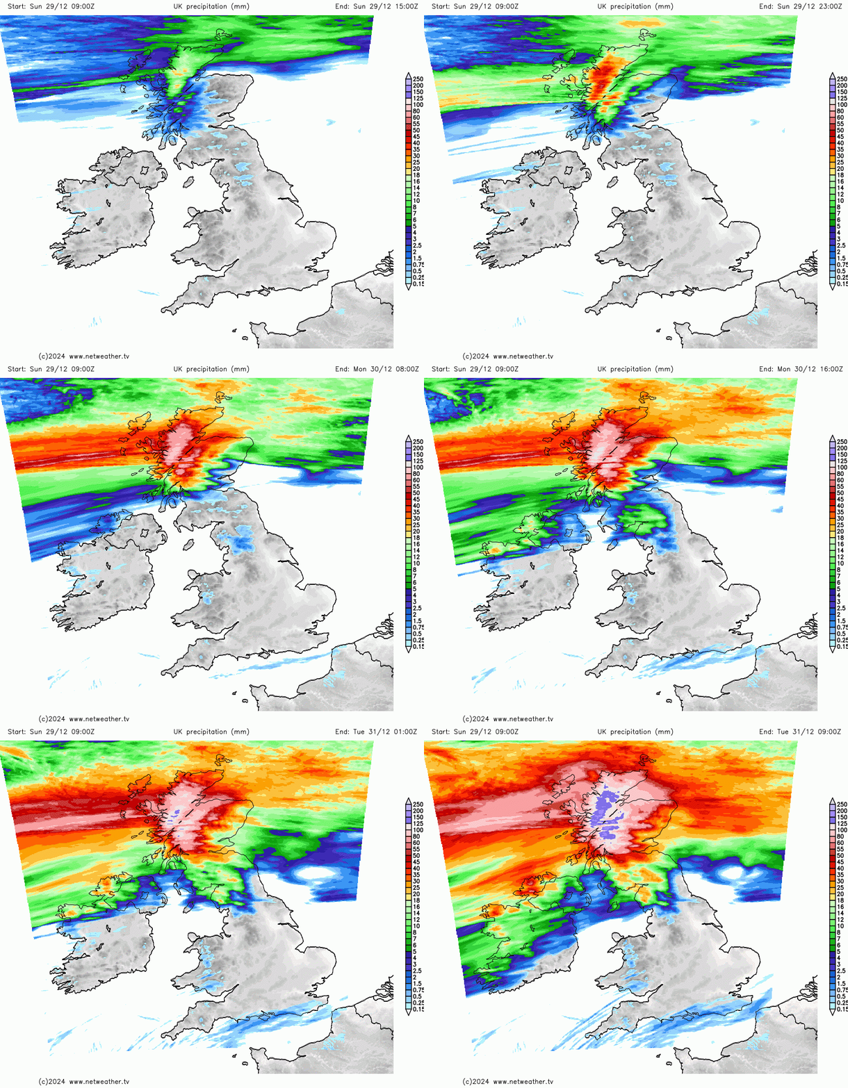
Gales are likely over Northern Ireland and southern Scotland, with gusty winds more variable in direction across the North. Over the Northern Isles, temperatures will probably hover around a raw 2 or 3°C, but further South it'll be milder.
After dark, a disturbance along that meandering front spawns a deepening Atlantic depression that'll head towards Scotland. Strong south-westerly winds, with severe gales possible in the North and West, could lead to blizzard conditions, particularly over high ground. Much of Scotland and Northern Ireland turn wet and windy where flooding may become an issue, with the rain probably spreading to parts of Wales and the North and West of England in another mild night for most.
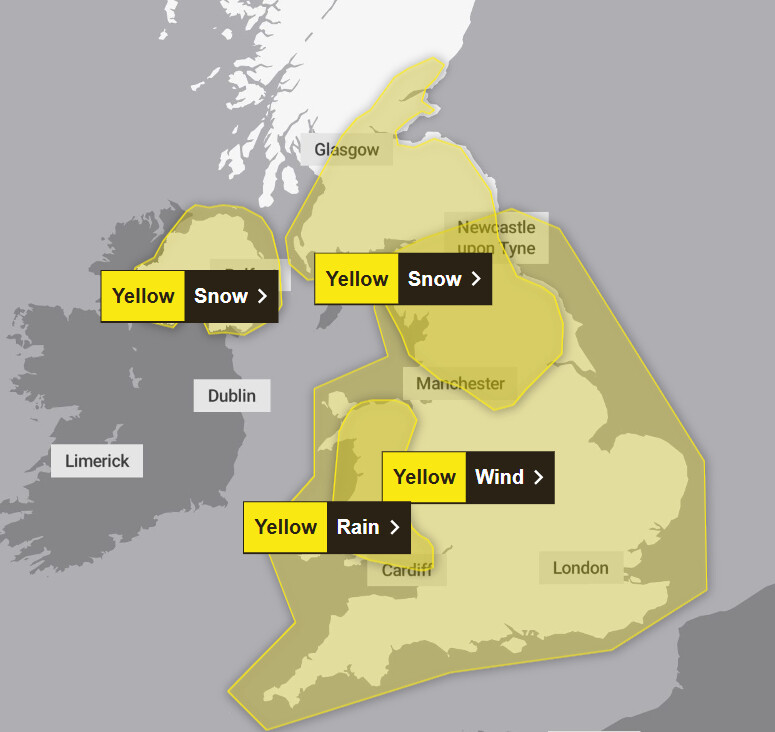
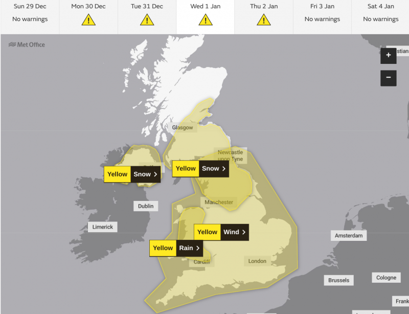
New Year's Eve becomes unsettled and windy more generally, with the prospect of perhaps some wild weather for New Year's Day when another low pressure system arrives. It may well become the next named storm 'Eowyn'. This system has the potential to bring further heavy rain, snow, and strong winds across the UK, and the Met Office has already issued yellow advanced warnings that cover a good part of the country.
Loading recent activity...