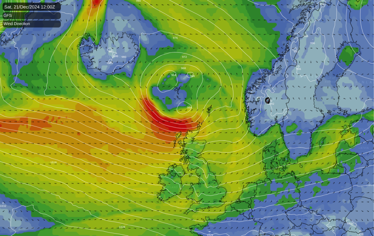
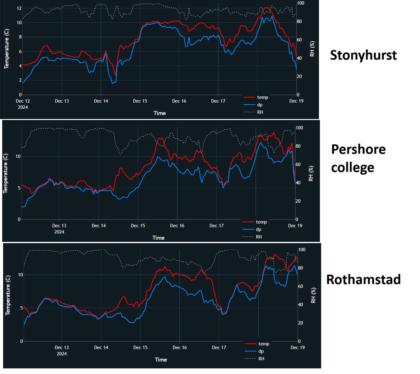
This year is looking set to have a mild and green Christmas, following a relatively cold north-westerly this weekend. Earlier in December, I thought that there was a chance of some of us seeing a white Christmas via north-westerly winds, but that a milder regime with high pressure to the south looked set to establish towards the end of December and that this could establish by Christmas. There is now high confidence in this latter scenario coming off, with high pressure building over the south and milder air coming in on the 23rd and 24th December.
This is continuing the recent trend, which has been for Christmasses to be green and mild. There was a period between 1993 and 2010 when white Christmasses were relatively common. The record breaking cold December of 2010 produced the most widespread instance of lying snow on Christmas Day when 83% of Met Office sites had a snow cover. Snow cover on Christmas Day was also widespread in 1981, 1995 and 2009, though less so than in 2010, and to a lesser extent in 1993, 1996, 1999, 2000, 2001 and 2004. Many western areas in particular had lying snow by the end of Christmas Day 2004. However, there have been no widespread examples since 2010. Several recent Christmasses have had some snow on high ground, but not at low levels. December 2022 had a very cold first half, but it was mild over the Christmas period.
Through the rest of today and tomorrow, a showery and fairly cold north-westerly will set in, with strong winds. The Met Office has a yellow wind warning out which covers most regions from around Manchester northwards today, and which covers all of the UK except the eastern side of England on Sunday. The Met Office assesses this warning as having a medium likelihood but a low overall impact, though impacts could be more substantial in western and northern Scotland, where winds will be strongest tonight.
Showers in the north-westerly flow will be squally and blustery in places, especially in the west. However, temperatures are not forecast to be far below average for the time of year. It is anticipated that showers will turn wintry for a time over much of the country during tonight and early tomorrow, particularly in Scotland, Northern Ireland and northern England, but mainly of rain, hail and sleet at low levels, with lying snow restricted to high ground, mainly in the north.
After this north-westerly, high pressure will establish over southern Britain and will bring a mild and moist west to south-westerly flow on its northern flank. This means that the Christmas period will be predominantly mild and dry, although some rain will affect north-west Scotland and there will be some light drizzle near west-facing coasts. Southern Britain can expect plenty of anticyclonic gloom - quite a common weather type during the past few months. However, in eastern Scotland and north-east England, especially near the east coast, there will be a fair chance of seeing plenty of sunshine, thanks to being sheltered from the westerly and south-westerly winds.
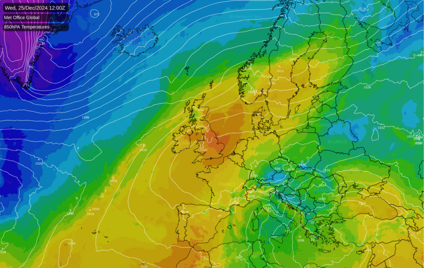
The cloud sheet will tend to break up as it passes over the Pennines and the Scottish Highlands. Temperatures will mostly peak at between 10 and 13C during the Christmas period, but parts of northern and eastern Scotland may see higher temperatures than that, due to the Föhn effect.
December has so far been very mild, despite a couple of colder northerly and north-westerly spells and some anticyclonic spells (high pressure is often associated with cold and frosty weather at this time of year). In Gordon Manley’s Central England Temperature (CET) series that goes back to 1659, which is maintained by the Met Office, the mean temperature for December currently stands at 7.2C. However, it is not going to challenge the warmest December on record, which occurred in 2015, which had a mean CET of 9.7C.
For a time I thought that December 2024 had a chance of slotting in as the second warmest December in the series, as 2015 was a big outlier (the second warmest December in the series is 1934 with a mean of 8.1C). However, the forecast models have moved towards a stronger high pressure influence between Christmas and the New Year, and some continental air will get into our air stream after Christmas Day. This means that the last week of December will not be quite as exceptionally mild for the English Midland region as had previously looked likely, with temperatures tending to fall closer to average, though still mostly above the seasonal norm. As a result, the month’s Central England Temperature is now anticipated to not rise substantially from its current figure during the rest of December. It has a slight chance of making it into the top 10 mildest (the threshold for this is 7.3C) but it will probably finish around 7.0C.
However, with persistent south-westerlies in Scotland, it will be much milder relative to normal in Scotland, particularly the north and east, with potential for further exceptional temperatures thanks to the Föhn effect. Anticyclonic gloom will be a recurring feature for most, but again eastern Scotland and north-east England, particularly near the east coast, will probably see plenty of sunshine.
There is potential for some colder weather into the New Year, when there is quite a strong signal for high pressure to develop to the west and north-west of the UK, giving increased potential for northerly winds, but there will probably still be mild interludes as well.
Loading recent activity...