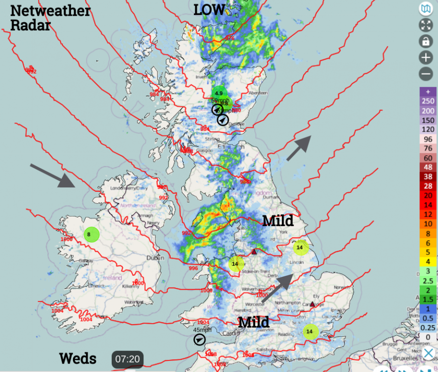
It's a windy Wednesday and there is more wet and windy weather for the middle of this week. It is mild though, with temperatures up to 14C at 7am. One low pressure is moving past northern Scotland to start Wednesday and another will follow this evening for southern Britain. There is a colder, showery but sunny theme for Thursday before more low pressures run in from the Atlantic over the weekend.
We are coming up to a very busy time of the year for travel. On the roads and by rain, ferry services and airlines will have lots of extra passengers and motorists in the next week. The Met Office has a yellow wind warning for Wednesday and it is worth understanding these if you have travel plans. Today’s “This warning has a medium likelihood and a low impact” relates to the matrix embedded under the extra text accompanying all UK weather warnings maps. In the areas marked, the high ground of north Wales and northern England along with coastal counties, it is quite likely that people could see impacts from the strong and gusty winds. Impacts such as disruption to services or longer travel times. Difficult driving conditions for high-sided vehicles especially on high-level routes, such as across the Pennines. Also large waves and spray along coasts.
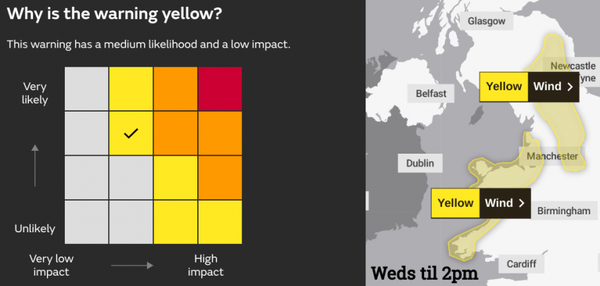
Each weather type and warning level has a list of likely impacts. For example, a yellow lightning warning would be “Unlikely but High impacts” the bottom right corner of the matrix. Within the wider warning area, you might be unlikely to see a lightning strike but if you do, then the impacts could be significant.
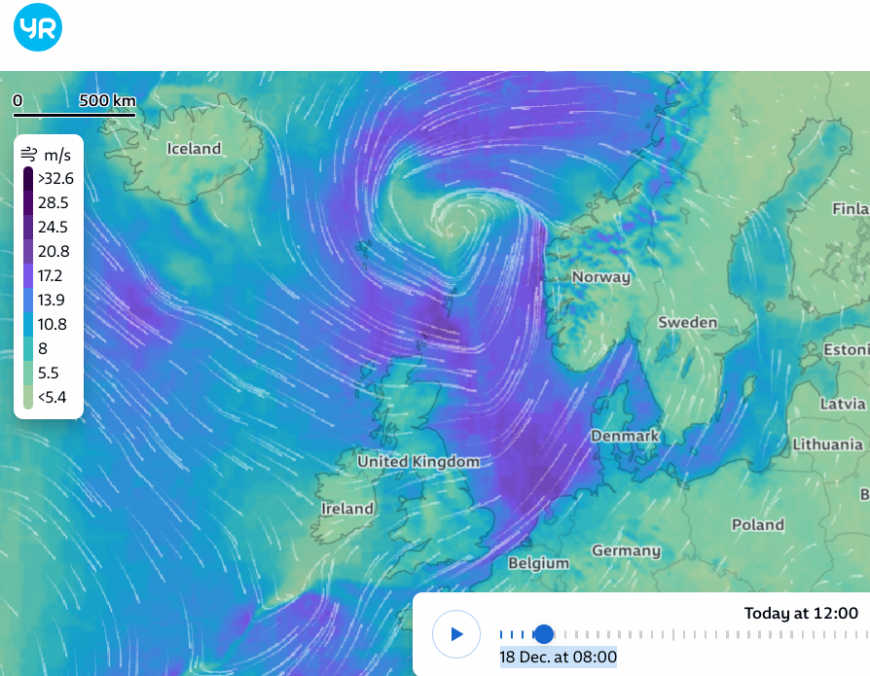
The low pressure responsible for the windy start on Wednesday is still deepening as it heads towards western Norway. The SW winds begin to veer to the west and then a colder northwesterly. Northern Ireland will have lighter winds and the wind will ease for southwestern Britain but the Northern Isles continue with strong winds today. There will be severe gales and very rough seas with ferry schedule adjustments to the Islands.
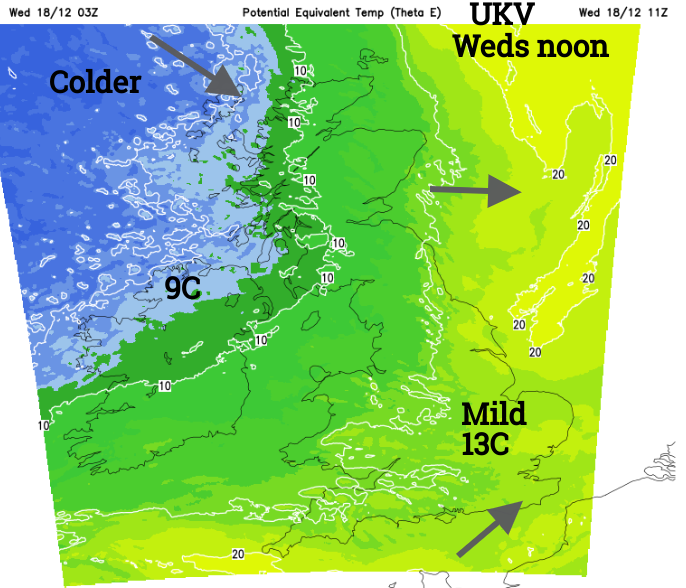
Wednesday has started off with mild air across Britain and temperatures up at 13 or 14C. As the winds ease and the skies brighten up it won’t feel too bad but colder air from the northwest will encroach over Northern Ireland and Scotland by this afternoon. There will be a few showers about, mostly for western Britain but overall an improving theme for the middle of the day.
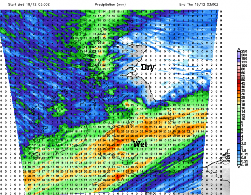
Next, we look away to the southwest for the next low pressure. The frontal rain will reach over Cornwall, Devon and Pembrokeshire by mid-afternoon and the southwesterly winds will freshen after dark. Whilst northern Britain and Northern Ireland stay clear and colder there will be cloud, wind and rain over much of England and Wales tonight with the milder air trying to hold on.
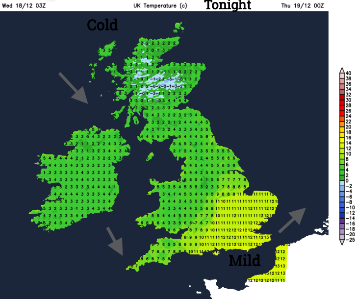
There will be a few hours of rain as the low pressure moves by and some heavy downpours. As the low moves away in the small hours there could be a bit of hill snow on the back edge. Depending on the timing and reach of the southern low, the Peak District looks most likely. Showers will follow from the northwest in the colder air and these will be a mix of rain, sleet and snow. Snow could reach to lower levels for Scotland but will be mainly over the higher ground when they reach Wales. All of the UK will be in the colder air by Thursday morning and daytime temperatures will be 5 to 8C and it will feel colder in the blustery wind. Quite a change from today.
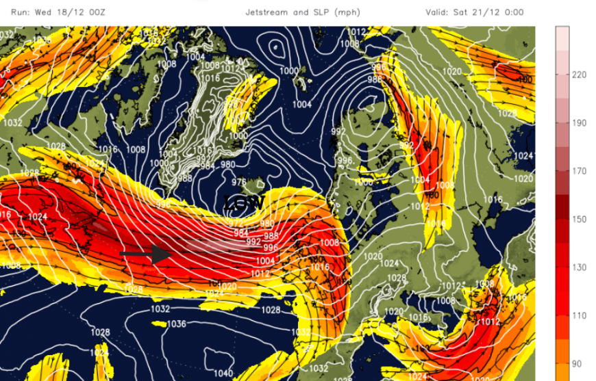
The winds will ease for Thursday night but a strong jetstream will be heading right above the UK by the weekend, helping to develop low pressure that will bring more windy weather our way.
Loading recent activity...