Turning increasingly unsettled and windy in the run up to Christmas, while temperatures will be on a rollercoaster between mild and cold.
There is forecast to be a rollercoaster of temperatures in the run-up to Christmas, as the UK flirts with Tropical or Polar maritime airmasses. There will be some rain around too & becoming windier, with gales at times in the north and west. Wednesday is looking the mildest day and Sunday is looking the coldest day before Christmas, with a cold and strong NW wind, perhaps cold enough for sleet and snow in showers. But turning mild in time for Christmas.
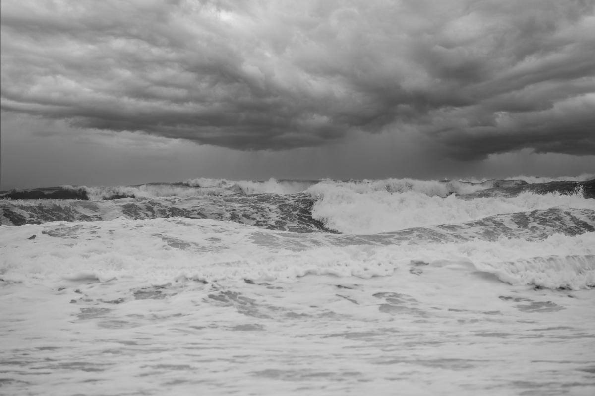
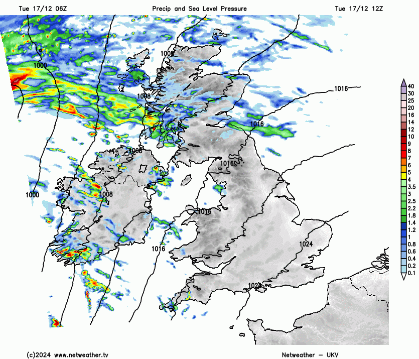
High pressure has dominated in recent days, but its influence is on the way out for the rest of the week until its return early next week – in time for Christmas. The first of a succession low pressure systems will track northeast past the northwest of Scotland tonight, deepening as it does so. So a southerly wind will pick up later today, especially in the north and west – where gusts of 45-60mph are forecast over coasts and hills, perhaps over 65mph in the far northwest. Outbreaks of rain also spreading in across Scotland and N. Ireland this afternoon and evening, heavy over hills, with patchy bursts of rain erratically spreading east across England and Wales overnight. Increasingly mild, with temperatures widely reaching double figures by dawn.
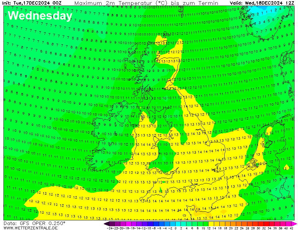
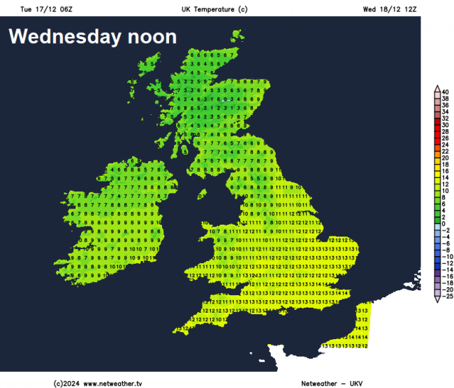
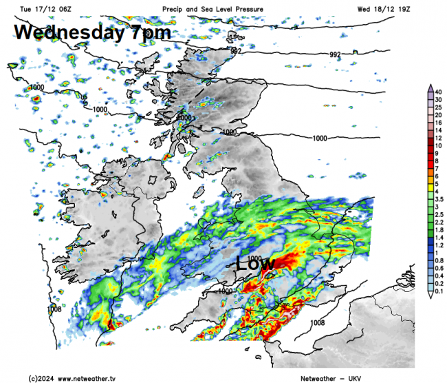
The first low of the week brushing the far northwest tonight will move on towards Norway tomorrow, then another low that has developed northwest of the Azores along a trailing frontal boundary will move northeast further south this time across southern Britain Wednesday evening. This low will be shallower than the first, but will spread heavy rain across England and Wales Wednesday evening, before clearing out into the North Sea in the early hours of Thursday. Before the rain arrives, despite strong wind and cloud, it will be very mild across England and Wales, with temperatures reaching 13-14°C widely – well-above the average for this stage in December. However, it will be turning colder across Scotland, as winds turn northwesterly here.
Temperatures come tumbling back down for all on Thursday, though, as winds switch to a northwesterly across all parts, bringing a polar maritime airmass across the UK rather than tropical maritime airmass. It will be a clearer airmass, so sunny spells, but also some showers in the west, which will be wintry over higher ground. Temperatures reaching 5-7C in the north, 7-9℃ in the south – about the average for the time of year.
Thursday night could see a widespread ground frost develop under clearing skies in the colder air. All change again on Friday, as we see winds switch to a westerly - bringing cloud and a band of rain east across most parts during the day. Temperatures may stay in single figures though.
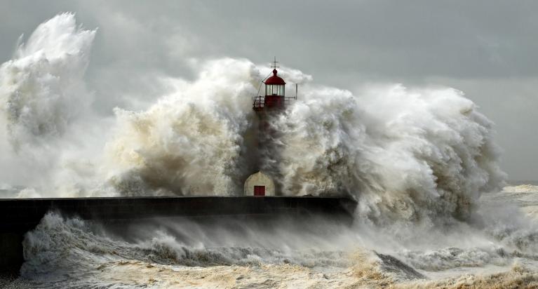
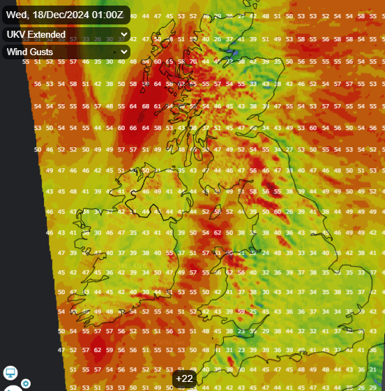
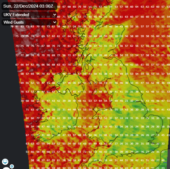
Unsettled and windy on Saturday, with showers or longer spells of rain. Mild across England and Wales – where temperatures look to reach double figures. Turning colder across Scotland though, as polar maritime air returns here, with showers turning increasingly wintry over higher ground. An area of low pressure, coming out of NE Canada tomorrow morning, will deepen as it crosses the Atlantic and past the north of Scotland on Saturday. This will generate gales or severe gales across the far north over the weekend, with winds gusting 60-70mph, locally more with exposure on Sunday, as winds veer northwesterly. Winds gusting 40-50mph across England and Wales too, higher around coasts.
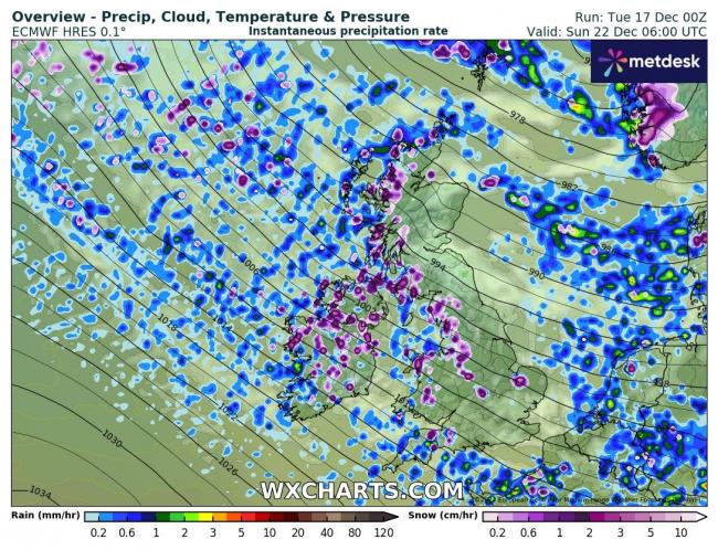
Sunday is looking a cold day, exacerbated by the strong northwesterly wind touching gale force, bringing a noticeable wind chill. It will be a showery day too, with showers penetrating well inland towards the east and south on the northwesterly wind. Dew points in the northwesterly flow currently forecast to be low enough (below 0C) for sleet or snow to fall to low-levels in any showers, though likely temperatures too high for settling away from high ground in the north and west.
Widespread frost Sunday night under clearing skies and as winds ease. Monday drier with a brief ridge of high pressure toppling through, still on the chilly side though. Perhaps followed by another cold and frosty night before cloudier and milder air returns off the Atlantic through Christmas Eve, with some patchy rain too. Christmas Day looking mild but dry, as high pressure builds. Too far out to say whether it will be cloudy or sunny and where. But it’s looking dry.
Loading recent activity...