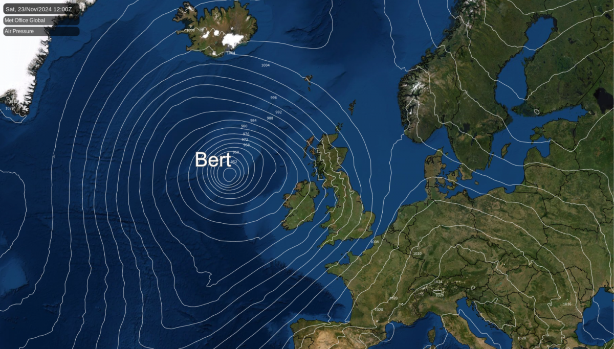
All change as Storm Bert moves from Ireland, across the UK with wild winds, heavy rain and a spell of snow. Travel disruption seems likely. It will be milder by Saturday night.
All change for the start of the weekend as Storm Bert arrives with strong winds and heavy rain which will be preceded by snow for a time. After this cold, wintry spell, it will feel very different by Saturday.
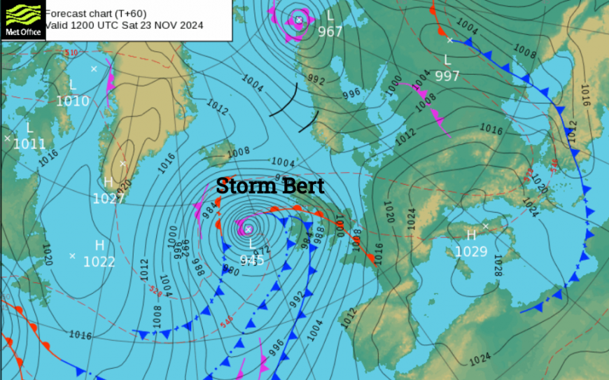
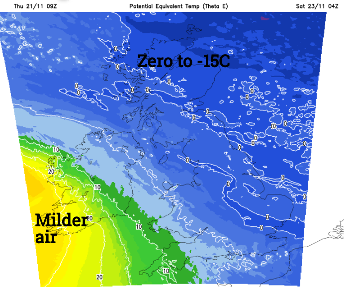
This low pressure will bring wild conditions with heavy frontal rain starting over Ireland on Friday night and spreading over the UK on Saturday. As that precipitation hits the Arctic air, that has gripped the UK this week, there will be snow. The hills and mountains of northern England, Scotland and north Wales look most prone. Conditions over high ground and exposed routes will be tricky with travel disruption likely. There will be strong gusty winds, driving snow which will turn to rain and slush later in the day as mild air arrives from the southwest. All the while, the winds will blow, bringing down the last of the leaves, blocking drains and getting onto rails.
Friday evening will be very cold in northern mainland Scotland with plummeting temperatures. The winds over Ireland will strengthen during the night as heavy frontal rain moves in. There could be snow for a time over the Sperrins and Antrim Hills but not amounting to much as the rain takes hold. County Donegal and County Mayo could see wild conditions along the coast before dawn with gales possible into the east coast by Dublin as people start their day on Saturday. Bert was named by Met Eireann
“Storm Bert: Very strong southeast to south winds coupled with heavy rain. Possible impacts: • Localised flooding • Travel disruption • Fallen trees”
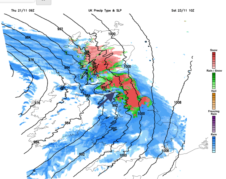
As Ireland wakes and gets going for the weekend Storm Bert will have hit and be moving on. Northern Ireland will be wet and windy first thing as the rain and hill snow reaches western Britain accompanied by strong, gusty S/SE winds. Ahead of all of this, it will be cold and cloudy before the rain or snow arrives.
Stormy conditions will hit the Western Isles as Bert passes by on Saturday. Expect disruption to ferry services and on the railways of western Scotland and NW England.
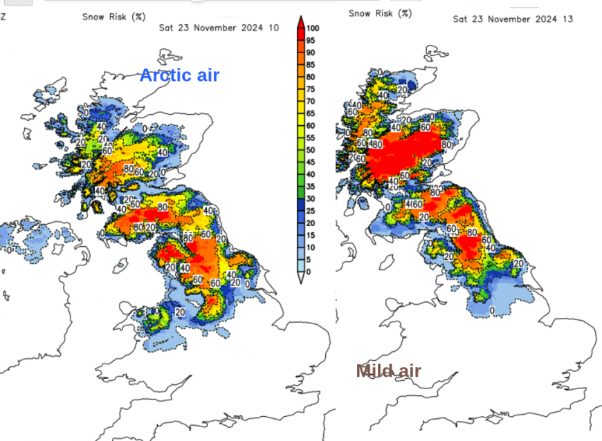
For central Scotland and the Cairngorms, there is an Amber warning for snow and ice “Storm Bert will bring a spell of heavy snow, leading to some disruption on Saturday” Met Office. By the end of Saturday, it will only be Highland Scotland seeing any snow. Much milder air will follow the frontal band turning any snow to rain. There is a rash of warnings for wind, snow and heavy rain but the temperatures will leap up. Belfast, 3C maximum on Thursday but up to 12C on Saturday. Leeds, only 2C today but up to 14C by Saturday night.
This will be a real change for the UK weather. Most areas have not had strong winds for a while, although it has felt extra cold where there has been a breeze. There will be heavy rain which could bring its own surface water flooding issues but this milder air will cause any lying snow to melt. There will be ongoing issues with ice particularly in northern Scotland where there has been a lot of snow this week. Also, with the potentially blowing and drifting snow on Saturday as Storm Bert arrives.
Loading recent activity...