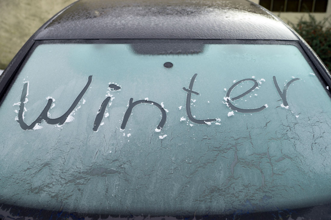
The cold Arctic air has taken hold for the start of the new week and in the breeze it is feeling bitter. Tulloch Bridge in Highland Scotland fell to -7.8C overnight with many areas in northern Britain dipping near to freezing. There will be a widespread frost over the next few nights. The far north of Scotland has seen snow showers; over the Islands and the mainland with a covering or dusting adding to the wintry feel. This feed of snow showers will continue but increase later on Tuesday as a bitter northerly wind sets in for Tuesday night. There are other areas at risk of ice and snow with several yellow warnings from the UK Met Office.
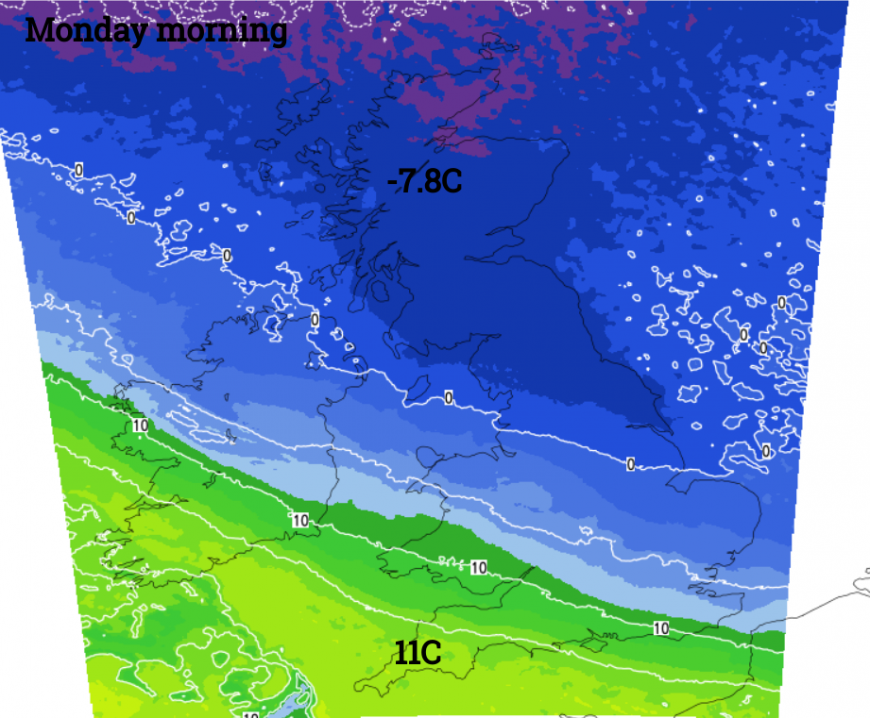
It was still mild for southwestern Britain on Monday morning and it will take until Tuesday lunchtime for this cold air to reach right down to London. Inland the winds will be very light by day, and for many, Tuesday will become a fine, chilly day with crisp sunshine. On Tuesday night it will be clear for most but with a chilly breeze as the temperatures tumble below freezing.
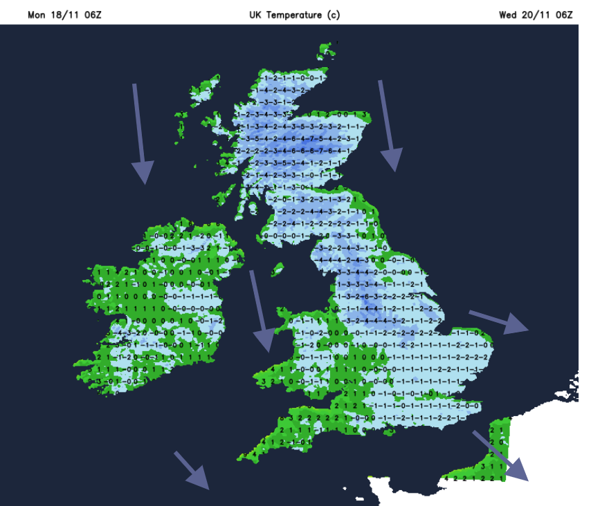
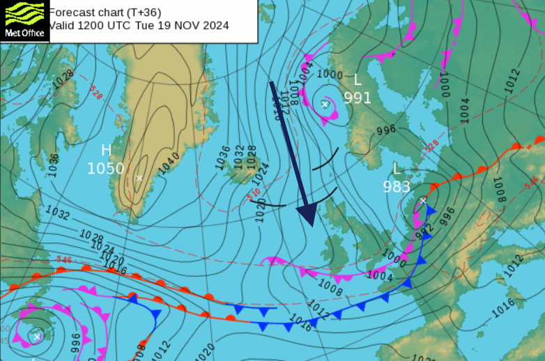
That is the background picture, increasingly cold air from the Arctic taking hold over the UK for the whole working week. We have an increasing flow of snow showers from the far north but other areas could be affected by rain, sleet and snow in the next few days.
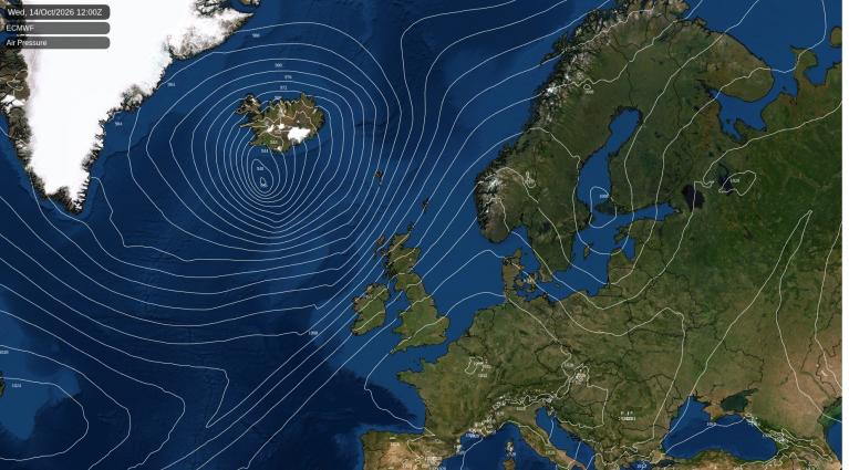
The frontal band, dividing the mild air in the SW from the Arctic air, links back to a low pressure out in the Atlantic. This will slide over Wales tonight then onwards to Germany as the cold northerly flow sets in bringing snow showers to a few more exposed parts.
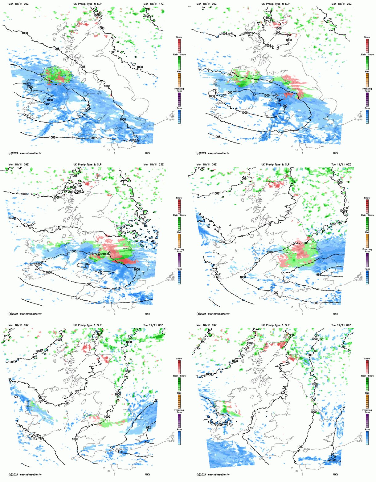
As this wave slides eastwards the northern edge will come up against the cold air and any frontal rain will turn to sleet and snow tonight, especially over the higher ground of northern England and Snowdonia. There is uncertainty in this part of the forecast. How far north the frontal band will reach and so it’s precipitation? Then how much will turn to sleet, hill snow and then even snow to lower levels ready for Tuesday morning?
Risk of snow and ice
Northern Ireland has a weather warning for Monday afternoon into Tuesday morning. There will be wintriness as the frontal band arrives this afternoon and as it pulls away tonight allowing cold, clear air to take hold. Snow is likely over the hills and ice will soon form.
“Snow and icy surfaces leading to difficult travel conditions” MO
The frontal band will reach over Wales and England, starting this afternoon for the West Country but extending northeastwards as strengthening winds wrap around the low centre. The rain will turn to sleet and snow on the northern edge, over high ground and in the heavier downpours. Before dawn on Tuesday, the low will be pulling away from East Anglia leaving a lot of damp, cloudy weather over southern Britain. Sunshine will appear with a feed of wintry showers clipping the North Sea coasts of England, plenty for Aberdeenshire and the trailing occluded front will keep cloud and rain showers over Cornwall and Devon into the evening.
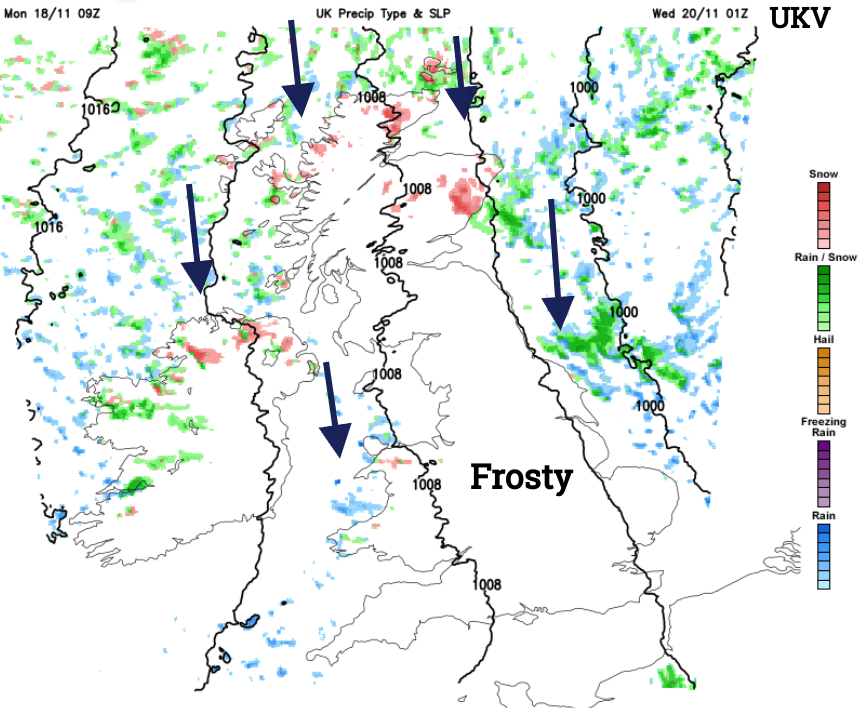
For Tuesday night we have a traditional wishbone pattern of showers from the north. There will be cold, clear conditions with hard frost over Britain as many snow showers collide with the far north of Scotland. Other sleet and snow showers will feed down the west coast of Scotland to the north coast of Northern Ireland, and to north and west Wales. Gradually there will be snow showers clipping the North Yorkshire coast and north Norfolk, possibly with heavier trough lines pushing south over more of eastern Britain. Wednesday morning will start cold and frosty with lying snow for a few more areas.
Loading recent activity...